
Darley Dale, also known simply as Darley, is a town and civil parish in the Derbyshire Dales district of Derbyshire, England, with a population of 5,413. It lies north of Matlock, on the River Derwent and the A6 road. The town forms part of a built up area with both Matlock and Rowsley.

Wimpole Estate is a large estate containing Wimpole Hall, a country house located within the civil parish of Wimpole, Cambridgeshire, England, about 8+1⁄2 miles southwest of Cambridge. The house, begun in 1640, and its 3,000 acres (12 km2) of parkland and farmland are owned by the National Trust. The estate is regularly open to the public and received over 335,000 visitors in 2019. Wimpole is the largest house in Cambridgeshire.

Dethick, Lea and Holloway is a civil parish, in the Amber Valley borough of the English county of Derbyshire. The population of the civil parish taken at the 2011 census was 1,027.

Bellister Castle is a National Trust owned castellated 19th-century mansion house attached to the ruinous remains of a 14th-century tower house, near Haltwhistle, Northumberland, England. It is a Scheduled Ancient Monument and a Grade I listed building.

Minshull Vernon is a hamlet and civil parish in the unitary authority of Cheshire East and the ceremonial county of Cheshire, England. The hamlet lies 3 miles (5 km) to the north west of Crewe, south east of Winsford and south west of Middlewich. The parish also includes the small settlements of Bradfield Green, Eardswick, Hoolgrave, Minshull Hill, Walley's Green and Weaver Bank. The total population of the civil parish is somewhat over 200, measured at 391 in the Census 2011. Nearby villages include Church Minshull, Warmingham and Wimboldsley.

Stancliffe Hall is a grade II Listed building on Whitworth Road in the settlement of Darley Dale, near Matlock, Derbyshire.

Tissington Hall is an early 17th-century Jacobean mansion house in Tissington, near Ashbourne, Derbyshire. It is a Grade II* listed building.

Norbury Manor is a 15th-century Elizabethan manor house and the adjoining 13th-century stone-built medieval Norbury Hall, known as The Old Manor in Norbury near Ashbourne, Derbyshire. It is a Grade I listed building.

Willersley Castle is a late 18th-century country mansion above the River Derwent at Cromford, Derbyshire, outside Peak District National Park. The castle has been a Grade II* listed building since April 2000.

Barlow Woodseats Hall is a Grade II* listed manor house situated at Barlow Woodseats, on the edge of the village of Barlow, in Derbyshire. It remains the only manor house in the Parish of Barlow, and the current house dates from the early 17th century, although there are much earlier origins to before 1269.

Yeaveley Preceptory, also known as Stydd Preceptory, was a preceptory of the Knights Hospitaller, near the village of Yeaveley, in Derbyshire, England. It was around a mile west of the village, on the site of the current Stydd Hall. The Preceptory has been variously known as "Yeaveley Preceptory", "Yeaveley Bailiwick", "Yeaveley and Barrow Preceptory" and "Stydd Preceptory".

Darley Bridge is a village in Derbyshire, located in South Darley parish in the Derbyshire Dales, bordering the Peak District. The village lies at the bottom of the hill below Wensley where the road crosses the River Derwent. A grade II* listed stone bridge spans the river and links the village with Darley Dale. Close to the bridge, the road winds between terraced stone houses in the oldest part of the village. The only public house in the parish, The Three Stags Heads, is in this area.
Dronfield is a civil parish in the North East Derbyshire district of Derbyshire, England. The parish contains 44 listed buildings that are recorded in the National Heritage List for England. Of these, one is listed at Grade I, the highest of the three grades, four are at Grade II*, the middle grade, and the others are at Grade II, the lowest grade. The parish contains the town of Dronfield, the district of Dronfield Woodhouse, the village of Coal Aston, and the surrounding area. Most of the listed buildings are houses, cottages and associated structures, farmhouses and farm buildings. The other listed buildings include churches, a churchyard cross, public houses, a former school, a milestone, a monument, and a bridge.

South Darley is a civil parish in the Derbyshire Dales. It is a largely rural parish and covers the villages of Darley Bridge, Wensley and the hamlets of Oker and Snitterton. South Darley lies west of Matlock and east of Winster. The River Derwent forms the north-eastern boundary of South Darley parish with Darley Dale parish on the other bank. About two thirds of the parish lies within the Peak District.
Edlaston and Wyaston is a civil parish within the Derbyshire Dales district, in the county of Derbyshire, England. The parish includes the villages of Edlaston and Wyaston. In 2011 the parish had a population of 220. It is 120 miles (190 km) north west of London, 11 miles (18 km) north west of the county city of Derby, and 2+1⁄2 miles (4 km) south of the market town of Ashbourne. Edlaston and Wyaston touches the parishes of Clifton and Compton, Osmaston, Rodsley, Shirley, Snelston and Yeaveley. There are seven listed buildings in Edlaston and Wyaston.

Snitterton is a hamlet in Derbyshire, located in South Darley parish, of some fifteen properties including two working farms and Snitterton Hall, a late 16th century manor house which is Grade 1 listed. There are signs that it was once a larger village.

Northwood and Tinkersley is a civil parish within the Derbyshire Dales district, in the county of Derbyshire, England. Named for its main settlements, with a mix of rural and built up areas, it had a population of 665 residents in 2011. The parish is 126 miles (203 km) north west of London, 18 miles (29 km) north west of the county city of Derby, and 3+1⁄2 miles (5.6 km) north west of the nearest market town of Matlock. Northwood and Tinkersley is directly adjacent to the Peak District national park to the west, and shares a border with the parishes of Darley Dale, Rowsley and Stanton.
Darley Dale is a civil parish in the Derbyshire Dales district of Derbyshire, England. The parish contains 27 listed buildings that are recorded in the National Heritage List for England. Of these, three are listed at Grade II*, the middle of the three grades, and the others are at Grade II, the lowest grade. The parish contains the town of Darley Dale and the surrounding area. Most of the listed buildings are houses, cottages and associated structures, farmhouses and farm buildings. The other listed buildings include a church and its former rectory, a road bridge over the River Derwent, public houses, a mile post and a milestone, buildings associated with Darley Dale railway station, an institute, and a school.
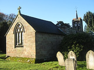
South Darley is a civil parish in the Derbyshire Dales district of Derbyshire, England. The parish contains nine listed buildings that are recorded in the National Heritage List for England. Of these, one is listed at Grade I, the highest of the three grades, and the others are at Grade II, the lowest grade. The parish contains the villages of Darley Bridge, Snitterton and Wensley, and the surrounding countryside. The listed buildings consist of houses and associated structures, a public house, a church, a milestone and a telephone kiosk.

