Hildburghausen is a district in Thuringia, Germany. It is bounded by the district of Schmalkalden-Meiningen, the city of Suhl, the districts of Ilm-Kreis, Saalfeld-Rudolstadt and Sonneberg, and the state of Bavaria. Located roughly halfway between the mountain chains of the Rhön and the Thuringian Forest, the district is densely forested and covered by hilly countryside. Its territory is similar to that of the former Ernestine duchy, Saxe-Hildburghausen.
Ilm-Kreis is a district in Thuringia, Germany. It is bounded by the city of Erfurt, the districts of Weimarer Land, Saalfeld-Rudolstadt and Hildburghausen, the city of Suhl, and the districts of Schmalkalden-Meiningen and Gotha. It is named after the river Ilm, flowing through the district.
Kronach is a Landkreis (district) in Bavaria, Germany. It is bounded by the districts of Hof, Kulmbach, Lichtenfels and Coburg, and the state of Thuringia.
Saale-Holzland is a Kreis (district) in the east of Thuringia, Germany. Neighboring districts are the district Burgenlandkreis in Saxony-Anhalt, the district-free city Gera, the districts Greiz, Saale-Orla, Saalfeld-Rudolstadt, Weimarer Land and the district-free city Jena.
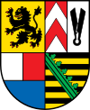
Saalfeld-Rudolstadt is a Kreis (district) in the south of Thuringia, Germany. Neighboring districts are the districts Weimarer Land, Saale-Holzland, Saale-Orla, the district Kronach in Bavaria, and the districts Sonneberg, Hildburghausen and Ilm-Kreis.
Weimarer Land is a Landkreis (district) in the east of Thuringia, Germany. Neighboring districts are the district Burgenlandkreis in Saxony-Anhalt, the district Saale-Holzland and the district-free city Jena, the district Saalfeld-Rudolstadt, Ilm-Kreis, and the district-free city Erfurt. The district-free city Weimar is completely enclosed by the district.

Gräfenthal is a town in the district of Saalfeld-Rudolstadt in Thuringia, Germany.

Lauscha is a town in the district of Sonneberg, in Thuringia, Germany. It is situated 13 km north of Sonneberg, and 24 km southwest of Saalfeld. Lauscha is known for its glassblowing, especially for Christmas tree decorations like baubles.

Neuhaus am Rennweg is a town in the district of Sonneberg, in Thuringia, Germany. It is situated in the Thuringian Forest, 17 km north of Sonneberg, and 22 km southwest of Saalfeld. The former municipalities Lichte and Piesau were merged into Neuhaus am Rennweg in January 2019.

Lichte is a village and a former municipality in the district of Sonneberg in Thuringia, Germany, close to the Thuringian Rennsteig. Formerly in the district Saalfeld-Rudolstadt, it is part of the town Neuhaus am Rennweg since January 2019.
Piesau is a village and a former municipality in the district of Sonneberg in Thuringia, Germany, close to the Thuringian Rennsteig. Formerly in the district Saalfeld-Rudolstadt, it is part of the town Neuhaus am Rennweg since January 2019.

The Thuringian Highland, Thuringian Highlands or Thuringian-Vogtlandian Slate Mountains is a low range of mountains in the German state of Thuringia.

Sonneberg (Thür) Hauptbahnhof is a railway station for the city of Sonneberg in the German state of Thuringia and is on the Coburg–Sonneberg line. The station was built as part of the construction of the Hinterland Railway and still plays a central role in public transport of Sonneberg and the surrounding area. It was built in 1907 to replace the old station, which was built in 1857 and 1858 by the Werra Railway Company, together with the single-track Coburg–Sonneberg line, a branch line of the Werra Railway.
The Rückersbiel a 755.6 m high mountain located in the Thuringian Highland, Thuringia (Germany).

The Lichte (Thuringia) station German: Bahnhof Lichte (Thüringen) was a Deutsche Reichsbahn station in the Thuringian municipality of Lichte in the district of Saalfeld-Rudolstadt. The station is elevated 623 m above Sea Level.

The Lichte (Thuringia) east station was a Deutsche Reichsbahn station of the Thuringian municipality of Lichte (Wallendorf) in the district of Saalfeld-Rudolstadt.
Hildburghausen II – Sonneberg II is an electoral constituency represented in the Landtag of Thuringia. It elects one member via first-past-the-post voting. Under the current constituency numbering system, it is designated as constituency 20. It covers the eastern part of Hildburghausen district and the northern part of Sonneberg district.
Saalfeld-Rudolstadt II is an electoral constituency represented in the Landtag of Thuringia. It elects one member via first-past-the-post voting. Under the current constituency numbering system, it is designated as constituency 29 and It covers the eastern part of Saalfeld-Rudolstadt.

Saalfeld-Rudolstadt – Saale-Holzland-Kreis – Saale-Orla-Kreis is an electoral constituency represented in the Bundestag. It elects one member via first-past-the-post voting. Under the current constituency numbering system, it is designated as constituency 195. It is located in eastern Thuringia, comprising the districts of Saalfeld-Rudolstadt, Saale-Holzland-Kreis, and Saale-Orla-Kreis.