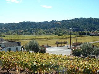
Sonoma Valley is a valley located in southeastern Sonoma County, California, in the North Bay region of the San Francisco Bay Area. Known as the birthplace of the California wine industry, the valley is home to some of the earliest vineyards and wineries in the state, some of which survived the phylloxera epidemic of the 1870s and the impact of prohibition in the early 20th century. Today, the valley's wines are promoted by the U.S. federal government's Sonoma Valley and Carneros AVAs.

The North Bay is a subregion of the San Francisco Bay Area, in California, United States. The largest city is Santa Rosa, which is the fifth-largest city in the Bay Area. It is the location of the Napa and Sonoma wine regions, and is the least populous and least urbanized part of the Bay Area. It consists of Marin, Napa, Solano and Sonoma counties.

The Roman Catholic Diocese of Santa Rosa in California is a diocese, or ecclesiastical territory, of the Roman Catholic Church in the northern California region of the United States, named in honor of St. Rose of Lima. It comprises the Counties of Del Norte, Humboldt, Lake, Mendocino, Napa and Sonoma. Also known as the See of Santa Rosa in California, it is led by a bishop, currently Bishop Robert Francis Vasa, who pastors the mother church in the City of Santa Rosa, the Cathedral of Saint Eugene.
The Cotati-Rohnert Park Unified School District (CRPUSD) is a school district in Sonoma County, California.

Sonoma Mountain Zen Center is a Soto Zen practice center located on 80 acres (30 ha) in the mountainous region of Sonoma County in California—near Santa Rosa—carrying on the tradition and lineage of Shunryu Suzuki. Founded by Jakusho Kwong and his wife Laura Kwong in 1973, Kwong-roshi is the current guiding teacher of the Zen center. Offering residential training, Saturday Community and group retreats. Sonoma Mountain Zen Center also offers a practice regimen for members of the surrounding area and elsewhere who are not residents.

The Healdsburg Fault is a seismically active geological feature associated with the Santa Rosa Plain and the Alexander Valley, in Sonoma County, California, United States. The eastern sides of these floodplains are bounded by strike-slip or transform faults. The maximum credible earthquake expected to be generated from the Healdsburg Fault is estimated to be about 7.5 on the Richter magnitude scale.

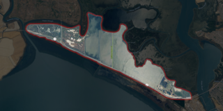
The Napa Sonoma Marsh is a wetland at the northern edge of San Pablo Bay, which is a northern arm of the San Francisco Bay in California, United States. This marsh has an area of 48,000 acres (194 km2), of which 13,000 acres (53 km2) are abandoned salt evaporation ponds. The United States Government has designated 13,000 acres (53 km2) in the Napa Sonoma Marsh as the San Pablo Bay National Wildlife Refuge.
Tomales High School is located in the town of Tomales, California, United States. It is the comprehensive high school of the Shoreline Unified School District. It serves the western Marin and Sonoma County communities, stretching from the towns of Point Reyes Station and Inverness along Tomales Bay, running north past the fishing port of Bodega Bay to the mouth of the Russian River, a distance of nearly 50 miles (80 km), and widening 13 miles (21 km) east from the west coast. Tomales High School draws its students from approximately 450 square miles (1,200 km2). Tomales High School was recognized as a California Distinguished School in 2011.

The Dry Creek Valley AVA is an American Viticultural Area in Sonoma County, California, located northwest of the town of Healdsburg. The valley is formed by Dry Creek, a tributary of the Russian River, and is approximately 16 miles (25.7 km) long and 2 miles (3.2 km) wide. The appellation benefits from the proximity of the Lake Sonoma reservoir for irrigation in this relatively dry area.
The Northern Sonoma AVA is an American Viticultural Area in Sonoma County, California, United States. The appellation covers most of the county with the notable exceptions of the Los Carneros AVA and Sonoma Valley AVA wine regions, which are located in the southern portion of the county. The creation of this AVA was largely based on the petitioning of the E & J Gallo Winery as part of their expansion of their Gallo of Sonoma brand. The viticultural area incorporates the Alexander Valley AVA, Chalk Hill AVA, Dry Creek Valley AVA, Knights Valley AVA, Russian River Valley AVA, Sonoma Coast AVA, and parts of the Green Valley of Russian River Valley AVA and Rockpile AVA valleys.

The Sonoma Valley AVA is an American Viticultural Area in Sonoma County, California which centers on the Sonoma Valley in the southern portion of the county. The name 'Sonoma' means 'Valley of the Moon' in the local Native American dialect. The appellation is bordered by two mountain ranges: the Mayacamas Mountains to the east and the Sonoma Mountains to the west.

The Sonoma County Fairgrounds is a fairground and exhibition center located in Santa Rosa, California. It is where the annual Sonoma County fair takes place and other events throughout the year.

Little Island is a partially submerged marsh island in the Napa Slough, branching off from the Napa River upstream of San Pablo Bay. It is almost entirely in Napa County, California, although part of its southern tip is in Solano County; it is managed as part of the Napa-Sonoma Marshes Wildlife Area. Its coordinates are 38°10′48″N122°21′05″W, and the United States Geological Survey measured its elevation as 3 ft (0.91 m) in 1981.

Coon Island is an island in the Napa River, upstream of San Pablo Bay. It is in Napa County, California, and managed as part of the Napa-Sonoma Marshes Wildlife Area. Its coordinates are 38°11′33″N122°19′24″W, and the United States Geological Survey measured its elevation as 3 ft (0.91 m) in 1981.

Edgerly Island is an island in the Napa River, upstream of San Pablo Bay. It is in Napa County, California, and managed as part of the Napa-Sonoma Marshes Wildlife Area. Its coordinates are 38°12′12″N122°18′52″W, and the United States Geological Survey measured its elevation as 3 ft (0.91 m) in 1981.

Green Island is an island in the Napa River, upstream of San Pablo Bay. It is in Napa County, California, and managed as part of the Napa-Sonoma Marshes Wildlife Area. Its coordinates are 38°12′09″N122°18′16″W, and the United States Geological Survey measured its elevation as 23 ft (7.0 m) in 1981. It, long with Island No. 1, Island No. 2 and Tubbs Island, are labeled on a 1902 USGS map of the area.

Island No. 1 is a partially submerged island in the Napa River, upstream of San Pablo Bay. It is in Napa and Solano County, California, and parts of it are managed as part of the Napa-Sonoma Marshes Wildlife Area. Its coordinates are 38°08′35″N122°20′40″W, and the United States Geological Survey measured its elevation as 3 ft (0.91 m) in 1981. It, along with Island No. 2, Green Island and Tubbs Island, are labeled on a 1902 USGS map of the area.

Knight Island is a mostly-submerged island in the Napa River, upstream of San Pablo Bay. It is in Solano County, California, and managed as part of the Napa-Sonoma Marshes Wildlife Area. Its coordinates are 38°08′09″N122°17′58″W, and the United States Geological Survey measured its elevation as 3 ft (0.91 m) in 1981.

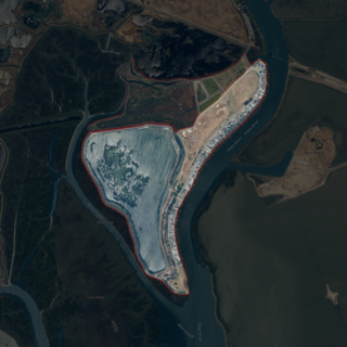
Tubbs Island is an island in San Pablo Bay. It is in Sonoma County, California, and parts of it are managed as part of the Napa-Sonoma Marshes Wildlife Area. Its coordinates are 38°08′59″N122°25′27″W, and the United States Geological Survey measured its elevation as 0 ft (0 m) in 1981. It, long with Island No. 1, Island No. 2 and Green Island, are labeled on a 1902 USGS map of the area.
Sutter Solano Medical Center (SSMC) is a 106-bed general acute care hospital located in Vallejo, California, the largest city in Solano County and second largest city in the North Bay (San Francisco Bay Area). It is part of Sutter Health.


