Related Research Articles
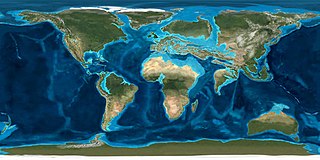
The Eocene Epoch is a geological epoch that lasted from about 56 to 33.9 million years ago (mya). It is the second epoch of the Paleogene Period in the modern Cenozoic Era. The name Eocene comes from the Ancient Greek ἠώς and καινός and refers to the "dawn" of modern ('new') fauna that appeared during the epoch.
The Miocene is the first geological epoch of the Neogene Period and extends from about 23.03 to 5.333 million years ago (Ma). The Miocene was named by Scottish geologist Charles Lyell; the name comes from the Greek words μείων and καινός and means "less recent" because it has 18% fewer modern marine invertebrates than the Pliocene has. The Miocene is preceded by the Oligocene and is followed by the Pliocene.
The Oligocene is a geologic epoch of the Paleogene Period and extends from about 33.9 million to 23 million years before the present. As with other older geologic periods, the rock beds that define the epoch are well identified but the exact dates of the start and end of the epoch are slightly uncertain. The name Oligocene was coined in 1854 by the German paleontologist Heinrich Ernst Beyrich from his studies of marine beds in Belgium and Germany. The name comes from the Ancient Greek ὀλίγος and καινός, and refers to the sparsity of extant forms of molluscs. The Oligocene is preceded by the Eocene Epoch and is followed by the Miocene Epoch. The Oligocene is the third and final epoch of the Paleogene Period.
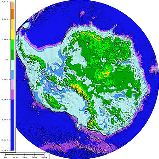
The Western Antarctic Ice Sheet (WAIS) is the segment of the continental ice sheet that covers West Antarctica, the portion of Antarctica on the side of the Transantarctic Mountains that lies in the Western Hemisphere. The WAIS is classified as a marine-based ice sheet, meaning that its bed lies well below sea level and its edges flow into floating ice shelves. The WAIS is bounded by the Ross Ice Shelf, the Ronne Ice Shelf, and outlet glaciers that drain into the Amundsen Sea.

The Antarctic ice sheet is one of the two polar ice caps of Earth. It covers about 98% of the Antarctic continent and is the largest single mass of ice on Earth, with an average thickness of over 2 kilometres. It covers an area of almost 14 million square kilometres and contains 26.5 million cubic kilometres of ice. A cubic kilometre of ice weighs approximately one metric gigaton, meaning that the ice sheet weighs 26,500,000 gigatons. It holds approximately 61% of all fresh water on Earth, equivalent to about 58 metres of sea level rise. In East Antarctica, the ice sheet rests on a major land mass, while in West Antarctica the bed can extend to more than 2,500 m below sea level.

Mount Morning is a shield volcano at the foot of the Transantarctic Mountains in Victoria Land, Antarctica. It lies 100 kilometres (62 mi) from Ross Island. Mount Morning rises to an elevation of 2,723 metres (8,934 ft) and is almost entirely mantled with snow and ice. A 4.1 by 4.9 kilometres wide summit caldera lies at the top of the volcano and several ice-free ridges such as Hurricane Ridge and Riviera Ridge emanate from the summit. A number of parasitic vents mainly in the form of cinder cones dot the mountain.

Mount Takahe is a 3,460-metre-high (11,350 ft) snow-covered shield volcano in Marie Byrd Land, Antarctica, 200 kilometres (120 mi) from the Amundsen Sea. It is a c. 30-kilometre-wide (19 mi) mountain with parasitic vents and a caldera up to 8 kilometres (5 mi) wide. Most of the volcano is formed by trachytic lava flows, but hyaloclastite is also found. Snow, ice, and glaciers cover most of Mount Takahe. With a volume of 780 km3 (200 cu mi), it is a massive volcano; the parts of the edifice that are buried underneath the West Antarctic Ice Sheet are probably even larger. It is part of the West Antarctic Rift System along with eighteen other known volcanoes.

Crary Mountains are a group of ice-covered volcanoes in Marie Byrd Land, Antarctica. They consist of two or three shield volcanoes, named Mount Rees, Mount Steere and Mount Frakes, which developed during the course of the Miocene and Pliocene and last erupted about 30,000-40,000 years ago. The first two volcanoes are both heavily incised by cirques, while Mount Frakes is better preserved and has a 4 kilometres (2.5 mi) wide caldera at its summit. Boyd Ridge is another part of the mountain range and lies southeast of Mount Frakes; it might be the emergent part of a platform that underlies the mountain range.

The West Antarctic Rift System is a series of rift valleys between East and West Antarctica. It encompasses the Ross Embayment, the Ross Sea, the area under the Ross Ice Shelf and a part of Marie Byrd Land in West Antarctica, reaching to the base of the Antarctic Peninsula. It has an estimated length of 3,000 km (1,900 mi) and a width of approximately 700 km (430 mi). Its evolution is due to lithospheric thinning of an area of Antarctica that resulted in the demarcation of East and West Antarctica. The scale and evolution of the rift system has been compared to that of the Basin and Range Province of the Western United States.
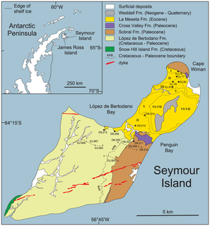
Seymour Island or Marambio Island, is an island in the chain of 16 major islands around the tip of the Graham Land on the Antarctic Peninsula. Graham Land is the closest part of Antarctica to South America. It lies within the section of the island chain that resides off the west side of the peninsula's northernmost tip. Within that section, it is separated from Snow Hill Island by Picnic Passage, and sits just east of the larger key, James Ross Island, and its smaller, neighboring island, Vega Island.
The term Middle Miocene disruption, alternatively the Middle Miocene extinction or Middle Miocene extinction peak, refers to a wave of extinctions of terrestrial and aquatic life forms that occurred around the middle of the Miocene, roughly 14 million years ago, during the Langhian stage of the Miocene. This era of extinction is believed to have been caused by a relatively steady period of cooling that resulted in the growth of ice sheet volumes globally, and the reestablishment of the ice of the East Antarctic Ice Sheet (EAIS). Cooling that led to the Middle Miocene disruption is primarily attributed to orbitally paced changes in oceanic and atmospheric circulation due to continental drift. These may have been amplified by CO2 being pulled out of the Earth's atmosphere by organic material before becoming caught in different locations like the Monterey Formation. This period was preceded by the Miocene Climatic Optimum, a period of relative warmth from 18 to 14 Ma.
Throughout Earth's climate history (Paleoclimate) its climate has fluctuated between two primary states: greenhouse and icehouse Earth. Both climate states last for millions of years and should not be confused with glacial and interglacial periods, which occur as alternate phases within an icehouse period and tend to last less than 1 million years. There are five known Icehouse periods in Earth's climate history, which are known as the Huronian, Cryogenian, Andean-Saharan, Late Paleozoic, and Late Cenozoic glaciations. The main factors involved in changes of the paleoclimate are believed to be the concentration of atmospheric carbon dioxide, changes in Earth's orbit, long-term changes in the solar constant, and oceanic and orogenic changes from tectonic plate dynamics. Greenhouse and icehouse periods have played key roles in the evolution of life on Earth by directly and indirectly forcing biotic adaptation and turnover at various spatial scales across time.
The natural history of New Zealand began when the landmass Zealandia broke away from the supercontinent Gondwana in the Cretaceous period. Before this time, Zealandia shared its past with Australia and Antarctica. Since this separation, the New Zealand landscape has evolved in physical isolation, although much of its current biota has more recent connections with species on other landmasses. The exclusively natural history of the country ended in about 1300 AD, when humans first settled, and the country's environmental history began. The period from 1300 AD to today coincides with the extinction of many of New Zealand's unique species that had evolved there.
Mulock Glacier in Antarctica is a heavily crevassed glacier which flows into the Ross Ice Shelf 40 kilometers south of the Skelton Glacier in the Ross Dependency, Antarctica.

Antarctica is Earth's southernmost and least-populated continent. Situated almost entirely south of the Antarctic Circle and surrounded by the Southern Ocean, it contains the geographic South Pole. Antarctica is the fifth-largest continent, being nearly twice the size of Australia and larger than Europe, and has an area of 14,200,000 km2 (5,500,000 sq mi). Most of Antarctica is covered by ice, with an average thickness of 1.9 km (1.2 mi).
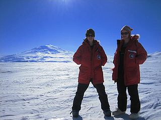
Kelly Jemison is an American academic geologist specializing in Antarctic diatoms. She studied at Florida State University, participated in the ANDRILL Project, and in 2011 was awarded the Antarctica Service Medal. She currently works as a Geologist for Bureau of Ocean Energy Management in Anchorage, Alaska.

The La Meseta Formation is a sedimentary sequence deposited during the Eocene. The formation is found on Seymour Island, Antarctica.

Christina Riesselman is an American paleoceanographer whose research focus is on Southern Ocean response to changing climate.
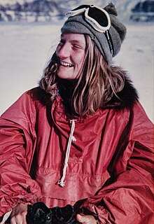
Rosemary Anne Askin, also known as Rosemary Askin Cully, is a New Zealand geologist specialising in Antarctic palynology. She was a trailblazer for women in Antarctic science, becoming the first New Zealand woman to undertake her own research programme in Antarctica in 1970.

Amelia E. Shevenell is an American marine geologist who specializes in high-latitude paleoclimatology and paleoceanography. She is currently an Associate Professor in the College of Marine Science at the University of South Florida. She has made notable contributions to understanding the history of the Antarctic ice sheets and published in high-impact journals and, as a result, was awarded full membership of Sigma Xi. She has a long record of participation in international ocean drilling programs and has served in leadership positions of these organizations. Shevenell is the elected Geological Oceanography Council Member for The Oceanography Society (2019-2021).
References
- ↑ "2016 Executive Council" . Retrieved August 9, 2015.
- ↑ Warny, S.; Askin, R. A.; Hannah, M. J.; Mohr, B. A.R.; Raine, J. I.; Harwood, D. M.; Florindo, F.; Team, the SMS Science (2009). "Palynomorphs from a sediment core reveal a sudden remarkably warm Antarctica during the middle Miocene". Geology. 37 (10): 955–958. Bibcode:2009Geo....37..955W. doi:10.1130/g30139a.1.
- ↑ "SHALDRIL". shaldril.org. Retrieved 2016-08-10.
- ↑ Anderson, John B.; Warny, Sophie; Askin, Rosemary A.; Wellner, Julia S.; Bohaty, Steven M.; Kirshner, Alexandra E.; Livsey, Daniel N.; Simms, Alexander R.; Smith, Tyler R. (2011-07-12). "Progressive Cenozoic cooling and the demise of Antarctica's last refugium". Proceedings of the National Academy of Sciences. 108 (28): 11356–11360. Bibcode:2011PNAS..10811356A. doi: 10.1073/pnas.1014885108 . ISSN 0027-8424. PMC 3136253 . PMID 21709269.
- ↑ Griener, Kathryn W.; Warny, Sophie; Askin, Rosemary; Acton, Gary (2015-04-01). "Early to middle Miocene vegetation history of Antarctica supports eccentricity-paced warming intervals during the Antarctic icehouse phase". Global and Planetary Change. 127: 67–78. Bibcode:2015GPC...127...67G. doi:10.1016/j.gloplacha.2015.01.006.
- ↑ "The Antarctic Sun: News about Antarctica – Polarpalooza (page 1)". antarcticsun.usap.gov. Retrieved 2016-08-09.
- ↑ "AASP Newsletter" (PDF). American Association of Stratigraphic Palynologists. 29 (3). 1996.
- ↑ Berthelot, Ashley (April 12, 2011). "LSU's Sophie Warny receives prestigious NSF CAREER Award". AAAS EurekAlert!.
- ↑ "LSU Rising Faculty Research Award". Louisiana State University Alumni Magazine. 90 (3): 21. Fall 2014. Retrieved August 10, 2016.