
Ayrshire is a historic county and registration county in south-west Scotland, located on the shores of the Firth of Clyde. Its principal towns include Ayr, Kilmarnock and Irvine and it borders the counties of Renfrewshire and Lanarkshire to the north-east, Dumfriesshire to the south-east, and Kirkcudbrightshire and Wigtownshire to the south. Like many other counties of Scotland it currently has no administrative function, instead being sub-divided into the council areas of East Ayrshire, North Ayrshire and South Ayrshire. It has a population of approximately 366,800.

Musselburgh is the largest settlement in East Lothian, Scotland, on the coast of the Firth of Forth, 5 miles (8 km) east of Edinburgh city centre. It has a population of 21,100.
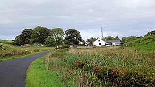
Fenwick is a village in East Ayrshire, Scotland. In 2019, its population was estimated to be 989. Fenwick is the terminus of the M77 following its extension which was opened in April 2005, at the beginning of the Kilmarnock bypass.
South Ayrshire was a county constituency of the House of Commons of the Parliament of the United Kingdom from 1868 until 1983, when it was abolished. It returned one Member of Parliament (MP), elected by the first past the post voting system.

Catrine is a village in East Ayrshire, Scotland which was formerly a centre of cotton manufacture. It has a population of around 2,020 (mid-2020 est.)

Mauchline is a town and civil parish in East Ayrshire, Scotland. In the 2001 census Mauchline had a recorded population of 4,105. It is home to the National Burns Memorial.

Oldhamstocks or Aldhamstocks is a civil parish and small village in the east of East Lothian, Scotland, adjacent to the Scottish Borders and overlooking the North Sea. It is located 6 miles (10 km) south-east of Dunbar and has a population of 193. The church was consecrated by Bishop David de Bernham, 19 October 1242. Its chancel is a fine example of late Gothic — probably fifteenth-century work.

Forgandenny is a small village in Perth and Kinross, Scotland, located four miles south of Perth. Perth is a 20-minute bus ride from Forgandenny, and there is a regular Stagecoach service. It is 45 minutes from Edinburgh and one hour from Glasgow. There is a daily train service from Perth to London King's Cross.

Dunino is a village and parish in the East Neuk of Fife. It is 10 km from the nearest town, St Andrews, and 8 km from the fishing village of Anstruther. It is a small village with no local shops or services. It had one primary school which was closed down in 2014.
Riccarton is a village and parish in East Ayrshire, Scotland. It lies across the River Irvine from Kilmarnock, this river forming the boundary between Riccarton and Kilmarnock parishes, and also between the historical districts of Kyle and Cunningham. The name is a corruption of 'Richard's town', traditionally said to refer to Richard Wallace, the uncle of Sir William Wallace. The parish also contains the village of Hurlford.
Kilmaurs Place, The Place or Kilmaurs House, is an old mansion house and the ruins of Kilmaurs Tower grid reference NS41234112 are partly incorporated, Kilmaurs, East Ayrshire, Scotland. The house stands on a prominence above the Carmel Water and has a commanding view of the surrounding area. Once the seat of the Cunningham Earls of Glencairn it ceased to be the main residence after 1484 when Finlaystone became the family seat. Not to be confused with Kilmaurs Castle that stood on the lands of Jocksthorn Farm.

Broadstone lies close to the small village of Gateside in North Ayrshire, Scotland about half a mile east of Beith in the old Barony of Giffen.

Crosbie Castle and the Fullarton estate lie near Troon in South Ayrshire. The site was the home of the Fullarton family for several centuries. The lands were part of the feudal Barony of Corsbie Fullartoune (sic). The Crosbie Castle ruins were eventually used as an ice house after the new Fullarton House mansion was built. The mansion house was later demolished and the area set aside as a public park and golf course.

Closeburn is a village and civil parish in Dumfries and Galloway, Scotland. The village is on the A76 road 2+1⁄2 miles (4 km) south of Thornhill. In the 2001 census, Closeburn had a population of 1,119. Closeburn is recorded as Killosbern in 1185. The first element of the name is Gaelic cill 'cell or church'. The second element is a saint's name, but none has definitely been identified.

Haugh or The Haugh is a small village or hamlet in East Ayrshire, Parish of Mauchline, Scotland. The habitation is situated about two and a half miles downstream from Catrine, on the north bank of the River Ayr. The River Ayr Way runs through the village.

Shewalton House and estate were composed of the 'Lands of Shewalton' and the laird's dwelling, originally a tower castle and later a mansion house on the River Irvine in the Shewalton area, two miles from Irvine and west of Drybridge village, East Ayrshire, Dundonald Parish, Scotland. In 1883 the Boyle's estate of Shewalton was 2,358 acres in extent in Ayrshire and was worth at that time £2,708 a year.
Craigie is a small village and parish of 6,579 acres in the old district of Kyle, now South Ayrshire, four miles south of Kilmarnock, Scotland. This is mainly a farming district, lacking in woodland, with a low population density, and only one village. In the 19th century, high quality lime was quarried here with at least three sites in use in 1832.

Minishant is a village bordering the A77 in the old county of Carrick, South Ayrshire, Scotland. It is located in Maybole Parish, 3+1⁄2 miles from Maybole and standing close to the River Doon. The village was originally named Culroy after the Culroy Burn that runs through it.

The ruins of the large courtyard style Kyle Castle, once also known as Cavil Castle or occasionally Dalblair Castle lie close to the hamlet of Dalblair in Auchinleck parish near Muirkirk in the East Ayrshire council area, Scotland. The castle stands at the confluence of the Guelt Water and the Glenmuir Water on a peninsula carved out by these rivers. Its name suggests that it was once of some significance.
John Rankine (1816–1885) was a Scottish minister who served as Moderator of the General Assembly of the Church of Scotland in 1883.


