The South Platte River is one of the two principal tributaries of the Platte River. Flowing through the U.S. states of Colorado and Nebraska, it is itself a major river of the American Midwest and the American Southwest/Mountain West. Its drainage basin includes much of the eastern flank of the Rocky Mountains in Colorado; much of the populated region known as the Colorado Front Range and Eastern Plains; and a portion of southeastern Wyoming in the vicinity of the city of Cheyenne. It joins the North Platte River in western Nebraska to form the Platte, which then flows across Nebraska to the Missouri. The river serves as the principal source of water for eastern Colorado. In its valley along the foothills in Colorado, it has permitted agriculture in an area of the Colorado Piedmont and Great Plains that is otherwise arid.

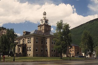
Las Animas is the Statutory City that is the county seat and the only incorporated municipality in Bent County, Colorado, United States. The city population was 2,410 at the 2010 United States Census. Las Animas is located on the Arkansas River, just west of its confluence with the Purgatoire River, in southeast Colorado east of Pueblo, near the historic Bent's Fort.

The Mojave River is an intermittent river in the eastern San Bernardino Mountains and the Mojave Desert in San Bernardino County, California, United States. Most of its flow is underground, while its surface channels remain dry most of the time, with the exception of the headwaters and several bedrock gorges in the lower reaches.

The San Juan River is a major tributary of the Colorado River in the southwestern United States, providing the chief drainage for the Four Corners region of Colorado, New Mexico, Utah and Arizona. Originating as snowmelt in the San Juan Mountains of Colorado, it flows 383 miles (616 km) through the deserts of northern New Mexico and southeastern Utah to join the Colorado River at Glen Canyon. The river drains a high, arid region of the Colorado Plateau and along its length it is often the only significant source of fresh water for many miles. The San Juan is also one of the muddiest rivers in North America, carrying an average of 25 million US tons of silt and sediment each year.

Roaring Fork River is a tributary of the Colorado River, approximately 70 miles (110 km) long, in west central Colorado in the United States. The river drains a populated and economically vital area of the Colorado Western Slope called the Roaring Fork Valley or Roaring Fork Watershed, which includes the resort city of Aspen and the resorts of Aspen/Snowmass.

The Roaring Fork Valley is a geographical region in western Colorado in the United States. The Roaring Fork Valley is one of the most affluent regions in Colorado and the U.S. as well as one of the most populous and economically vital areas of the Colorado Western Slope. The Valley is defined by the valley of the Roaring Fork River and its tributaries, including the Crystal and Fryingpan River. It includes the communities of Aspen, Snowmass Village, Basalt, Carbondale, and Glenwood Springs. Mount Sopris and the Roaring Fork River serve as symbols of the Roaring Fork Valley.

State Highway 3 is a short north–south state highway located in and near the city of Durango, in the county of La Plata in the U.S. State of Colorado, United States. It follows the former alignment of U.S. Routes 160 and 550 south of downtown, lying across the Animas River from the modern highway constructed about 1980.
South-Central Colorado is a region of the U.S. state of Colorado. It can be roughly defined by Chaffee County in the northwest, El Paso County in the northeast, Las Animas County in the southeast, and Conejos County in the southwest. Some notable towns and cities there include Colorado Springs, Pueblo, Cripple Creek, Cañon City, Salida, Buena Vista, Monte Vista, Alamosa, Walsenburg, and Trinidad. The landscapes of South-Central Colorado were made known to the Western world by the explorations of Zebulon Pike and Kit Carson, who were later followed by settlers, many of whom came by the Santa Fe Trail. The upper tributaries of the Arkansas River and South Platte River provide ample whitewater rafting and are famous for trout and bass fishing in scenic settings such as Royal Gorge. Much of the local economic system is dependent on mining, forestry, ranching, and tourism related to these endeavors. South-Central Colorado has so far largely escaped urbanization, allowing visitors to experience something of the American Old West.

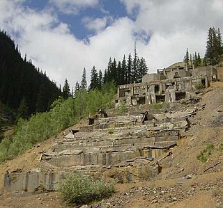
Animas Forks is a ghost town located twelve miles (19 km) northeast of Silverton in San Juan County, Colorado, United States. The area is managed by the Bureau of Land Management. At over 11,000 feet, Animas Forks is one of the highest mining camps in the Western US.

Eureka is a mining ghost town in San Juan County, Colorado, United States, along the Animas River, between Silverton and Animas Forks. The town derives its name from the Greek interjection Eureka!

The Silverton Northern Railroad, now defunct, was an American 3 ft narrow gauge railroad constructed to reach the mining area north of Silverton, Colorado along the upper Animas River. This line, the third railroad project by Otto Mears, began in 1889 as a branch of the Silverton Railroad to Eureka. Incorporated in 1895 as the Silverton Northern Railroad, the line was projected to run past Eureka to Animas Forks and on to Mineral Point and then on to Lake City via Henson Creek, including a proposed three-quarter-mile tunnel through the mountains. However, Animas Forks was the end of the line, which was reached in 1896.

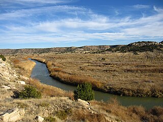
The Purgatoire River is a river in southeastern Colorado, United States. The river is also known locally as the Purgatory River or the Picketwire River. Purgatoire means Purgatory in French. French trappers named the river to commemorate Spanish explorers killed in a Native American attack.

The Alpine Loop National Back Country Byway is located northeast of Silverton, Colorado in San Juan and Hinsdale Counties. The route is circular, running from the ghost town of Animas Forks to Lake City and return. The Byway combines crossings of Engineer and Cinnamon Passes with high country scenery that features river meadows, alpine tundra, and ghost towns.
North Fork Vermejo River is a tributary of the Vermejo River. The river flows from Las Animas County, Colorado south to a confluence with Little Vermejo Creek in Colfax County, New Mexico that forms the Vermejo River.
West Fork Animas River is a tributary of the Animas River in San Juan County, Colorado. It flows from a source near Hurricane Peak to a confluence with the North Fork Animas River that forms the Animas River.
North Fork Animas River is a tributary of the Animas River in San Juan County, Colorado. It flows south to a confluence with the West Fork Animas River that forms the Animas River.


