South Normanton

Last updated

South Normanton
SNormanton Windmill 254916 74401cc4.jpg
A windmill conversion off Fordbridge Lane
Derbyshire UK location map.svg
Red pog.svg
South Normanton
Location within Derbyshire
Population9,445 (2011)
OS grid reference SK467592
District
Shire county
Region
Country England
Sovereign state United Kingdom
Post town Alfreton
Postcode district DE55
Dialling code 01773
Police Derbyshire
Fire Derbyshire
Ambulance East Midlands
UK Parliament
List of places
UK
England
Derbyshire
53°06′25″N1°20′35″W / 53.107°N 1.343°W / 53.107; -1.343

South Normanton is a village and civil parish in the Bolsover District of Derbyshire, England. The population at the 2011 Census was 9,445. [1] An ex-mining village, it is two miles east of Alfreton. The historic industries of the village were agriculture, stocking, spinning and mining. Normanton means 'the farm of the north men' or 'Northwegans'.

Contents

South Normanton Colliery closed in 1952, B Winning in 1964 and A Winning in 1969. Carnfield Hall was for several centuries the seat of the Revel family.

History

Before 1888 South Normanton was a small hamlet concerned with farming activities. There were very few buildings in the area and only a small track road leading to the settlement.

St. Michael's Church South Normanton 145686 833ec66d.jpg
St. Michael's Church

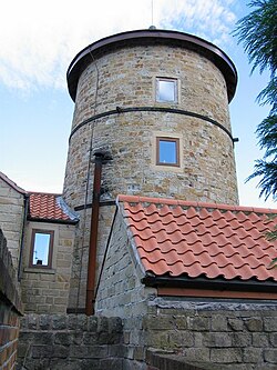
Around 1888 the only houses that were there were a few cottages around the church of St Michael, on the hilltop in South Normanton Centre and the Windmill. The church was also there of course. All the settlement and buildings at this point were clustered around the main road along the roadsides of what is now Church Street and Market Street (a linear settlement). There were farming fields around the arched shaped village.

Around 1921 the village began its main industry of mining. Many people moved in from the surrounding countryside to work in the mines. The wages they earned were better than the crops that they grew in the fields as security so they came to the village in their hundreds. Many terraced houses were built to accommodate them. These were small and cheap housing for the poor people that came, the streets around Peel Street, South Street and Albert Street. More houses were built on Berristow Lane and Carter Lane East. At this time there was one infant school called Hamlet Lane School. The population of the village grew dramatically. Notice on the 1921 map that the 'hamlet' remains.

Around 1957 the government and councils of Britain were concerned about the lot of poor people in the country and began a house building programme to improve the housing. In South Normanton New Street and Hilcote Street were built (new street shows up on the 1880 to 1888 map of south normanton and hilcote st shows up on the 1900 map along with half of downing street) along with King Street and other such areas. Schools were built to educate the children of the villagers and shops sprang up to serve the community. At the same time some houses were beginning to spring up along the main roads of Market Street and Mansfield Road. The schools included; Glebe Junior School, New Street Secondary School, Green Infant School and Brigg Infant School. In the period after the Second World War the council built an estate to give some of the residents of South Normanton the chance to rent very high quality housing. This was known as council housing. The streets in South Normanton that were built were along Lansbury Drive. The secondary school (Frederick Gent School) was built in 1959 also helped cater for the growing population.

After the 1980s there had been a huge infilling around South Normanton. The areas of Broadmeadows, Rippon Homes and newer housing areas were built. These were higher cost housing for the private market. Major roads had also been built including the M1 motorway creating easier access to the village and surrounding area for car owners. The East Midlands Designer Outlet (owned by McArthurGlen Group) is located near the edge of the settlement close to the M1.

Sport

South Normanton has some sporting facilities.
The village is home to South Normanton Athletic F.C. and it also has many Sunday and Saturday teams such as Carnfield F.C., a Grassroots Football Charter Standard Club (South Normanton Albion Football Club, catering for Under 7s to under 17s), and a Mini Colts soccer skills group.

A few footballers from the village went on to play professionally, such as Lee Holmes (formerly of Derby County), Jordan Smith (Nottingham Forest) and Chris Martin (formerly of Nottingham Forest and Port Vale).

South Normanton is also home to the South Normanton School of Boxing catering for all ages from 10 upwards; the South Normanton Cricket Club was formed in 1990; and the South Normanton Cycling Club most commonly known as 'SNCC'.

Notable residents

See also

Related Research Articles

<span class="mw-page-title-main">Tipton</span> Town in the West Midlands, England

Tipton is an industrial town in the Metropolitan Borough of Sandwell in the West Midlands County in England. It had a population of 38,777 at the 2011 UK Census. It is located northwest of Birmingham and southeast of Wolverhampton. It is also contiguous with nearby towns of Darlaston, Dudley, Wednesbury and Bilston.

<span class="mw-page-title-main">Alfreton</span> Town and civil parish in Amber Valley, Derbyshire, England

Alfreton is a town and civil parish in the Amber Valley district of Derbyshire, England. The town was formerly a Norman Manor and later an Urban District. The population of the Alfreton parish was 8,799 at the 2021 Census. The villages of Ironville, Riddings, Somercotes and Swanwick were historically part of the Manor and Urban District, and the population including these was 24,476 in 2001.

<span class="mw-page-title-main">Bramley, Surrey</span> Village and civil parish in Surrey, England

Bramley is a village and civil parish about three miles (5 km) south of Guildford in the Borough of Waverley in Surrey, south east England. Most of the parish lies in the Surrey Hills Area of Outstanding Natural Beauty.

<span class="mw-page-title-main">Littleover</span> Human settlement in England

Littleover is a village and suburb in the city of Derby, in Derbyshire, England, between Rose Hill, Normanton, Sunny Hill and Mickleover, about three miles (4.8 km) southwest of Derby city centre.

<span class="mw-page-title-main">Sutton Bonington</span> Village in Nottinghamshire, England

Sutton Bonington is a village and civil parish lying along the valley of the River Soar in the Borough of Rushcliffe, south-west Nottinghamshire, England. The University of Nottingham has a 420 hectares (4.2 km2) site just to the north of the village: Sutton Bonington Campus.

<span class="mw-page-title-main">Normanton, Derby</span> Human settlement in England

Normanton is an inner city suburb and ward of the city of Derby in Derbyshire, England, situated approximately 2 miles (3.2 km) south of the city centre. Neighbouring suburbs include Littleover, Pear Tree, Rose Hill and Sunny Hill. The original village of Normanton-by-Derby, which now forms the southern part of the suburb, dates back to the medieval period. As the Normanton area became rapidly urbanised in the 19th century, the New Normanton area to the north was developed for housing, linking the old village to Derby, into which it was eventually absorbed. The area is characterised by high density late 19th century terraced housing in New Normanton and mid-20th century housing estates elsewhere, and has the most ethnically diverse population in Derby. The Normanton ward had a population of 17,071 in 2011.

<span class="mw-page-title-main">Wythall</span> Village and civil parish in Bromsgrove, England

Wythall is a village and civil parish in the Bromsgrove District, in the north-east corner of the county of Worcestershire, England. Wythall parish borders Solihull and Birmingham, and had a population of 12,269 in the UK census of 2021.

<span class="mw-page-title-main">Featherstone</span> Town and civil parish in West Yorkshire, England

Featherstone is a town and civil parish in the City of Wakefield, West Yorkshire, England, two miles south-west of Pontefract. Historically part of the West Riding of Yorkshire, in 2011 it had a population of 15,244. Featherstone railway station is on the Pontefract Line.

<span class="mw-page-title-main">Rossington</span> Civil parish and former mining village in South Yorkshire, England

Rossington is a civil parish and former mining village in the Metropolitan Borough of Doncaster in South Yorkshire, England and is surrounded by countryside and the market towns of Bawtry and Tickhill.

<span class="mw-page-title-main">Hackenthorpe</span> Village in South Yorkshire, England

Hackenthorpe is a village 5 miles south east of Sheffield’s city centre, now classed as a historic township of the city. Due to much expansion, the village became a part of Sheffield city during the 1950s. During much of the late 19th and 20th centuries the village was noted for its steelmaking, with the Thomas Staniforth & Co Sickle works being based at Main Street. Another prominent feature of the village is the 17th century Hackenthorpe Hall, built by John Newbould for the Hounsfield family, with James Hounsfield being a prominent land owner. The building is today used as a nursery.

Whitfield is a village, civil parish and electoral ward in the English county of Kent. It now forms part of the urban area of the town of Dover. It has a modern counterpart in the large settlement located at the junction of the A2 and A256 roads, some four miles (6.4 km) north of Dover.

<span class="mw-page-title-main">New Inn</span> Human settlement in Wales

New Inn - - is a village and community directly south east of Pontypool, within the County Borough of Torfaen in Wales, within the historic boundaries of Monmouthshire. It had a population of 5,986 at the 2011 Census.

<span class="mw-page-title-main">Huntington, Staffordshire</span> Village in Staffordshire, England

Huntington is a civil parish and former mining village in Staffordshire, on the outskirts of Cannock Chase. It lies on the A34 road just north of Cannock and is surrounded by woodland. The village had an estimated population of 3,720 in 2004, increasing to 4,536 at the 2011 Census. The population in Huntington on the 2021 census was 4,715, a 3.94% increase from the decade before.

<span class="mw-page-title-main">Packington</span> Human settlement in England

Packington is a village and civil parish in the district of North West Leicestershire. It is situated close to the A42 road and the towns of Ashby de la Zouch and Measham. The population of Packington according to the 2001 UK census is 738, reducing slightly to 734 at the 2011 census. Nearby villages include Normanton le Heath and Heather.

<span class="mw-page-title-main">Outwood, Wakefield</span> Settlement in West Yorkshire, England

Outwood is a district to the north of Wakefield in West Yorkshire, England. The district is centred on the A61 Leeds Road south of Lofthouse. It grew up as a pit village and was only a small settlement until the 1970s, when construction of new houses caused it to grow and merge with neighbouring settlements such as Wrenthorpe and Stanley. In 2001, it had a population of 7,623.

<span class="mw-page-title-main">Hilcote</span> Human settlement in England

Hilcote is a small village in the south of the Bolsover district in Derbyshire, England, located close to the A38 junction with the M1.

<span class="mw-page-title-main">Slip End</span> Human settlement in England

Slip End is a village and civil parish in Central Bedfordshire, England. The village is located very near to Luton. As well as the village of Slip End, the parish contains the hamlets of Lower Woodside, Woodside and Pepperstock. In 2021 it had a population of 1,842.

Brighton-le-Sands: a brief history to 31 January 1971, prior to the name change for the suburb

<span class="mw-page-title-main">Shirland and Higham</span> Civil parish in Derbyshire, England

Shirland and Higham is a civil parish within the North East Derbyshire district, which is in the county of Derbyshire, England. Mainly built up with rural fringes, its population was 4,802 residents in the 2011 census. The parish is 120 miles (190 km) north west of London, 14 miles (23 km) north east of the county city of Derby, and 1+34 miles (2.8 km) north of the nearest market town of Alfreton. It shares a boundary with the parishes of Alfreton, Blackwell, Brackenfield, Morton, South Normanton, South Wingfield, Stretton, Tibshelf and Wessington.

<span class="mw-page-title-main">Grassmoor, Hasland and Winsick</span> Civil parish in Derbyshire, England

Grassmoor, Hasland and Winsick is a civil parish within the North East Derbyshire district, which is in the county of Derbyshire, England. Named for local settlements, with a mix of a number of villages and hamlets amongst a semi-rural area, it had a population of 3,360 residents in 2011. The parish is 130 miles (210 km) north west of London, 20 miles (32 km) north of the county city of Derby, and 2 miles (3.2 km) south east of the nearest market town of Chesterfield. It shares a boundary with the borough of Chesterfield, along with the parishes of Calow, North Wingfield, Temple Normanton, Tupton as well as Wingerworth. The parish paradoxically does not include the majority of the nearby built-up suburb of Hasland which is now within an adjacent unparished area of Chesterfield.

References

  1. "Civil Parish population 2011". Neighbourhood Statistics. Office for National Statistics. Retrieved 18 March 2016.