Related Research Articles
The Global 200 is the list of ecoregions identified by the World Wide Fund for Nature (WWF), the global conservation organization, as priorities for conservation. According to WWF, an ecoregion is defined as a "relatively large unit of land or water containing a characteristic set of natural communities that share a large majority of their species dynamics, and environmental conditions". For example, based on their levels of endemism, Madagascar gets multiple listings, ancient Lake Baikal gets one, and the North American Great Lakes get none.

The Ethiopian Highlands is a rugged mass of mountains in Ethiopia in Northeast Africa. It forms the largest continuous area of its elevation in the continent, with little of its surface falling below 1,500 m (4,900 ft), while the summits reach heights of up to 4,550 m (14,930 ft). It is sometimes called the "Roof of Africa" due to its height and large area. It is the only country in the region with such a high elevated surface. This elevated surface is bisected diagonally by the Great East African Rift System which extends from Syria to Mozambique across the East African Lakes. Most of the Ethiopian Highlands are part of central and northern Ethiopia, and its northernmost portion reaches into Eritrea.
The Yaeda Valley, or Yaida Valley, is a swampy valley located in Mbulu District of Manyara Region, Tanzania. The Valley is situated south of Lake Eyasi.
The Ethiopian montane grasslands and woodlands is a montane grasslands and shrublands ecoregion in Ethiopia. It occupies the middle elevations of the Ethiopian Highlands, between the high-elevation Ethiopian montane moorlands and lowland woodlands, savannas, shrublands, and thickets.
The Southern Highlands is a highland region in southwestern Tanzania, at the northern end of Lake Malawi. The highlands include portions of Mbeya, Njombe, Rukwa, Ruvuma, and Songwe regions, bordering Malawi, Mozambique, and Zambia. Mbeya is the largest city in the highlands.

The Mbulu Highlands is a plateau in north-central Tanzania.

Northern Zanzibar–Inhambane coastal forest mosaic, also known as the Northern Swahili coastal forests and woodlands, is a tropical moist broadleaf forest ecoregion of coastal East Africa. The ecoregion includes a variety of habitats, including forest, savanna and swamps.

The Ethiopian montane forests is a tropical moist broadleaf forest ecoregion in Ethiopia. It covers the southwestern and southeastern portions of the Ethiopian Highlands. The ecoregion includes distinctive Afromontane evergreen forests. The ecoregion's biodiversity is threatened by deforestation, conversion to agriculture, and overgrazing.

The Usangu Plain is a lowland in south-central Tanzania. It is named for the Sangu people.

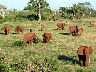
The Southern Acacia–Commiphora bushlands and thickets is a tropical grasslands, savannas, and shrublands ecoregion in Tanzania and Kenya. It includes portions of Serengeti National Park and Ngorongoro Conservation Area, which are designated World Heritage Sites and biosphere reserves for their outstanding wildlife and landscapes. It is one of three Acacia–Commiphora bushlands and thickets ecoregions in eastern Africa.
The Northern Acacia–Commiphora bushlands and thickets are a tropical grasslands, savannas and shrublands ecoregion in eastern Africa. The ecoregion is mostly located in Kenya, extending north into southeastern South Sudan, northeastern Uganda and southwestern Ethiopia and south into Tanzania along the Kenya-Tanzania border.

The Somali Acacia–Commiphora bushlands and thickets is a semi-arid tropical grasslands, savannas, and shrublands ecoregion in the Horn of Africa. It is home to diverse communities of plants and animals, including several endemic species.

The Masai xeric grasslands and shrublands is a Desert and xeric shrubland ecoregion in Kenya and Ethiopia. It includes the lowlands around Lake Turkana and the Chalbi Desert east of the lake.

The Victoria Basin forest–grassland mosaic is an ecoregion that lies mostly in Uganda and extends into neighboring countries. The ecoregion is centered north and west of Lake Victoria, with an outlier on the border of Ethiopia and South Sudan.
References
| | This ecoregion article is a stub. You can help Wikipedia by expanding it. |