
Colonial National Historical Park is located in the Hampton Roads region of Virginia and is operated by the National Park Service of the United States government. The park protects and interprets several sites relating to the Colony of Virginia and the history of the United States more broadly, ranging from the site of the first landing of the English settlers who would settle at Jamestown, to the battlefields of Yorktown where the British Army was finally defeated in the American Revolutionary War. Over 3 million people visit the park each year.

Shiloh National Military Park preserves the American Civil War Shiloh and Corinth battlefields. The main section of the park is in the unincorporated town of Shiloh, about nine miles (14 km) south of Savannah, Tennessee, with an additional area located in the city of Corinth, Mississippi, 23 miles (37 km) southwest of Shiloh. The Battle of Shiloh began a six-month struggle for the key railroad junction at Corinth. Afterward, Union forces marched from Pittsburg Landing to take Corinth in a May siege, then withstood an October Confederate counter-attack.

Chickamauga and Chattanooga National Military Park, located in northern Georgia and southeastern Tennessee, preserves the sites of two major battles of the American Civil War: the Battle of Chickamauga and the Siege of Chattanooga. A detailed history of the park's development was provided by the National Park Service in 1998.

The Richmond National Battlefield Park commemorates 13 American Civil War sites around Richmond, Virginia, which served as the capital of the Confederate States of America for most of the war. The park connects certain features within the city with defensive fortifications and battle sites around it.
The Fort Mill Ridge Civil War Trenches are battle trenches in West Virginia that were originally dug between 1861 and 1862 to be later used in 1863 for the civil war. These trenches lined with chestnut logs by the Confederate artillery during the American Civil War to defend the approaches to Romney on the Northwestern Turnpike and the South Branch Potomac River. The trenches were then refurbished between March and June 1863 by the 54th Pennsylvania Infantry and the 1st West Virginia Infantry. When Colonel Jacob M. Campbell garrisoned Union forces at Romney, camps were set up at nearby at Mechanicsburg Gap. The Confederates might have created these trenches but all throughout the war the Union had control of these trenches.

Fort Pocahontas was an earthen fort on the north bank of the James River at Wilson's Wharf, in Charles City County, Virginia which served as a Union supply depot during the American Civil War. The fort was constructed by African-American soldiers of the United States Colored Troops under the command of Brig. Gen. Edward Augustus Wild.
Fort Ward is a former Union Army installation now located in the city of Alexandria in the U.S. state of Virginia. It was the fifth largest fort built to defend Washington, D.C. in the American Civil War. It is currently well-preserved with 90-95% of its earthen walls intact.
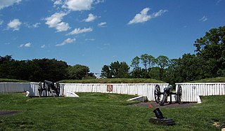
The Port Hudson State Historic Site is located on the Mississippi River north of Baton Rouge in East Feliciana Parish, Louisiana, just outside the limits of Port Hudson and in the vicinity of Jackson. The site preserves a portion of the fortifications and battle area of the longest siege in American history, during the American Civil War from May 23 through July 9, 1863. The state of Louisiana maintains the site, which includes a museum about the siege, artillery displays, redoubts, and interpretive plaques. Historical reenactments are held each year. It was designated a National Historic Landmark in 1974, significant as the first place where African-American military units fought for the Union Army under African-American field leadership.

This is a list of the National Register of Historic Places listings in York County, Virginia.

Fort Morris Historic Site is a Georgia state historic park in Liberty County, Georgia in the United States. The fort is on a bend in the Medway River and played an important role in the protection of southeast Georgia throughout various conflicts beginning in 1741 and ending in 1865 at the conclusion of the American Civil War, including the French and Indian and American Revolutionary Wars and War of 1812. The historic site is 70 acres (28 ha) and sits at an elevation of 23 feet (7.0 m).
Union Civil War Fortification, also known as Bulltown Civil War Site, is a historic archaeological site located near Napier, Braxton County, West Virginia. The site relates to the American Civil War Battle of Bulltown, that took place on October 13, 1863. During test excavations in the 1970s, remnants of structures, features, and artifacts were recovered. The site was purchased by the Army Corps of Engineers during the development of Burnsville Lake, and is administered as part of the Bulltown Historic Area.

Massaponax Baptist Church is an historic Southern Baptist church built in the Greek Revival style, located in Spotsylvania County, Virginia. The Baptist congregation that built the church was established in 1788 at a small church near Massaponax Creek. When that building became too small to hold the growing congregation, the church was moved to its present location at the intersection of U.S. Route 1 and State Route 608. The new church was a small, frame building which was also outgrown. In 1859, the current brick building was constructed on the site. Kilns in a nearby field fired the bricks for the exterior walls. By October 1859 the new church was completed at a cost of $3,000. Joseph Billingsly was the first pastor in the new building. An addition was built in 1949 and a brick cottage for the pastor, was built near the church in 1956. The church was listed on the National Register of Historic Places in January 1991.

Fort Riverview is a historic archaeological site located near Madison Heights, Amherst County, Virginia. It is an American Civil War redoubt built by the Confederate States Army about 1863 to protect Six Mile Bridge and the James River and Kanawha Canal system along the James River. Fort Riverview served as part of the outer defense system for Lynchburg, Virginia. The protection of this bridge was vital to the Confederacy as it carried supplies for General Robert E. Lee. Since Lynchburg served as a major supply, staging, and hospital center, Fort Riverview was strategically located to protect this critical center.

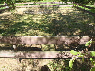
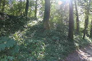
Redoubt No. 2, also known as Fort No Name, is a historic archaeological site located near Stafford, Stafford County, Virginia. The site was the central of the three, perhaps four, Federal defensive fortifications ordered constructed in early (February) 1863 during the American Civil War to protect the approaches to the Union supply depot at Aquia Creek Landing, Stafford, Virginia. Redoubt No.2 is an earthen field fortification that is nearly 95 feet square.
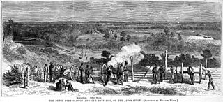
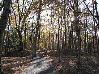
Fort Clifton Archeological Site is a historic American Civil War fort archaeological site located at Fort Clifton Park, Colonial Heights, Virginia. The park is the site of Fort Clifton on the Appomattox River where five Union ships sailed on Confederate troops on June 11, 1864. The Confederate Battery, with cannon emplacements, remained in Confederate hands as the cannons drove the Union attackers away. The park has earthworks that criss-cross the property. Fort Clifton Park has hiking trails and Civil War campaign signage on site.
Fort Crafford is a historic archaeological site located at Fort Eustis, Newport News, Virginia. It is a pentagonal-shaped earthwork located on Mulberry Island and built by Confederate forces in 1862. The earthworks on Mulberry Island are considered part of the Warwick Line. The purpose of these works was to prevent the Union from flanking the line on the James River. The fort formed the James River terminus of the second trans-peninsula defensive line, which included fortifications at Lee's Mill, as well as Dam No.1 and Wynne's Mill in Newport News Park.
Fort Boykin is a historic site in Isle of Wight County, Virginia, located along the James River. The history of the site is believed to date back to 1623 when colonists were ordered to build a fort to protect them from attacking Native Americans or Spanish marauders. Today the remains of the fort, mostly from the American Civil War, are preserved in a public park.
The Gloucester Point Archaeological District is a site at the tip of Gloucester Point, Virginia. The district includes the historic center of colonial Gloucestertown, as well as military sites from both the American Revolutionary War and the American Civil War. The site may also have remains of fortifications dating to the 17th century.
Whitaker's Mill Archeological Complex, also known as Burwell's Mill, is the site of an early colonial mill complex in York County near Williamsburg. Located on the historic King's Creek Plantation near Route 199 and Water Country Parkway, the site has industrial remains of millworks from the 17th and 18th centuries, as well as military encampment sites associated with the American Revolutionary War and the American Civil War.
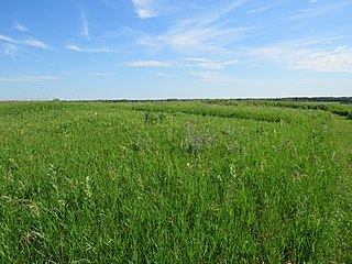
Fort Juelson, designated 21OT198 in the state archaeological inventory, is a historic site located east of Underwood, Minnesota, United States. An earthen fort was built at this hilltop in July 1876 after rumors of Indian attacks in Foxhome, French, and Fergus Falls following the Battle of Little Bighorn in Montana. Many settlers left the area. Charles A. Dollner, a local merchant, suggested the rest of the people band together and build the fortification under leadership of two American Civil War veterans, Hans Juelson and Berge O. Lee. The scare proved to be a hoax, and the fort was never used for defensive purposes. Remnants of the sod barricade are still on the site.

