Roehampton is an area in southwest London, in the Putney SW15 postal district, and takes up a far western strip running north to south of the London Borough of Wandsworth. It contains a number of large council house estates and is home to the University of Roehampton.

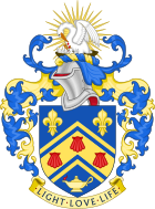
The University of Roehampton, London, formerly Roehampton Institute of Higher Education, is a public university in the United Kingdom, situated on three major sites in Roehampton, in the London Borough of Wandsworth. The University traces its roots to four institutions founded in the 1800s, which today make up to university's constituent colleges, around which student accommodation is centred: Digby Stuart College, Froebel College, Southlands College and Whitelands College.
Trefeca, located between Talgarth and Llangorse Lake in what is now south Powys in Wales, was the birthplace and home of the 18th-century Methodist leader Howell Harris (1714–1773),. It was also the site of two Calvinistic Methodist colleges at different times; the first sponsored by Selina, Countess of Huntingdon in the late eighteenth century; the second supported by the Welsh Calvinistic Methodist Connexion in the later nineteenth century.

Methodist College Belfast (MCB), locally known as Methody, is a co-educational voluntary grammar school in Belfast, located at the foot of the Malone Road, Northern Ireland. It was founded in 1865 by the Methodist Church in Ireland and is one of eight Northern Irish schools represented on the Headmasters' and Headmistresses' Conference. It is also a member of the Independent Schools Council and the Governing Bodies Association.
Froebel College is one of the four constituent colleges of the University of Roehampton.
Whitelands College is the oldest of the four constituent colleges of the University of Roehampton.

Wesley's Chapel is a Methodist church situated in the St Luke's area in the south of the London Borough of Islington. Opened in 1778, it was built under the direction of John Wesley, the founder of the Methodist movement. The site is a place of worship and visitor attraction, incorporating the Museum of Methodism in its crypt and John Wesley's House next to the chapel. The chapel has been called "The Mother Church of World Methodism".

The West Street Chapel is a former chapel at 24 West Street, London WC2. It was John Wesley’s first Methodist chapel in London's West End.

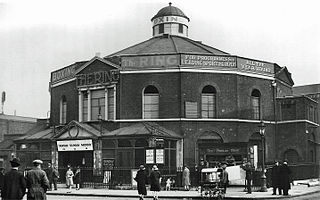
The Surrey Chapel (1783–1881) was an independent Methodist and Congregational church established in Blackfriars Road, Southwark, London on 8 June 1783 by the Rev. Rowland Hill. His work was continued in 1833 by the Congregational pastor Rev. James Sherman, and in 1854 by Rev. Newman Hall. The chapel's design attracted great interest, being circular in plan with a domed roof. When built it was set in open fields, but within a few years it became a new industrial area with a vast population characterised by great poverty amidst pockets of wealth. Recently the site itself has been redeveloped as an office block, and Southwark Underground Station has been built opposite.

The Alton Estate is a large council estate situated in Roehampton, southwest London. One of the largest council estates in the UK, it occupies an extensive area of land west of Roehampton village and runs between the Roehampton Lane through-road and Richmond Park Golf Courses.

Mount Clare is a Grade I listed house built in 1772 in Minstead Gardens, Roehampton, in the London Borough of Wandsworth.

St Joseph's Church is a Roman Catholic Parish church in Roehampton in the London Borough of Wandsworth. It was founded by the Jesuits in 1869 and designed by Frederick Walters. It is situated on the corner of Roehampton Lane and Medfield Street.

The King's Head is a Grade II listed public house at 1 Roehampton High Street, Roehampton, London SW15 4HL.

The Montague Arms is a Grade II listed building at 3 Medfield Street, Roehampton, London. Previously a public house, it dates to the 17th century, although has been altered since.

Roehampton House is a Grade I listed house at Roehampton Lane, Roehampton, London.

Grove House is a Grade II* listed house at Roehampton Lane, Roehampton, London.

Parkstead House, formerly known as Manresa House and Bessborough House, is a neo-classical Palladian villa in Roehampton, London, built in the 1760s. The house and remaining grounds are now Whitelands College, part of the University of Roehampton. It is situated on Holybourne Avenue, off Roehampton Lane, next to the Richmond Park Golf Course in the London Borough of Wandsworth. In 1955 it was designated Grade I on the National Heritage List for England.

Charles Bell FRIBA (1846–99) was a British architect who designed buildings in the United Kingdom, including over 60 Wesleyan Methodist chapels.

Bull is a Grade II* listed sculpture by Robert Clatworthy, in Daneburry Avenue, Roehampton, London.

Hinde Street Methodist Church in Hinde Street, Marylebone, London, is Grade II listed with Historic England. It was built 1807-10 and rebuilt in the 1880s.


