
The Somerset and Dorset Joint Railway, also known as the S&D, SDJR or S&DJR, was an English railway line connecting Bath and Bournemouth, with a branch from Evercreech Junction to Burnham-on-Sea and Bridgwater. Strictly speaking, the main line ran from Bath Junction to Broadstone, as the line between Broadstone and Bournemouth was owned by the London and South Western Railway, while the line between Bath Junction and Bath was owned by the Midland Railway.
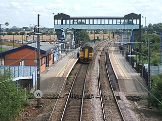
Adwick railway station serves the communities of Adwick le Street and Carcroft, in the Metropolitan Borough of Doncaster, South Yorkshire, England. Located on the line linking Leeds to Doncaster via Wakefield, immediately south-east of the point where it passes beneath Church Lane, the present station is the second to serve Adwick: the first, the main building of which still stands, lay on the other side of the present road bridge.

Town Green railway station is a railway station in Town Green, Aughton, Lancashire, England, situated on the Ormskirk branch of Merseyrail's Northern Line.

Rainhill railway station serves the district of Rainhill in Merseyside, England. It is situated on the electrified northern route of the Liverpool to Manchester Line, forming part of the Liverpool City Line. The station, and all trains serving it, are operated by Northern Trains on behalf of Merseytravel and are branded as Merseytravel services.
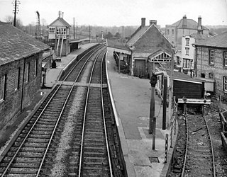
Blandford Forum railway station was a station on the Somerset & Dorset Joint Railway which served the town of Blandford Forum.
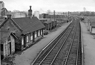
Bailey Gate railway station was on the Somerset & Dorset Joint Railway in the English county of Dorset.

Liverpool Road is a former railway station on the Liverpool and Manchester Railway in Manchester, England that opened on 15 September 1830. The station was the Manchester terminus of the world's first inter-city passenger railway in which all services were hauled by timetabled steam locomotives. It is the world's oldest surviving terminal railway station. With tracks running at a second floor level behind the building, it could also be considered one of the world's first elevated railway stations.
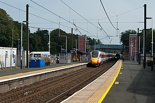
Alnmouth is a railway station on the East Coast Main Line, which runs between London King's Cross and Edinburgh Waverley. The station, situated 34 miles 69 chains north of Newcastle, serves the villages of Alnmouth and Lesbury and the neighbouring market town of Alnwick in Northumberland, England. It is owned by Network Rail and managed by Northern Trains.

Turton and Edgworth railway station, located at 4 miles, 856 yards from Bolton, on the Bolton to Blackburn line, opened as Chapel Town Station. The short length original low height platform seen in early photographs at the front of the station building are replicated exactly at Bromley Cross, itself known to have opened in June 1848. Permanent station buildings were provided along the line in 1859, constructed with locally quarried sandstone, by Joseph Greenup and Co of Manchester. The original minutes of the railway company held at National Archives, Kew, reveal that the engineers drew up the plans for the 1859 building at Chapel Town and minute 273, dated 25 May 1859, reveals that tenders were sought for a station and detached cottage and loading shed at Chapel Town, at an estimated cost of £500. The 'detached cottage' survives as a private house close to the automated level crossing and the distinct two-half structure there appears identical to that surviving at the former Oaks Station, down the line towards Bolton, both being built as part of the same contract.

Upwey Wishing Well Halt was a railway station at Bincombe in the county of Dorset in England. It served the northern part of the village of Upwey, now a suburb of Weymouth, on what is now known as the Heart of Wessex Line and the South West Main Line.

Boscombe railway station was a station in Bournemouth, now in the county of Dorset, England. It was opened in 1897 at which time the previous station with the name was renamed Pokesdown. The station served the Royal Victoria Hospital and the centre of Boscombe around the Royal Arcade. It was also the closest station to Dean Court, the home of the football club known during the station's life as Bournemouth and Boscombe Athletic FC. The station had a goods yard which received traffic from a large area of Bournemouth, and a large coal depot with sidings. It also had substantial brick buildings which were demolished a few years after closure. Closure took place, just before the electrification of the line through it, on 4 October 1965.
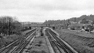
Broadstone was a railway station in the northern part of the Borough of Poole in the county of Dorset in England. It opened in 1872 under the name of New Poole Junction and closed to passengers in 1966. Between these dates there were several changes of name for a station which at its height provided a suburb of Poole with four substantial platforms and a goods yard. A prominent feature of the station was the large footbridge needed to span the four running lines.

Corfe Mullen Halt was a station in the English county of Dorset. It was located between Bailey Gate and Broadstone stations on the Somerset and Dorset Joint Railway. This section was built to enable trains to avoid the time-consuming reversal at Wimborne. The station consisted of a single platform and shelter lit by a solitary gas lamp.
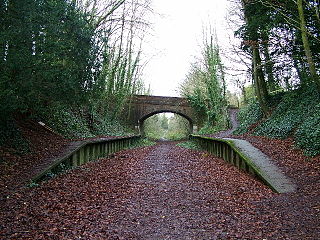
Charlton Marshall Halt was a station in the English county of Dorset. It was located between Blandford Forum and Bailey Gate on the Somerset and Dorset Joint Railway. The station consisted of two short platforms and shelters.

Stourpaine & Durweston Halt was a railway station in the English county of Dorset. It was located between Shillingstone and Blandford Forum on the Somerset & Dorset Joint Railway. The station consisted of a small concrete platform and shelter.

Shillingstone railway station was a station on the Somerset and Dorset Joint Railway (S&DJR), serving the village of Shillingstone in the English county of Dorset. Shillingstone is the last surviving example of a station built by the Dorset Central Railway.

Sturminster Newton railway station was a station in the town of Sturminster Newton, in the English county of Dorset. It was located on the Somerset and Dorset Joint Railway.

Henstridge railway station was a station at Henstridge in the county of Somerset, in England. It was located on the Somerset and Dorset Joint Railway. Sited on a single line stretch, the station had one short platform with a modest station building. A siding was controlled from a ground frame, and an adjacent level crossing operated by hand.
Rosherville Halt was a railway station on the Gravesend West Line which was built to serve the popular Rosherville Gardens, a pleasure garden in Gravesend which closed in 1910. The station survived a further 23 years before itself closing in 1933.
Coed Ely railway station served the portion of the Ely Valley around the mining communities of Thomastown and Coed-Ely in South Wales, between 1925 and 1958.


