
The Tube map is a schematic transport map of the lines, stations and services of the London Underground, known colloquially as "the Tube", hence the map's name. The first schematic Tube map was designed by Harry Beck in 1931. Since then, it has been expanded to include more of London's public transport systems, including the Docklands Light Railway, London Overground, the Elizabeth line, Tramlink, the London Cable Car and Thameslink.

A bus stop is a place where buses stop for passengers to get on and off the bus. The construction of bus stops tends to reflect the level of usage, where stops at busy locations may have shelters, seating, and possibly electronic passenger information systems; less busy stops may use a simple pole and flag to mark the location. Bus stops are, in some locations, clustered together into transport hubs allowing interchange between routes from nearby stops and with other public transport modes to maximise convenience.

Henry Charles Beck was an English technical draughtsman who created the present London Underground Tube map in 1931. Beck drew the diagram after being fired at the London Metro Signal Office.
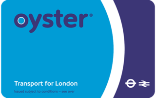
The Oyster card is a payment method for public transport in London in England, United Kingdom. A standard Oyster card is a blue credit-card-sized stored-value contactless smart card. It is promoted by Transport for London (TfL) and can be used on travel modes across London including London Buses, London Underground, the Docklands Light Railway (DLR), London Overground, Tramlink, some river boat services, and most National Rail services within the London fare zones. Since its introduction in June 2003, more than 86 million cards have been used.

Strathclyde Partnership for Transport (SPT) is a regional transport partnership for the Strathclyde area of western Scotland. It is responsible for planning and coordinating regional transport, especially the public transport system in the area, including responsibility for operating the Glasgow Subway, the third-oldest in the world.

Buses have been used as a mode of public transport in London since 1829, when George Shillibeer started operating a horse-drawn omnibus service from Paddington to the City of London. In the decades since their introduction, the red London bus has become a symbol of the city.

London Buses is the subsidiary of Transport for London (TfL) that manages most bus services in London, England. It was formed following the Greater London Authority Act 1999 that transferred control of London Regional Transport (LRT) bus services to TfL, controlled by the Mayor of London.
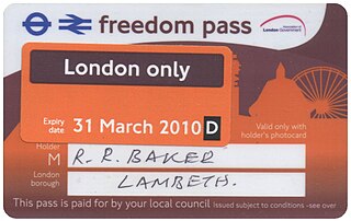
Freedom Pass is a concessionary travel scheme, which began in 1973, to provide free travel to residents of Greater London, England, for people with a disability or over the progressively increasing women's state pension age. The scheme is funded by local authorities and coordinated by London Councils. Originally the pass was a paper ticket, but since 2004 it has been encoded on to a contactless smartcard compatible with Oyster card readers.

Road signs in the United Kingdom and in its associated Crown dependencies and overseas territories conform broadly to European design norms, though a number of signs are unique: direction signs omit European route numbers and road signs generally use the Imperial System of units, unlike the rest of Europe. Signs in Wales and parts of Scotland are bilingual.
Jamuria is a neighbourhood in Asansol of Paschim Bardhaman district in the Indian state of West Bengal. It is governed by Asansol Municipal Corporation

Road signs in Norway are regulated by the Norwegian Public Roads Administration, Statens vegvesen in conformity with the 1968 Vienna Convention on Road Signs and Signals, to which Norway is a signatory.
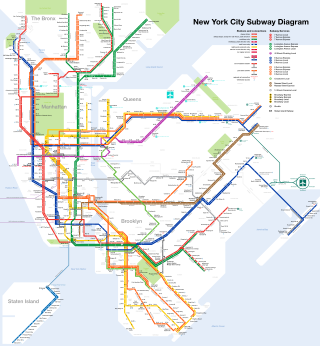
A transit map is a topological map in the form of a schematic diagram used to illustrate the routes and stations within a public transport system—whether this be bus, tram, rapid transit, commuter rail or ferry routes. The main components are color-coded lines to indicate each route or service, with named icons to indicate stations or stops.

Intalink is the organisation responsible for organising the management of public transport services, such as buses and trains, in Hertfordshire on behalf of Hertfordshire County Council. They design, create and promote cross-operator multi-journey tickets and occasionally run competitions. They manage Quality Bus Partnerships maintaining good standards along routes that need it. Along with this, they provide printed timetables, maps and leaflets promoting the above services.
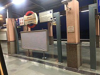
The Sultanpur metro station is located on the Yellow Line of the Delhi Metro. During Peak hours, it serves as an alternate southern Terminus for the yellow line along with Qutab Minar
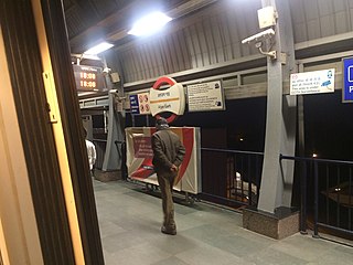
The Arjan Garh metro station is located on the Yellow Line of the Delhi Metro. It is on the HUDA City Centre metro station route towards Gurgaon.
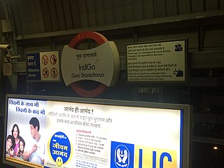
The Guru Dronacharya metro station is located on the Yellow Line of the Delhi Metro.
The main public transport in the Netherlands for longer distances is by train. Long-distance buses are limited to a few missing railway connections. Regional and local public transport is by bus, and in some cities by metro and tram. There are also ferries.
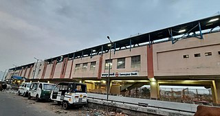
The Samaypur Badli is a terminal station on the Yellow Line of the Delhi Metro. It is an elevated station and is located in Samaypur Badli, Rohini Sector-18 in the National Capital Region of Delhi in India. The station was inaugurated on 10 November 2015.
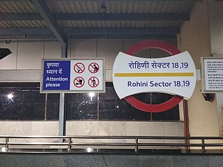
The Rohini Sector 18, 19 is a station on the Yellow Line of the Delhi Metro. It is an elevated station and is located in Rohini in the National Capital Region of India. The station was inaugurated on 10 November 2015.
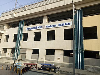
The Haiderpur Badli Mor is a metro station on the Yellow Line of the Delhi Metro. It is an elevated station and is located in Shalimar Bagh in the National Capital Region of India.
