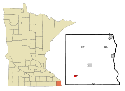
Spring Grove, Minnesota

Last updated

Spring Grove
Spring Grove, Minnesota.jpg
Motto: 
"pretty. neat. small town."
Houston County Minnesota Incorporated and Unincorporated areas Spring Grove Highlighted.svg
Location of Spring Grove, Minnesota
Coordinates: 43°33′40″N91°38′14″W / 43.56111°N 91.63722°W / 43.56111; -91.63722
Country United States
State Minnesota
County Houston
Government
  MayorSaundra Solum [ citation needed ]
Area
[1]
  Total0.99 sq mi (2.58 km2)
  Land0.99 sq mi (2.57 km2)
  Water0.00 sq mi (0.00 km2)
Elevation
[2]
1,322 ft (403 m)
Population
 (2020)
  Total1,256
  Density1,263.58/sq mi (487.88/km2)
Time zone UTC-6 (Central (CST))
  Summer (DST) UTC-5 (CDT)
ZIP code
55974
Area code 507
FIPS code 27-61852 [3]
GNIS feature ID2395931 [2]
Website www.springgrove.govoffice.com
Giants of the Earth Heritage Center in Spring Grove HeritageCenterSpringGroveMN.jpg
Giants of the Earth Heritage Center in Spring Grove

Spring Grove is a city in Houston County, Minnesota, United States. The population was 1,330 at the 2010 census. [4] It is part of the La Crosse-Onalaska, WI-MN Metropolitan Statistical Area.

Contents

History

A post office has been in operation at Spring Grove since 1855. [5] The community was named for a spring and a grove near the original town site. [6]

Geography

According to the United States Census Bureau, the city has a total area of 0.96 square miles (2.49 km2), all land. [7] Minnesota State Highway 44 and County Highways 4 and 16 are three of the main routes in the community.

Demographics

Historical population
CensusPop.Note
1880 293
1890 39434.5%
1900 49124.6%
1910 62026.3%
1920 75321.5%
1930 86715.1%
1940 96711.5%
1950 1,09313.0%
1960 1,34222.8%
1970 1,290−3.9%
1980 1,275−1.2%
1990 1,153−9.6%
2000 1,30413.1%
2010 1,3302.0%
2020 1,256−5.6%
U.S. Decennial Census [8]

2010 census

As of the census [9] of 2010, there were 1,330 people, 600 households, and 343 families living in the city. The population density was 1,385.4 inhabitants per square mile (534.9/km2). There were 653 housing units at an average density of 680.2 per square mile (262.6/km2). The racial makeup of the city was 97.8% White, 0.7% African American, 0.1% Native American, 0.6% Asian, and 0.8% from two or more races. Hispanic or Latino of any race were 1.0% of the population.

There were 600 households, of which 25.0% had children under the age of 18 living with them, 44.5% were married couples living together, 9.8% had a female householder with no husband present, 2.8% had a male householder with no wife present, and 42.8% were non-families. 39.5% of all households were made up of individuals, and 23.3% had someone living alone who was 65 years of age or older. The average household size was 2.10 and the average family size was 2.78.

The median age in the city was 47 years. 21.3% of residents were under the age of 18; 5.2% were between the ages of 18 and 24; 21.4% were from 25 to 44; 23.1% were from 45 to 64; and 29% were 65 years of age or older. The gender makeup of the city was 46.2% male and 53.8% female.

2000 census

As of the census [3] of 2000, there were 1,304 people, 581 households, and 349 families living in the city. The population density was 1,455.8 inhabitants per square mile (562.1/km2). There were 610 housing units at an average density of 681.0 per square mile (262.9/km2). The racial makeup of the city was 99.00% White, 0.08% Native American, 0.31% Asian, and 0.61% from two or more races. Hispanic or Latino of any race were 0.23% of the population.

There were 581 households, out of which 25.8% had children under the age of 18 living with them, 48.5% were married couples living together, 8.6% had a female householder with no husband present, and 39.9% were non-families. 36.3% of all households were made up of individuals, and 23.2% had someone living alone who was 65 years of age or older. The average household size was 2.12 and the average family size was 2.74.

In the city, the population was spread out, with 21.7% under the age of 18, 6.5% from 18 to 24, 24.7% from 25 to 44, 18.1% from 45 to 64, and 29.0% who were 65 years of age or older. The median age was 43 years. For every 100 females, there were 86.6 males. For every 100 females age 18 and over, there were 82.3 males.

The median income for a household in the city was $29,643, and the median income for a family was $38,000. Males had a median income of $28,182 versus $18,125 for females. The per capita income for the city was $16,307. About 6.7% of families and 11.0% of the population were below the poverty line, including 10.3% of those under age 18 and 15.1% of those age 65 or over.

Notable people

Spring Grove schools Spring Grove schools 01.jpg
Spring Grove schools
Spring Grove athletic field Spring Grove schools 02.jpg
Spring Grove athletic field
Northern Engraving in Spring Grove Northern Engraving in Spring Grove.jpg
Northern Engraving in Spring Grove

See also

Related Research Articles

<span class="mw-page-title-main">Oak Grove, Minnesota</span> City in Minnesota, United States

Oak Grove is a city in Anoka County, Minnesota, United States. It is north of Minneapolis. The population was 8,929 at the 2020 census.

White Earth Township is a township in Becker County, Minnesota, United States. The population was 799 at the 2000 census.

<span class="mw-page-title-main">Foley, Minnesota</span> City in Minnesota, United States

Foley is a city and the county seat of Benton County, Minnesota, United States. The population was 2,711 at the 2020 census.

<span class="mw-page-title-main">Storden, Minnesota</span> City in Minnesota, United States

Storden is a city in Cottonwood County, Minnesota, United States. The population was 219 at the 2010 census.

<span class="mw-page-title-main">Ironton, Minnesota</span> City in Minnesota, United States

Ironton is a city in Crow Wing County, Minnesota, United States. The population was 572 at the 2010 census. It is part of the Brainerd Micropolitan Statistical Area.

<span class="mw-page-title-main">Clarks Grove, Minnesota</span> City in Minnesota, United States

Clarks Grove is a city in Freeborn County, Minnesota, United States. The population was 706 at the 2010 census.

Spring Grove Township is a township in Houston County, Minnesota, United States. The population was 422 at the 2000 census.

<span class="mw-page-title-main">Taconite, Minnesota</span> City in Minnesota, United States

Taconite is a city in Itasca County, Minnesota, United States. The population was 360 at the 2010 census.

<span class="mw-page-title-main">Oslo, Minnesota</span> City in Minnesota, United States

Oslo is a city in Marshall County, Minnesota, United States. The population was 239 at the 2020 census.

<span class="mw-page-title-main">Lastrup, Minnesota</span> City in Minnesota, United States

Lastrup is a city in Morrison County, Minnesota, United States. The population was 120 at the 2020 census.

<span class="mw-page-title-main">Clitherall, Minnesota</span> City in Minnesota, United States

Clitherall is a city in Otter Tail County, Minnesota, United States. The population was 62 at the 2020 census.

<span class="mw-page-title-main">Elizabeth, Minnesota</span> City in Minnesota, United States

Elizabeth is a city in Otter Tail County, Minnesota, United States. The population was 168 at the 2020 census.

<span class="mw-page-title-main">Richville, Minnesota</span> City in Minnesota, United States

Richville is a city in Otter Tail County, Minnesota, United States. The population was 77 as of the 2020 census.

Grove Township is a township in Stearns County, Minnesota, United States. The population was 493 at the 2010 census. The township includes the southern one-third of the City of Melrose and the City of Greenwald.

<span class="mw-page-title-main">Lake Henry, Minnesota</span> City in Minnesota, United States

Lake Henry is a city in Stearns County, Minnesota, United States. The population was 103 at the 2010 census. It is part of the St. Cloud Metropolitan Statistical Area.

<span class="mw-page-title-main">Dellwood, Minnesota</span> City in Minnesota, United States

Dellwood is a city in Washington County, Minnesota, United States and a suburb of St. Paul. The population was 1,063 at the 2010 census.

<span class="mw-page-title-main">Pine Springs, Minnesota</span> City in Minnesota, United States

Pine Springs is a city in Washington County, Minnesota, United States. The population was 408 at the 2010 census.

<span class="mw-page-title-main">Meire Grove, Minnesota</span> City in Minnesota, United States

Meire Grove is a city in Stearns County, Minnesota, United States. The population was 179 at the 2010 census. It is part of the St. Cloud Metropolitan Statistical Area.

<span class="mw-page-title-main">Dennison, Minnesota</span> City in Minnesota, United States

Dennison is a city in Goodhue and Rice counties in the U.S. state of Minnesota. The population was 212 at the 2010 census. Most of Dennison is in Goodhue County, with only a small part that extends into Rice County.

<span class="mw-page-title-main">Eden Valley, Minnesota</span> City in Minnesota, United States

Eden Valley is a city in Meeker and Stearns counties in the U.S. state of Minnesota. The population was 1,027 at the 2020 census. Most of Eden Valley is in Meeker County; the Stearns County portion is part of the St. Cloud Metropolitan Statistical Area.

References

  1. "2020 U.S. Gazetteer Files". United States Census Bureau. Retrieved July 24, 2022.
  2. 1 2 U.S. Geological Survey Geographic Names Information System: Spring Grove, Minnesota
  3. 1 2 "U.S. Census website". United States Census Bureau . Retrieved January 31, 2008.
  4. "2010 Census Redistricting Data (Public Law 94-171) Summary File". American FactFinder. United States Census Bureau . Retrieved April 27, 2011.[ dead link ]
  5. "Houston County". Jim Forte Postal History. Retrieved July 5, 2015.
  6. Upham, Warren (1920). Minnesota Geographic Names: Their Origin and Historic Significance. Minnesota Historical Society. p.  240.
  7. "US Gazetteer files 2010". United States Census Bureau. Archived from the original on January 25, 2012. Retrieved November 13, 2012.
  8. "Census of Population and Housing". Census.gov. Retrieved June 4, 2015.
  9. "U.S. Census website". United States Census Bureau . Retrieved November 13, 2012.