St Giles' Church, Oxford

Last updated

St Giles' Church
Parish Church of St Giles
StGilesChurchOxford.jpg
St Giles' Church, looking north from the churchyard
St Giles' Church, Oxford
Location St Giles', Oxford
CountryUnited Kingdom
Denomination Church of England
Website Welcome to St Giles Oxford
History
Founder(s)Edwin, son of Godegose
Dedication Saint Giles
Consecrated 1200
Associated people William Juxon, [1] Thomas Turner [1]
Architecture
Style Norman, Early English Gothic, Decorated Gothic
Years built1120
Administration
Province Canterbury
Diocese Oxford
Archdeaconry Oxford
Deanery Oxford
Clergy
Vicar(s) Daniel Walters
War memorial just south of the church at the northern end of St Giles', where it divides into Woodstock Road (left) and Banbury Road (right). St Giles, Oxford.jpg
War memorial just south of the church at the northern end of St Giles', where it divides into Woodstock Road (left) and Banbury Road (right).

St. Giles' Church is a church in North Oxford, England. [2] It is at the northern end of the wide thoroughfare of St Giles', at the point where it meets Woodstock Road and Banbury Road. It stands between where Little Clarendon Street joins Woodstock Road and Keble Road joins Banbury Road.

Contents

The church was built in the 12th and 13th centuries. [3]

Oxford's main war memorial adjoins the southern end of St. Giles' churchyard.

Foundation, dedication and building

The church was first mentioned in the Domesday Book of 1086, where it was recorded that the owner of the land north of the city intended to build a Norman church there. [4] The church was built for one Edwin, son of Godegose [1] and finished in 1120. In 1139, Edwin granted the church and all its property to the then newly created Benedictine Godstow Abbey, 2 miles (3.2 km) to the northwest.

St Giles' Church is 550 yards (500 m) north of Oxford's city wall, and when built it stood in open fields. There were no other buildings between it and the city wall, where the St Michael at the North Gate church stands.[ citation needed ] About a thousand people lived within the walls of Oxford at this time.[ citation needed ]

The church was not actually consecrated until 1200, by Saint Hugh, Bishop of Lincoln. There is a 13th- or 14th-century consecration cross consisting of interlaced circles cut into the western column of the bell tower [1] that is believed to commemorate this. Also in commemoration of the consecration, St Giles' Fair was established. The fair continues to this day, held on the Monday and Tuesday after the Sunday following 1 September, which is St Giles' Day. [5] St Hugh also expanded the St Mary Magdalen's Church to the south in 1194.

Surviving 12th-century features of the church include two windows in the north side of the clerestory of the nave and the lower parts of the bell tower. [6] The tower was finished early in the 13th century, which is the date of the aisle arcades and Early English Gothic lancet windows as well. [6] The Decorated Gothic chancel was built late in the 13th century. [6]

During and after the Reformation

Godstow Abbey surrendered St Giles' church and all its lands to the Crown in 1539 during the dissolution of the monasteries. [1] In 1542 the Crown granted St Giles' to Dr George Owen of Godstow, [1] a physician of King Henry VIII. In 1573 his son Richard Owen sold St. Giles to Sir Thomas White, [1] Lord Mayor of London, who in 1555 had refounded the Cistercian house of St Bernard on the east side of St Giles' Street as St John's College. Sir Thomas granted St Giles' to St John's, which since then has held the advowson of the parish. [1] Incumbents of St. Giles' have included two notable Laudians: William Juxon from 1610 to 1615 [1] and Thomas Turner from 1624 to 1629. [1]

Monuments in St. Giles' church include figurines of Henry Bosworth (died 1634), his wife Alice and their three children. [1] They seem to have been made for a tomb that has not survived. [1] St. Giles' church was damaged during the English Civil War, [1] in which the Parliamentarian army besieged the Royalist force defending Charles I in Oxford. John Goad, vicar from 1644 until 1646, is said to have led services in St. Giles during Parliamentary artillery bombardments of Oxford in 1645. [1] The Civil War may have been when the Bosworth tomb was destroyed.

St. Giles' church building received only minor repairs during the 17th and 18th centuries. [1] At different times in the 19th century parts of the building were repaired and the chapel on the south side of the chancel was partly rebuilt.

The benefice since the 19th century

The church hall, located on Woodstock Road. St Giles' Church Hall, Oxford.jpg
The church hall, located on Woodstock Road.

Oxford has expanded over time, so St Giles' church is now relatively central within the city. As north Oxford was built up and its population grew, new parishes were created out of parts of St. Giles'. They included St Philip and St James', consecrated in 1862 and St. Margaret's, consecrated as a daughter church of SS. Philip and James in 1883. [1] St. Giles remains a separate ecclesiastical parish but is now reunited with the parish of St Philip and St James with St Margaret in a united benefice.

Bells

The bell tower has a ring of eight bells. [7] The oldest bell is the tenor, cast by Ellis Knight I of Reading, Berkshire in 1632. [8] Five more were cast by William Taylor, [8] presumably at the Taylor family's then Oxford bell-foundry, [9] in 1850: the same year as the rebuilding of St. Giles south chapel was begun. St. Giles' youngest bells are the treble and second, cast in 1927 by Mears and Stainbank [8] at the Whitechapel Bell Foundry [9] in the East End of London.

See also

Related Research Articles

<span class="mw-page-title-main">Steeple Aston</span> Human settlement in England

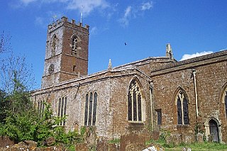
Steeple Aston is a village and civil parish on the edge of the Cherwell Valley, in the Cherwell District of Oxfordshire, England, about 12 miles (19 km) north of Oxford, 7 miles (11 km) west of Bicester, and 10 miles (16 km) south of Banbury. The 2011 Census recorded the parish population as 947. The village is 108 metres (354 ft) above sea level. The River Cherwell and Oxford Canal pass 1 mile (2 km) east of the village. The river forms part of the eastern boundary of the parish. The parish's southern boundary, 12 mile (800 m) south of the village, also forms part of Cherwell District's boundary with West Oxfordshire.

<span class="mw-page-title-main">Swalcliffe</span> Human settlement in England

Swalcliffe is a village and civil parish about 5 miles (8 km) west of Banbury in Oxfordshire. The parish is about 2+12 miles (4 km) long north–south and about 1 mile (1.6 km) east–west. The 2011 Census recorded the population of the modern Swalcliffe parish as 210. The toponym "Swalcliffe" comes from the Old English swealwe and clif, meaning a slope or cliff frequented by swallows. The ancient parish of Swalcliffe was larger than the present civil parish, and included the townships of East Shutford, Epwell, Sibford Ferris, Sibford Gower and West Shutford.

<span class="mw-page-title-main">Bodicote</span> Human settlement in England

Bodicote is a village and civil parish in North Oxfordshire, approximately 2 miles (3 km) south of the centre of Banbury. The 2011 Census recorded the parish's population as 2,126. The Church of England parish church of Saint John the Baptist is a Grade II* listed building, with the chancel arch dating back to the 13th century.

<span class="mw-page-title-main">Summertown, Oxford</span> Human settlement in England

Summertown in North Oxford is a suburb of Oxford, England. Summertown is a one-mile square residential area, north of St Giles, the boulevard leading out of Oxford's city centre. Summertown is home to several independent schools and the city's most expensive houses. On both sides of Banbury Road are Summertown's popular shops. There is also a smaller street of shops and restaurants, South Parade, that links Banbury Road and Woodstock Road. Summertown is home to much of Oxford's broadcast media. BBC Radio Oxford and the BBC Television's Oxford studios are on Banbury Road. Start-ups also have an increasing presence on the parade, such as Brainomix and Passle. The studios for JACK FM, Glide FM, and Six TV Oxford are on Woodstock Road.

<span class="mw-page-title-main">Wardington</span> Human settlement in England

Wardington is a village and civil parish in Oxfordshire, about 4 miles (6.4 km) northeast of Banbury. The village consists of two parts: Wardington and Upper Wardington. The village is on a stream that rises in Upper Wardington and flows north to join the River Cherwell.

<span class="mw-page-title-main">St Mary Magdalen's Church, Oxford</span> Church in Oxford, England

St Mary Magdalen is a Church of England parish church in Magdalen Street, Oxford, England, dedicated to Jesus' companion Mary Magdalene. It is one of the city's ancient parish churches and is a Grade I listed building.

<span class="mw-page-title-main">Horspath</span> Human settlement in England

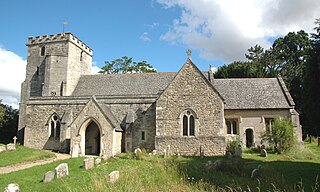
Horspath is a village and civil parish in South Oxfordshire about 3+12 miles (5.6 km) east of the centre of Oxford, England. The 2011 census recorded the parish's population as 1,378.

<span class="mw-page-title-main">Stanton Harcourt</span> Human settlement in England

Stanton Harcourt is a village and civil parish in Oxfordshire about 4 miles (6.4 km) southeast of Witney and about 6 miles (10 km) west of Oxford. The parish includes the hamlet of Sutton, 12 mile (800 m) north of the village. The 2011 Census recorded the parish's population as 960.

<span class="mw-page-title-main">Cassington</span> Human settlement in England

Cassington is a village and civil parish in Oxfordshire about 5 miles (8 km) northwest of Oxford. The village lies on gravel strata about 12 mile (800 m) from the confluence of the River Evenlode with the River Thames. The parish includes the hamlet of Worton northeast of the village and the site of the former hamlet of Somerford to the south. Somerford seems to have been abandoned early in the 14th century. Cassington is formed of two parts, "upper" and "lower", each with its own village green. The 2011 Census recorded the parish's population as 750.

<span class="mw-page-title-main">North Leigh</span> Human settlement in England

North Leigh is a village and civil parish about 3 miles (5 km) northeast of Witney in Oxfordshire. The parish includes the hamlet of East End and since 1932 has also included the hamlet of Wilcote. The 2011 Census recorded the parish's population as 1,929.

<span class="mw-page-title-main">Rousham</span> Human settlement in England

Rousham is a village and civil parish beside the River Cherwell in Oxfordshire. The village is about 6+12 miles (10.5 km) west of Bicester and about 6 miles (10 km) north of Kidlington. The parish is bounded by the River Cherwell in the east, the A4260 main road between Oxford and Banbury in the west, partly by the B4030 in the north, and by field boundaries with Tackley parish in the south. The 2001 Census recorded the parish's population as 80. Rousham was founded early in the Anglo-Saxon era. Its toponym is derived from Old English meaning Hrothwulf's ham or farm.

<span class="mw-page-title-main">Church Hanborough</span> Human settlement in England

Church Hanborough is a village in Hanborough civil parish about 5 miles (8 km) northeast of Witney in Oxfordshire.

<span class="mw-page-title-main">Horley, Oxfordshire</span> Human settlement in England

Horley is a village and civil parish in the north of Oxfordshire about 3 miles (5 km) north-west of Banbury.

<span class="mw-page-title-main">Wigginton, Oxfordshire</span> Human settlement in England

Wigginton is a village and civil parish about 6 miles (10 km) southwest of Banbury in Oxfordshire. The village is beside the River Swere, which forms the southern boundary of the parish. A Channel Four documentary, Hitler's British Girl, investigated the possibility that Unity Mitford gave birth to the son of Adolf Hitler in Hill View Cottage, Wigginton.

<span class="mw-page-title-main">Tadmarton</span> Human settlement in England

Tadmarton is a village and civil parish about 4 miles (6.4 km) west of Banbury, Oxfordshire. The 2011 Census recorded the parish's population as 541, which is a 26% increase on the figure of 430 recorded by the 2001 Census.

<span class="mw-page-title-main">Hornton</span> Human settlement in England

Hornton is a village and civil parish about 3 miles (5 km) northwest of Banbury in Oxfordshire.

<span class="mw-page-title-main">Alkerton, Oxfordshire</span> Human settlement in England

Alkerton is a village and former civil parish, now in the parish of Shenington with Alkerton, in the Cherwell district, in the county of Oxfordshire, England. It is on the county boundary with Warwickshire, about 5 miles (8 km) west of Banbury. In 1961 the parish had a population of 82. On 1 April 1970 the parish was abolished and merged with Shenington to form "Shenington with Alkerton".

<span class="mw-page-title-main">Hanwell, Oxfordshire</span> Human settlement in England

Hanwell is a village and civil parish in Oxfordshire, about 2 miles (3 km) northwest of Banbury. Its area is 1,240 acres (500 ha) and its highest point is about 500 feet (150 m) above sea level. The 2011 Census recorded the parish's population as 263.

<span class="mw-page-title-main">St Peter ad Vincula, South Newington</span> Church in Oxfordshire, England

The Parish Church of Saint Peter ad Vincula, South Newington is the Church of England parish church of South Newington, a village about 5 miles (8 km) southwest of Banbury in Oxfordshire. The church is one of only 15 in England dedicated to St Peter ad Vincula, after the basilica of San Pietro in Vincoli in Rome.

<span class="mw-page-title-main">St Mary's Church, Bloxham</span> Church in Bloxham, England

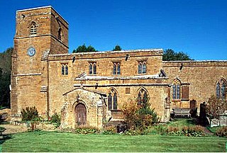
The church of Our Lady of Bloxham, informally called St Mary's Bloxham, is the Church of England parish church in Bloxham, Oxfordshire. It is notable for its 14th-century tower and spire, which is the highest in Oxfordshire. It is unusually large for a parish church. The architectural historian Jennifer Sherwood described it as "one of the grandest churches in the country." It is a Grade I listed building.

References

  1. 1 2 3 4 5 6 7 8 9 10 11 12 13 14 15 16 Crossley & Elrington, 1979, pages 369–412
  2. The Church of England: Oxford St Giles, Oxford.
  3. Wood, Leslie, St Giles' Oxford: Yesterday and Today – The Story of the Parish of St Giles' Archived 13 January 2013 at archive.today , June 1974
  4. Sacred Destinations: St Giles' Church, Oxford.
  5. St Giles' Church: St Giles' Fair Archived 11 September 2012 at archive.today .
  6. 1 2 3 Sherwood & Pevsner, 1974, page 292
  7. The Oxford City Branch of Church Bell Ringers: Practising Towers
  8. 1 2 3 "Oxford S Giles". Dove's Guide for Church Bell Ringers. Retrieved 25 March 2010.
  9. 1 2 "Bellfounders". Dove's Guide for Church Bell Ringers. Retrieved 25 March 2010.

Sources

British History

51°45′33″N1°15′38″W / 51.75917°N 1.26056°W / 51.75917; -1.26056