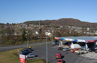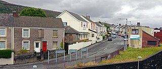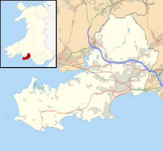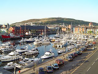
Swansea is a coastal city and county, officially known as the City and County of Swansea in Wales. The county area includes Swansea Bay and the Gower Peninsula. Swansea's position on the southwest coast of Wales is within the historic county boundaries of Glamorgan and the ancient Welsh commote of Gŵyr. Swansea is the second largest city in Wales and the twenty-fifth largest city in the United Kingdom. Swansea had a population of 241,300 in 2014; the second most populous local authority area in Wales after Cardiff. Together with Neath and Port Talbot, Swansea formed a wider Urban Area of 300,352 in 2011.

Swansea Bay is a bay on the southern coast of Wales. The River Neath, River Tawe, River Afan, River Kenfig and Clyne River flow into the bay. Swansea Bay and the upper reaches of the Bristol Channel experience a large tidal range. The shipping ports in Swansea Bay are Swansea Docks, Port Talbot Docks and Briton Ferry wharfs.

Pontardawe is both a town and a community in the Swansea Valley in Wales. With a population of 6,800, it comprises the electoral wards of Pontardawe and Trebanos. A town council is elected. Pontardawe forms part of the county borough of Neath Port Talbot. On the opposite bank of the River Tawe, the village of Alltwen, part of the community of Cilybebyll, is administered separately from Pontardawe, but has close ties to the town. Pontardawe is at the crossroads of the A474 road and the A4067 road. Pontardawe came into existence as a small settlement on the northwestern bank of the Tawe where the drovers' road from Neath and Llandeilo crossed the river to go up the valley to Brecon.

The River Tawe is a river in South Wales. It flows southwesterly for 30 miles (48 km) from its source below Moel Feity in the Black Mountains, the westernmost range of the Brecon Beacons National Park, to its estuary at Swansea. Its main tributaries are the right bank Upper and Lower Clydach Rivers and the Afon Twrch. The total area of the catchment is some 246 km2 (95 sq mi). The Tawe passes through a number of towns and villages including Ystradgynlais, Ystalyfera, Pontardawe, and Clydach and meets the sea at Swansea Bay below Swansea. The Tawe Valley is more commonly known as the Swansea Valley.
The history of Swansea, Wales covers a period of continuous occupation stretching back a thousand years, while there is archaeological evidence of prehistoric human occupation of the surrounding area for thousands of years before that.

The Neath and Tennant Canals are two independent but linked canals in South Wales that are usually regarded as a single canal. The Neath Canal was opened from Glynneath to Melincryddan, to the south of Neath, in 1795 and extended to Giant's Grave in 1799, in order to provide better shipping facilities. With several small later extensions it reached its final destination at Briton Ferry. No traffic figures are available, but it was successful, as dividends of 16 per cent were paid on the shares. The canal was 13.5 miles (21.7 km) long and included 19 locks.

The Maritime Quarter is a residential area of Swansea, Wales, UK located immediately south of the city centre shopping core. It falls within Swansea's Castle ward. The area is bounded by Brynmill to the west, Swansea Bay to the South, the River Tawe to the east and the A4067 to the north.

Port Tennant is a suburban district of Swansea, Wales, falling within the St. Thomas ward. Port Tennant lies at the southern foot of Kilvey Hill just east of St. Thomas and is bounded by the Fabian Way to the south. It is a mostly residential area.

Cwmbwrla is a residential area and community of Swansea in Wales, falling within the Cwmbwrla ward of the city. Located on rising ground about 1 mile (1.6 km) north of the city centre, it takes its name from the valley of the Burlais Brook which flows down from here to join the River Tawe immediately northeast of Swansea railway station. The neighbouring districts are Manselton, Greenhill, Mayhill, Townhill, and Cwmdu.

Swansea city centre in Swansea, Wales, contains the main shopping, leisure and nightlife district in Swansea. The city centre covers much of the Castle ward including the area around Oxford Street, Castle Square, and the Quadrant Shopping Centre; Alexandra Road, High Street, Wind Street and the Castle; Parc Tawe; and the Maritime Quarter extending down to the seafront.

Kilvey Hill is a hill in South Wales, to the east of Swansea. Kilvey Hill is 193 metres (633 ft) high and is classed as a Sub Marilyn. The top of Kilvey Hill enjoys panoramic views of Swansea city centre, Swansea Docks, Swansea Bay, the Lower Swansea Valley, Bon-y-maen, Neath and Port Talbot. Cilfái was a commote of Gower. The historic name of the hill in Welsh is Y Bigwrn, with its summit known as Pen y Bigwrn. Currently, however, it is generally known in Welsh as Mynydd Cilfái, a translation of the English name.
Swansea Docks is the collective name for several docks in Swansea, Wales. The Swansea docks are located immediately south-east of Swansea city centre. In the mid-19th century, the port was exporting 60% of the world's copper from factories situated in the Tawe Valley. The working docks area today is owned and operated by Associated British Ports as the Port of Swansea and the northern part around the Prince of Wales Dock is undergoing re-development into a new urban area branded the SA1 Swansea Waterfront.
The Lower Swansea valley is the lower half of the valley of the River Tawe in south Wales. It runs from approximately the level of Clydach down to Swansea docks, where it opens into Swansea Bay and the Bristol Channel. This relatively small area was a focus of industrial innovation and invention during the Industrial Revolution, leading to a transformation of the landscape and a rapid rise in the population and economy of Swansea.

Crymlyn Bog is a nature reserve and a designated Site of Special Scientific Interest of international significance, near Swansea, south Wales.

Parc Tawe is a retail park and leisure area in Swansea. It is located in the eastern area of the city centre on the west bank of the River Tawe in the Lower Swansea.
Crymlyn Burrows is an area of land in Wales, UK to the east of Swansea city centre, and south of Crymlyn Bog. It is bounded by Jersey Marine Beach to the south and the River Neath to the east. The land west of Baldwin's Crescent falls within the City and County of Swansea and from Baldwin's Crescent eastwards falls within Neath Port Talbot.

St. Thomas is the name of an electoral ward of Swansea, Wales.

SA1 Swansea Waterfront is the marketing name given to the brownfield development area located in northern part of Swansea Docks. The area is located directly to the southeast of Swansea city centre. It is bordered by the Fabian Way to the north and covers the Prince of Wales Dock area.
Eastside is an area of Swansea, Wales which is loosely defined as the populated areas to the east of the River Tawe. The Swansea local authority has a housing authority covering Eastside which covers the areas of Birchgrove, Talycoppa, Trallwn, Winch Wen, Port Tennant and St Thomas.


