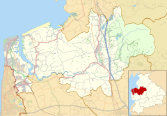
Wyre is a local government district with borough status in Lancashire, England. The population of the non-metropolitan district at the 2011 census was 107,749. The district borders the unitary authority area of Blackpool as well as the districts of Lancaster, Ribble Valley, Fylde and Preston. The council is based in Poulton-le-Fylde. The district is named after the River Wyre, which runs through the district. It was formed on 1 April 1974 by the Local Government Act 1972 and was a merger of the municipal borough of Fleetwood, along with Poulton-le-Fylde, Preesall, Garstang and Thornton-Cleveleys urban districts and various rural districts.

Poulton-le-Fylde, commonly shortened to Poulton, is a market town in Lancashire, England, situated on the coastal plain called the Fylde. In the 2001 United Kingdom census, it had a population of 18,264. There is evidence of human habitation in the area from 12,000 years ago and several archaeological finds from Roman settlement in England have been found in the area. At the time of the Norman conquest, Poulton was a small agricultural settlement in the hundred of Amounderness. The church of St Chad was recorded in 1094 when it was endowed to Lancaster Priory. By the post-Medieval period the town had become an important commercial centre for the region with weekly and triannual markets. Goods were imported and exported through two harbours on the River Wyre. In 1837, the town was described as the "metropolis of the Fylde", but its commercial importance waned from the mid-19th century with the development of the nearby coastal towns of Fleetwood and Blackpool.
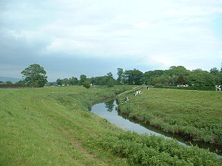
The River Wyre is a river in Lancashire, England, United Kingdom, which flows into the Irish Sea at Fleetwood. It is approximately 28 miles (45 km) in length. The river is a County Biological Heritage Site and has a sheltered estuary which, from its northwest corner, penetrates deep into the almost square peninsula of the Fylde.

Thornton is a village in the Borough of Wyre, about 4 miles (6 km) north of Blackpool and 2 miles (3 km) south of Fleetwood. The civil parish of Thornton became an urban district in 1900, and was renamed Thornton-Cleveleys in 1927. In 2011 the Thornton built-up area sub division had a population of 18,941.
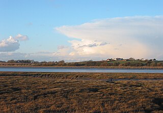
Over Wyre is the collective name given to a group of villages in Lancashire, England, situated on the Fylde, to the north and east of the River Wyre. The group is usually considered to include Hambleton, Stalmine, Knott End-on-Sea, Preesall, Pilling and Out Rawcliffe. The name distinguishes these villages from the larger southern part of the Fylde, between the Wyre and the Ribble, which includes the urban areas of Blackpool, Poulton-le-Fylde, Thornton, Cleveleys, Fleetwood and Lytham St Annes.
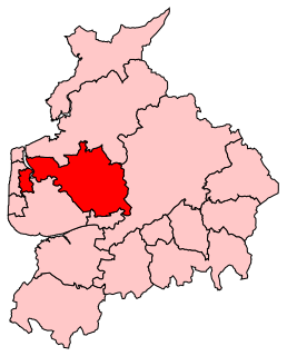
Wyre and Preston North is a county constituency represented in the House of Commons of the Parliament of the United Kingdom. Created in the most recent fifth periodic review of constituencies by the Boundary Commission for England, it elects one Member of Parliament (MP) by the first past the post voting system.
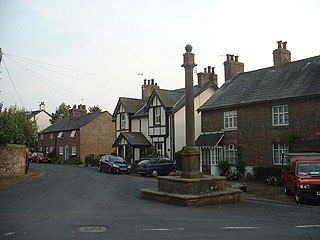
Kirkland is a civil parish, located on the banks of the River Wyre, midway between Preston and Lancaster, in the English county of Lancashire. It is also the historic name of what is now the village of Churchtown, within the parish. It is part of the Wyre district. In 2001 the parish had a population of 343, decreasing to 314 at the 2011 census.

Hambleton is a village and civil parish in the English county of Lancashire. It is situated on a coastal plain called the Fylde and in an area east of the River Wyre known locally as Over Wyre. Hambleton lies approximately 3 miles (4.8 km) north-east of its post town, Poulton-le-Fylde, and about 7 miles (11 km) north-east of the seaside resort of Blackpool. In the 2001 United Kingdom census, the parish had a population of 2,678, increasing to 2,744 at the 2011 census.
The Fylde is a coastal plain in western Lancashire, England. It is roughly a 13-mile-long (21-kilometre) square-shaped peninsula, bounded by Morecambe Bay to the north, the Ribble estuary to the south, the Irish Sea to the west, and the foot of the Bowland hills to the east which approximates to a section of the M6 motorway and West Coast Main Line.

Stalmine is a village in the civil parish of Stalmine-with-Staynall, in the Wyre borough of Lancashire, England, in a part of the Fylde known as Over Wyre. The village is located on a small hill on the A588, the main road between Hambleton and Lancaster, with the highest level 75 ft above sea level. The village name has been spelled Stalmin and Stalemynne. The village had a population of 1,087 at the 2011 Census.

Pilling is a village and civil parish within the Wyre borough of Lancashire, England. It is 6.5 miles (10.5 km) north-northeast of Poulton-le-Fylde, 9.4 miles (15.1 km) south-southwest of Lancaster and 14.5 miles (23.3 km) northwest of Preston, in a part of the Fylde known as Over Wyre.
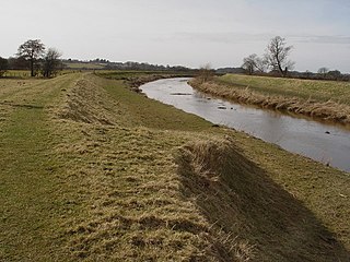
Great Eccleston is a village and civil parish in the English county of Lancashire, situated on a coastal plain called the Fylde. The village lies to the south of the River Wyre and the A586 road, approximately 10 miles (16 km) upstream from the port of Fleetwood. At the 2001 United Kingdom census, the parish had a population of 1,473, rising slightly to 1,486 at the Census 2011.
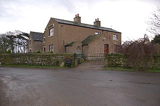
Little Eccleston-with-Larbreck is a civil parish on the southern bank of the River Wyre on the Fylde in the English county of Lancashire. The population taken at the 2011 census was 400. The river is crossed by Cartford Bridge at grid reference SD421408 which, unusually for England, is a toll bridge. The Cartford Inn stands at the southern side of the bridge.
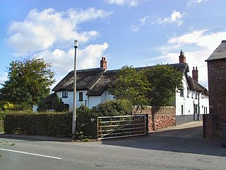
Greenhalgh-with-Thistleton is a civil parish on the Fylde in Lancashire, England. In 2001 it had a population of 462, falling to 439 at the 2011 Census.

Inskip-with-Sowerby is a civil parish in the Borough of Wyre, in Lancashire, England. A part of the Fylde, the parish includes the village of Inskip and the hamlets Crossmoor to the west and Sowerby to the east. Also Inskip Moss Side lies about a mile north-west of the village at grid reference SD452391. In 2011 it had a population of 840.

Upper Rawcliffe-with-Tarnacre is a civil parish on the Fylde, in the Borough of Wyre, in Lancashire, England. It had a population of 604 in 2001, increasing to 629 at the 2011 Census. The only settlements in the parish are the village of St Michael's on Wyre and the tiny hamlet of Ratten Row. The River Wyre passes through the parish, and the River Brock joins the Wyre on the parish boundary.

Skippool is an area of Thornton-Cleveleys, Lancashire, England. It is situated between Little Thornton and Poulton-le-Fylde along the western banks of the River Wyre, about three miles south of its mouth between Fleetwood and Knott End. These banks are known as Skippool Creek, an historic docks area now home to mostly run-down vessels. The MV Good Hope, for example, may date from the 1830s. Skippool Creek is a short branch off of Main Dyke, which empties into the River Wyre in front of Blackpool and Fleetwood Yacht Club.

Wardleys Pub was a public house on Wardley's Lane in the civil parish of Stalmine-with-Staynall, near the village of Hambleton, Lancashire. The building dated to the 18th century and occupied a location, on the eastern banks of the River Wyre and beside Wardleys Creek, believed to have been used since Roman times. Prior to nearby Fleetwood's emergence as a harbour, people emigrated to the Americas from the creek, including aboard the Quebec-bound Six Sisters on 3 April 1833. The harbour's foundation rocks are still visible beneath today's wooden jetty. A ferry used to run from Cockle Hall, on the western side of the river, to Wardleys Creek. Parts of the pier are still visible in the marsh in front of where Cockle Hall once stood.

Wyre Estuary Country Park is located in Thornton-Cleveleys, Lancashire, England. Established in 1991 and covering 0.79 acres (0.32 ha), it is situated on the western banks of the 28 miles (45 km) long River Wyre, near its mouth at the Irish Sea at Fleetwood. The Wyre estuary forms the southern boundary of Morecambe Bay.

