
Havant is a town in the south-east corner of Hampshire, England, between Portsmouth and Chichester. Its borough comprises the town (45,826), the resort of Hayling Island, the town of Waterlooville, and the town of Emsworth. Housing and population more than doubled in the 20 years following World War II, a period of major conversion of land from agriculture and woodland to housing across the region following the incendiary bombing of Portsmouth and the Blitz.

Whale Island is a small island in Portsmouth Harbour, close by Portsea Island. It is home to HMS Excellent, the oldest shore training establishment within the Royal Navy, and the location of the Navy Command Headquarters. The island is linked to Portsea Island and thence to the mainland by road bridges.

The fortifications of Portsmouth are extensive due to its strategic position on the English Channel and role as home to the Royal Navy. For this reason, Portsmouth was, by the 19th century, one of the most fortified cities in the world. The fortifications have evolved over the centuries in response to changes in tactics and technology and the area defended has increased. While the first defences focused on Portsmouth harbour, in step with the fortifications of Gosport, later defensive structures protected the whole of Portsea Island and an increasing distance inland. At the same time, the fortifications of Portsmouth and Gosport became part of the wider fortifications of the Solent. Old Portsmouth, on the southwest corner of Portsea Island, has been walled for much of its history.

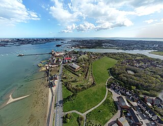
The Hilsea Lines are a line of 18th- and 19th-century fortifications built at Hilsea to protect the northern approach to Portsea Island, an island off the southern coast of England which forms the majority of the city of Portsmouth and its key naval base. They are now used as a greenspace and leisure area, also known locally as Foxes Forest.

Portsea Island is a flat and low-lying natural island 24.5 square kilometres in area, just off the southern coast of Hampshire in England. Portsea Island contains the majority of the city of Portsmouth.

Portsdown Hill is a long chalk ridge in Hampshire, England. The highest point of the hill lies within Fort Southwick at 131 m above sea level. The ridge offers good views to the south over Portsmouth, the Solent, Hayling Island and Gosport, with the Isle of Wight beyond. The hill is on the mainland, just to the north of Ports Creek, which separates the mainland from Portsea Island, on which lies the main part of the city of Portsmouth, one of the United Kingdom's main naval bases. To the north lies the Forest of Bere, with the South Downs visible in the distance. Butser Hill can be seen on a clear day. The hill is formed from an inlier of chalk which has been brought to the surface by an east–west upfold of the local strata known as the Portsdown Anticline.

The M275 is a 2-mile-long (3 km), dual three-lane motorway in Hampshire, southern England. It is the principal road route for entering and leaving Portsmouth. It continues as the A3 into Portsmouth, and meets the M27 at its northern terminus. From the motorway, there are scenic views over Portsmouth harbour, and the Sails of the South between the two carriageways.

Hilsea railway station is a railway station on Airport Service Road, Hilsea, Portsmouth, England serving the northern end of Portsea Island, including a large industrial estate nearby. The station was once the closest to Portsmouth Airport, which was closed in 1973.
Tipner is a residential district of Portsmouth, located on the north western corner of Portsea Island in southern England. It includes a housing estate, built during the 1930s, that used to function as married quarters for the Royal Navy, a yachting club, allotments, a primary school, The Harbour special school, and indoor and outdoor rifle ranges. There is a nearby sports centre at Alexandra Park. Tipner is bounded to the north and west by the M275 motorway and Tipner Lake. To the south is Stamshaw.
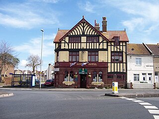
North End is a district in the city of Portsmouth, located on Portsea Island in Hampshire. The area developed rapidly as a part of the city after a horse-drawn tram route was opened between Portsmouth and Cosham. The area is mainly residential, being composed of mainly late Victorian to early 20th-century buildings.
Priddy's Hard is a former military installation in Gosport, England named for the original landowner and the firm beach found there. The site originated as a 1750s fort, and then became an armaments depot for Royal Navy and British Army weapons, explosives and other stores. The site was decommissioned in 1988, after over two hundred years of operation, with part now being developed for housing and an area retained as a museum.

Copnor is an area of Portsmouth, England, located on the eastern side of Portsea Island. The population of Copnor Ward at the 2011 Census was 13,608. As Copenore, it was one of the three villages listed as being on Portsea Island in the Domesday book.

Drayton is a residential area of the city of Portsmouth in the English county of Hampshire. Together with Farlington, its parent area, it makes up one of the electoral wards of the city.

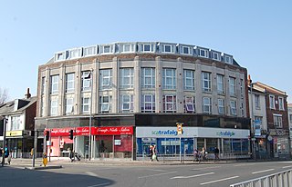
Hilsea is a district of the city of Portsmouth in the English county of Hampshire. Hilsea is home to one of Portsmouth's main sports and leisure facilities – the Mountbatten centre. Trafalgar School is also in Hilsea. It is also the home of Portsmouth rugby football club

Landport is a district located on Portsea Island and is considered the city centre of modern-day Portsmouth, England. The district is centred around Commercial Road and encompasses the Guildhall, Civic Centre, Portsmouth and Southsea Station and Commercial Road central shopping area. The original historic old town of Portsmouth lies to the south of Landport and is now known as Old Portsmouth. The district of Portsea lies to the West; Somers Town and Southsea are to the south; Fratton lies to the East and the Kingston Crescent area to the north.

Farlington Halt railway station was a disused station between Bedhampton and Hilsea, located immediately to the west of Farlington Junction on the Portsmouth Direct Line railway.

Portsbridge Creek, known officially as Portsea Creek, formerly as Portsea Lake and informally as Ports Creek, Port Creek, Portcreek and Canal Creek, is a tidal waterway just off the southern coast of England that runs between Portsea Island and the mainland from Langstone Harbour to Tipner Lake.

Hilsea Lido is a freshwater lido at Hilsea, Portsmouth, England, which opened in 1935. Portsmouth City Council is currently renovating Hilsea Lido as part of the Hilsea Lines project in the north of the city.

Alexandra Park, Portsmouth, was opened in 1907 and was a place of recreation for the people of Portsea Island. It provided lawns, flowers beds, paths and seats; it was an area to escape the toils of inner city life in the early twentieth century. The park was named after Queen Alexandra. At the time of the parks opening the site was already home to a bicycle track.
