Staples developed around a sawmill.[6] The settlement was originally called Staples Mill, and under the latter name was platted in 1889, and named for Samuel and Isaac Staples, businessmen in the lumber industry.[7]
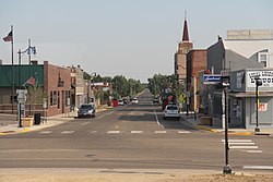
Geography
According to the United States Census Bureau, the city has a total area of 4.68 square miles (12.12km2); 4.67 square miles (12.10km2) is land and 0.01 square miles (0.03km2) is water.[8]
As of the census of 2010, there were 2,981 people, 1,222 households, and 696 families living in the city. The population density was 638.3 inhabitants per square mile (246.4/km2). There were 1,469 housing units at an average density of 314.6 per square mile (121.5/km2). The racial makeup of the city was 95.9% White, 0.5% African American, 0.9% Native American, 0.7% Asian, 0.3% from other races, and 1.6% from two or more races. Hispanic or Latino of any race were 1.5% of the population.
There were 1,222 households, of which 30.5% had children under the age of 18 living with them, 39.0% were married couples living together, 12.7% had a female householder with no husband present, 5.3% had a male householder with no wife present, and 43.0% were non-families. 37.0% of all households were made up of individuals, and 16.8% had someone living alone who was 65 years of age or older. The average household size was 2.26 and the average family size was 2.94.
The median age in the city was 38.8 years. 24.1% of residents were under the age of 18; 10% were between the ages of 18 and 24; 21.8% were from 25 to 44; 22.5% were from 45 to 64; and 21.6% were 65 years of age or older. The gender makeup of the city was 47.6% male and 52.4% female.
2000 census
As of the census of 2000, there were 3,104 people, 1,278 households, and 732 families living in the city. The population density was 684.5 inhabitants per square mile (264.3/km2). There were 1,436 housing units at an average density of 316.7 per square mile (122.3/km2). The racial makeup of the city was 97.49% White, 0.26% African American, 0.81% Native American, 0.35% Asian, 0.23% from other races, and 0.87% from two or more races. Hispanic or Latino of any race were 1.48% of the population. 33.5% were of German, 12.5% Norwegian, 6.4% American, 6.0% Irish and 5.9% Swedish ancestry.
There were 1,278 households, out of which 30.5% had children under the age of 18 living with them, 41.8% were married couples living together, 12.1% had a female householder with no husband present, and 42.7% were non-families. 35.8% of all households were made up of individuals, and 19.2% had someone living alone who was 65 years of age or older. The average household size was 2.36 and the average family size was 3.09.
In the city, the population was spread out, with 27.2% under the age of 18, 11.4% from 18 to 24, 24.0% from 25 to 44, 18.6% from 45 to 64, and 18.8% who were 65 years of age or older. The median age was 36 years. For every 100 females, there were 92.4 males. For every 100 females age 18 and over, there were 91.6 males.
The median income for a household in the city was $25,208, and the median income for a family was $33,472. Males had a median income of $26,481 versus $18,407 for females. The per capita income for the city was $14,244. About 15.4% of families and 20.3% of the population were below the poverty line, including 23.9% of those under age 18 and 9.4% of those age 65 or over.
The Amtrak station sees more than 5,000 riders a year get on or off the daily Empire Builder service.[21] The west bound train from Chicago and St Paul arrives an hour or two after midnight, heading toward Fargo and Seattle/Portland. East bound Empire Builders from Fargo arrive about 4 a.m. heading toward a daylight arrival in St Paul and an afternoon arrival in Chicago.[citation needed]
This page is based on this Wikipedia article Text is available under the CC BY-SA 4.0 license; additional terms may apply. Images, videos and audio are available under their respective licenses.