
Oak Lawn is a neighborhood in Dallas, Texas, defined in Dallas City Ordinance 21859 as Planned Development District No. 193, the Oak Lawn Special Purpose District. The unofficial boundaries are Turtle Creek Boulevard, Central Expressway, the City of Highland Park, Inwood Road, and Harry Hines Boulevard. It is over 12 square miles (31 km2) in area. Officially it is bounded by the City of Highland Park, the North Central Expressway, Stemmons Freeway, Woodall Rodgers Freeway, and other roads. The district is within the boundary defined by the City of Dallas law, excluding any existing planned development districts within.
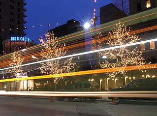
The Main Street District of downtown Dallas, Texas runs along Main Street and is bounded by Elm Street one block north, Commerce St. one block south, N. Lamar St. to the west, and US 75/I-45 (I-345) elevated highway to the east. The district is the spine of downtown Dallas, and connects many of the adjoining business and entertainment districts. It does not include Dealey Plaza or the John Fitzgerald Kennedy Memorial which are a few blocks west in the West End Historic District.

The West End Historic District of Dallas, Texas, is a historic district that includes a 67.5-acre (27.3 ha) area in northwest downtown, generally north of Commerce, east of I-35E, west of Lamar and south of the Woodall Rodgers Freeway. It is south of Victory Park, west of the Arts, City Center, and Main Street districts, and north of the Government and Reunion districts. A portion of the district is listed on the U.S. National Register of Historic Places as Westend Historic District. A smaller area is also a Dallas Landmark District. The far western part of the district belongs to the Dealey Plaza Historic District, a National Historic Landmark around structures and memorials associated with the assassination of John F. Kennedy.

The Arts District is a performing and visual arts district in downtown Dallas, Texas.

Interstate 345 (I-345) is an unsigned 1.4-mile-long (2.3 km) Auxiliary Interstate Highway in the city of Dallas within the US state of Texas. It is a freeway that connects I-45 with U.S. Highway 75 at State Highway Spur 366. Few maps actually display the road as I-345; signposts on the road show US 75 northbound, while southbound the highway is signed as I-45. In recent years, a debate over whether to maintain or decommission I-345 has received increased attention from several Dallas media outlets. TxDOT elected to maintain the freeway by lowering it below ground and removing frontage roads.

James Woodall Rodgers was an American attorney, businessman, and mayor of Dallas, Texas.

Lake Highlands is a neighborhood constituting most of Northeast Dallas. The neighborhood is a collection of dozens of subdivisions served by Richardson ISD and Dallas ISD public schools, as well as an array of private schools.

Victory Park is a master planned development northwest of downtown Dallas, Texas (USA) and north of Spur 366. It is along Interstate 35E, part of the Stemmons Corridor and Uptown.
Spur 366, also named Woodall Rodgers Freeway, is a highway that connects Beckley Avenue and Singleton Boulevard in West Dallas to Interstate 35E and U.S. Highway 75 in central Dallas, Texas. The highway, as part of the downtown freeway loop, also serves as a dividing line between downtown Dallas on the south and the Uptown and Victory Park neighborhoods on the north.

Cityplace is a TIF District and neighborhood in Old East Dallas, Texas (USA) - near the Uptown area of Dallas, adjacent to the intersection of Central Expressway and Haskell Avenue/Blackburn Street. East of Central Expressway, the neighborhood includes the tree-lined Haskell boulevard and travels past the 42-story Tower at Cityplace. At 42-stories, it is the tallest building in Dallas outside downtown. Also on the east is the newer Cityville high-end apartment complex. The west side Cityplace includes the new-urbanist West Village and the northern end of the Uptown neighborhood.
Central Expressway is a north–south highway in the Dallas-Fort Worth Metroplex in Texas (USA) and surrounding areas. The best-known section is the North Central Expressway, a name for a freeway section of U.S. Highway 75 between downtown Dallas and Van Alstyne, Texas. The southern terminus is south of the Woodall Rodgers Freeway at exit 284C of "hidden" Interstate 345. From there, Central Expressway becomes the South Central Expressway, the northernmost portion of which was renamed César Chávez Boulevard on April 9, 2010.

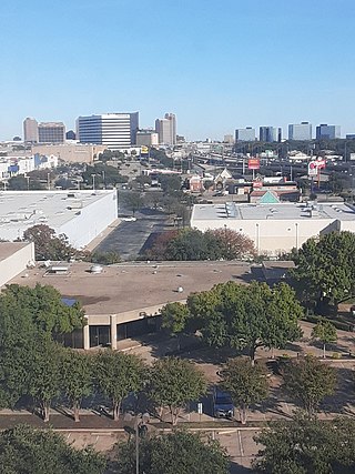
The Stemmons Corridor or Lower Stemmons is a stretch of industrial and commercial property in northwest Dallas, Texas (USA). From downtown north, Interstate 35E (I-35E) is known as the Stemmons Freeway, named so for Leslie Stemmons by his son, John M. Stemmons. It lies north of downtown, west of Oak Lawn, east of the Trinity River and Irving, and south of the Elm Fork of the Trinity River. The area has a considerable amount of hotels and office towers. Property in the district accounts for 20% of Dallas' tax base. I-35E in Dallas Texas is currently the widest freeway in the DFW area with 16 total lanes, 10 lanes of high speed freeway with 6 lanes of access roads, stretching from the Woodall Rodgers Expressway in Downtown Dallas to the State Highway 183 split. I-35E is one of the most congested freeways in the country.
The City Center District is an area in north-central downtown Dallas, Texas (USA). It lies south of the Arts District, north of the Main Street District, northwest of Deep Ellum, southwest of Bryan Place and east of the West End Historic District. The district contains a large concentration of downtown commercial space which prior to 1950 had been concentrated along Main Street. The district also contains remnants of Theatre Row, the historical entertainment area along Elm Street which contained theatres such as the Majestic Theatre.
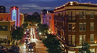
The West Village District is a walkable urban village in the Uptown area of Dallas, Texas. West Village is located at the northern edge of Uptown along McKinney Avenue and is bordered by Lemmon Avenue, Cole Avenue, Haskell Drive and Central Expressway.
This article is about transportation systems in and around Dallas, Texas (USA).

Uptown is a PID and a dense neighborhood in Dallas, Texas. Uptown is north of and adjacent to downtown Dallas, and is bordered by US 75 on the east, N Haskell Avenue on the northeast, the Katy Trail on the northwest, Bookhout Street and Cedar Springs Road on the west, N Akard Street on the southwest and Spur 366 on the south.
North Dallas is an area of numerous communities and neighborhoods in Dallas, Texas. The phrase "North Dallas" is also sometimes used to include any suburb or exurb north of Dallas proper within the metropolitan area. The majority of North Dallas is located in Dallas County, while a small portion is located in Collin and Denton counties. North Dallas generally includes areas of Dallas north of Northwest Highway, along with Lake Highlands and areas of Dallas north of IH-635 known as Far North Dallas. The area has strong social and economic ties to the Dallas enclave of Park Cities, and two inner suburbs of Dallas, Richardson and Addison.

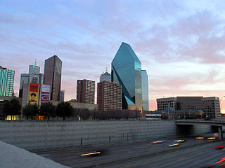
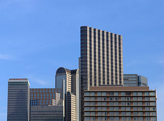
Downtown Dallas is the central business district (CBD) of Dallas, Texas, United States, located in the geographic center of the city. It is the second-largest business district in the state of Texas. The area termed "Downtown" has traditionally been defined as bounded by the downtown freeway loop, bounded on the east by I-345 (although known and signed as the northern terminus of I-45 and the southern terminus of US 75, on the west by I-35E, on the south by I-30, and on the north by Woodall Rodgers Freeway.
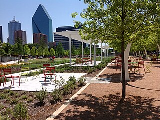
Klyde Warren Park is a 5.2-acre (2.1 ha) public park in Downtown Dallas, Texas. The park is over the Woodall Rodgers Freeway, and opened in 2012. It is named for Klyde Warren, the young son of billionaire Kelcy Warren who donated $10 million to the development of the park.
Whispering Hills is a neighborhood consisting of 615 homes within the Lake Highlands neighborhood of Dallas, Texas adjacent to the suburbs of Richardson and Garland. It is generally bounded by Buckingham Rd along the Richardson border to the north, to the east by the Garland border near Plano Rd, to the south by Walnut St, and to the west by the KCS Railroad and Audelia Branch Greenbelt near Audelia Rd.


