Related Research Articles

The United States Census Bureau (USCB), officially the Bureau of the Census, is a principal agency of the U.S. Federal Statistical System, responsible for producing data about the American people and economy. The Census Bureau is part of the U.S. Department of Commerce and its director is appointed by the President of the United States.
The Bureau of Labor Statistics (BLS) is a unit of the United States Department of Labor. It is the principal fact-finding agency for the U.S. government in the broad field of labor economics and statistics and serves as a principal agency of the U.S. Federal Statistical System. The BLS collects, processes, analyzes, and disseminates essential statistical data to the American public, the U.S. Congress, other Federal agencies, State and local governments, business, and labor representatives. The BLS also serves as a statistical resource to the United States Department of Labor, and conducts research measuring the income levels families need to maintain a satisfactory quality of life.

Berkshire County is the westernmost county in the U.S. state of Massachusetts. As of the 2020 census, the population was 129,026. Its largest city and traditional county seat is Pittsfield. The county was founded in 1761. The Berkshire Hills are centered on Berkshire County. Residents are known as Berkshirites. It exists today only as a historical geographic region, and has no county government, with the exception of the retirement board for former county workers, and certain offices such as the sheriff and registry of deeds.

Essex County is a county in the northeastern part of the U.S. state of Massachusetts. At the 2020 census, the total population was 809,829, making it the third-most populous county in the state, and the seventy-eighth-most populous in the country. It is part of the Greater Boston area. The largest city in Essex County is Lynn. The county was named after the English county of Essex. It has two traditional county seats: Salem and Lawrence. Prior to the dissolution of the county government in 1999, Salem had jurisdiction over the Southern Essex District, and Lawrence had jurisdiction over the Northern Essex District, but currently these cities do not function as seats of government. However, the county and the districts remain as administrative regions recognized by various governmental agencies, which gathered vital statistics or disposed of judicial case loads under these geographic subdivisions, and are required to keep the records based on them. The county has been designated the Essex National Heritage Area by the National Park Service.

Middlesex County is located in the Commonwealth of Massachusetts, in the United States. As of the 2020 census, the population was 1,632,002, making it the most populous county in both Massachusetts and New England and the 22nd most populous county in the United States. Middlesex County is one of two U.S. counties to be amongst the top 25 counties with the highest household income and the 25 most populated counties. It is included in the Census Bureau's Boston–Cambridge–Newton, MA–NH Metropolitan Statistical Area. As part of the 2020 United States census, the Commonwealth's mean center of population for that year was geo-centered in Middlesex County, in the town of Natick.

Suffolk County is located in the Commonwealth of Massachusetts, in the United States. As of the 2020 census, the population was 797,936, making it the fourth-most populous county in Massachusetts. The county comprises the cities of Boston, Chelsea, Revere, and Winthrop. The traditional county seat is Boston, the state capital and the largest city in Massachusetts. The county government was abolished in 1999, and so Suffolk County today functions only as an administrative subdivision of state government and a set of communities grouped together for some statistical purposes. Suffolk County is located at the core of the Boston-Cambridge-Newton, MA-NH Metropolitan Statistical Area as well as the greater Boston-Worcester-Providence, MA-RI-NH-CT Combined Statistical Area.

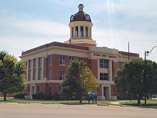
Tillman County is a county located in the southwestern part of Oklahoma, United States. As of the 2020 census, the population was 6,968. The county seat is Frederick.

Jefferson County is a county located in the U.S. state of Oklahoma. As of the 2020 census, the population was 5,337. Its county seat is Waurika. The county was created at statehood and named in honor of President Thomas Jefferson.
Beckham County is a county located on the western border of the U.S. state of Oklahoma. As of the 2020 census, the population was 22,410. Its county seat is Sayre. Founded upon statehood in 1907, Beckham County was named for J. C. W. Beckham, who was Governor of Kentucky and the first popularly elected member of the United States Senate from Kentucky. Beckham County comprises the Elk City, OK Micropolitan Statistical Area.

Union Parish is a parish located in the north central section of the U.S. state of Louisiana. As of the 2020 census, the population was 21,107. The parish seat is Farmerville. The parish was created on March 13, 1839, from a section of Ouachita Parish. Its boundaries have changed four times since then.

Fitchburg is a city in northern Worcester County, Massachusetts, United States. The third-largest city in the county, its population was 41,946 at the 2020 census. Fitchburg State University is located here.
The United States census is a census that is legally mandated by the Constitution of the United States. It takes place every ten years. The first census after the American Revolution was taken in 1790 under Secretary of State Thomas Jefferson. There have been 23 federal censuses since that time. The census includes territories of the United States. The United States Census Bureau is responsible for conducting the census.
The District of Maine was the governmental designation for what is now the U.S. state of Maine from October 25, 1780 to March 15, 1820, when it was admitted to the Union as the 23rd state. The district was a part of the Commonwealth of Massachusetts and before American independence had been part of the British province of Massachusetts Bay.

Massachusetts, officially the Commonwealth of Massachusetts, is a state in the New England region of the Northeastern United States. It borders the Atlantic Ocean and Gulf of Maine to its east, Connecticut and Rhode Island to its south, New Hampshire and Vermont to its north, and New York to its west. Massachusetts is the sixth-smallest state by land area. With over seven million residents as of 2020, it is the most populous state in New England, the 16th-most-populous in the country, and the third-most densely populated, after New Jersey and Rhode Island.

Massachusetts has an estimated population of 6.981 million as of 2022 according to the U.S. Census Bureau. This represents a −0.7% decrease in population from the 2020 census, when the population was 7.029 million. Currently, Massachusetts is the sixteenth most populous U.S. state.

In the United States, a state is a constituent political entity, of which there are 50. Bound together in a political union, each state holds governmental jurisdiction over a separate and defined geographic territory where it shares its sovereignty with the federal government. Due to this shared sovereignty, Americans are citizens both of the federal republic and of the state in which they reside. State citizenship and residency are flexible, and no government approval is required to move between states, except for persons restricted by certain types of court orders.

New England is a region comprising six states in the Northeastern United States: Connecticut, Maine, Massachusetts, New Hampshire, Rhode Island, and Vermont. It is bordered by the state of New York to the west and by the Canadian provinces of New Brunswick to the northeast and Quebec to the north. The Gulf of Maine and Atlantic Ocean is to the east and southeast, and Long Island Sound is to the southwest. Boston is New England's largest city, as well as the capital of Massachusetts. Greater Boston is the largest metropolitan area, with nearly a third of New England's population; this area includes Worcester, Massachusetts, Manchester, New Hampshire, and Providence, Rhode Island.

The Puerto Rico statehood movement aims to make Puerto Rico a state of the United States. Puerto Rico is an unincorporated territorial possession of the United States acquired in 1898 following the Spanish–American War, making it "the oldest colony in the modern world". As of 2023, the population of Puerto Rico is 3.2 million, around half the average state population and higher than that of 19 U.S. states. Statehood is one of several competing options for the future political status of Puerto Rico, including: maintaining its current status, becoming fully independent, or becoming a freely associated state. Puerto Rico has held six referendums on the topic. These are non-binding, as the power to grant statehood lies with the US Congress. The most recent referendum was in November 2020, with a majority (52.52%) of those who voted opting for statehood.
References
- 1 2 3 4 5 6 7 8 9 10 11 12 13 14 15 16 17 18 19 20 21 22 23 24 25 26 27 28 29 30 31 32 33 34 35 36 37 38 39 40 41 42 43 44 45 46 47 48 49 "State Censuses – History – U.S. Census Bureau". Census.gov. Retrieved September 22, 2017.
- 1 2 3 4 5 6 7 8 9 10 11 12 13 14 15 16 17 18 19 20 21 22 23 24 25 26 27 28 29 30 31 32 "Statehood Dates". 50states.com. Retrieved September 23, 2017.
- ↑ "Introduction-Early History of the California Coast-A National Register of Historic Places Travel Itinerary". Nps.gov. Retrieved September 23, 2017.
- 1 2 3 4 5 6 7 8 "1, Population In The Colonial And Continental Periods". A Century of Population Growth (PDF). Bureau of the Census. 1909.
- 1 2 Thirteenth Census of the United States Taken in the Year 1910: Statistics for Hawaii Containing Statistics of Population, Agriculture, and Manufactures for the Territory, Counties and Cities (PDF). Original from the University of Chicago: U.S. Government Printing Office. 1913.
- ↑ "Census of the Commonwealth of Massachusetts: 1875". Massachusetts. Bureau of Statistics of Labor. March 25, 2008. Retrieved September 23, 2017– via Archive.org.
- ↑ "Full text of "Census of Massachusetts: 1885"". Boston, Wright & Potter Print. Co., state printers. October 23, 2016. Retrieved September 23, 2017– via Archive.org.
- ↑ "Census of the Commonwealth of Massachusetts: 1895". Massachusetts. Bureau of Statistics of Labor. March 25, 2008. Retrieved September 23, 2017– via Archive.org.
- ↑ "Census of the commonwealth of Massachusetts, 1905". Massachusetts. Bureau of Statistics of Labor. March 25, 2008. Retrieved September 23, 2017– via Archive.org.
- ↑ "The decennial census, 1915". Massachusetts. Bureau of Statistics. Retrieved September 23, 2017– via Archive.org.
- ↑ "The decennial census, 1925". Massachusetts. Secretary of the Commonwealth. Retrieved September 23, 2017– via Archive.org.
- ↑ "Browsing State Census Documents by Issue Date". Archives.lib.state.ma.us. January 1, 1985. Retrieved September 23, 2017.
- ↑ "Archives: Researching Your Family's History at the Massachusetts Archives". Sec.state.ma.us. January 1, 2008. Retrieved September 23, 2017.
- 1 2 3 4 5 6 7 "New York State Census". Frontiernet.net. Retrieved September 23, 2017.
- 1 2 Governor, New York (State) (1889). Public Papers ... – New York (State). Governor, New York (State). Governor (1885–1892 : Hill).[ full citation needed ]
- 1 2 Peter R. Eisenstadt (May 19, 2005). The Encyclopedia of New York State. ISBN 9780815608080.[ full citation needed ]
- ↑ "1892 New York State Census". Frontiernet.net. September 7, 1996. Retrieved September 23, 2017.