The county was created by the Minnesota Territory legislature on February 20, 1855, using areas partitioned from Rice, Blue Earth, and Le Sueur counties. Owatonna, the settlement of which had commenced in 1854, was named the county seat. The county was named for Franklin Steele, a prominent early resident of the territory.[3]
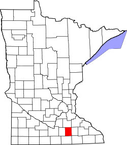
Geography
Soils of Steele County
The Straight River rises in Freeborn County and flows northward through the central part of Steele County, continuing into Rice County on the north. The South Branch of the Middle Fork of the Zumbro River rises in Steele County and flows eastward into Dodge County. The county terrain consists of low rolling hills, etched with drainages, completely devoted to agriculture where possible.[5] The terrain slopes to the east and north, with its highest point near the midpoint of its south border, at 1,293ft (394m) ASL.[6] The county has an area of 432 square miles (1,120km2), of which 430 square miles (1,100km2) are land and 2.7 square miles (7.0km2) (0.6%) are water.[7]
The Straight River flows northward through the county, and the Le Sueur River flows through its southwestern corner. The Middle Fork of the Zumbro River rises in NE Steele County.[8]
As of the 2020 census, the county had a population of 37,406. The median age was 39.9 years. 25.0% of residents were under the age of 18 and 18.2% of residents were 65 years of age or older. For every 100 females there were 99.6 males, and for every 100 females age 18 and over there were 98.5 males age 18 and over.[15][16]
70.3% of residents lived in urban areas, while 29.7% lived in rural areas.[17]
There were 14,823 households in the county, of which 30.9% had children under the age of 18 living in them. Of all households, 52.2% were married-couple households, 17.9% were households with a male householder and no spouse or partner present, and 22.6% were households with a female householder and no spouse or partner present. About 27.8% of all households were made up of individuals and 12.3% had someone living alone who was 65 years of age or older.[15]
There were 15,691 housing units, of which 5.5% were vacant. Among occupied housing units, 76.1% were owner-occupied and 23.9% were renter-occupied. The homeowner vacancy rate was 1.1% and the rental vacancy rate was 6.1%.[15]
As of the 2000 census, there were 33,680 people, 12,846 households, and 9,082 families in the county. The population density was 78.3 per square mile (30.2/km2). There were 13,306 housing units at an average density of 30.9 per square mile (11.9/km2). The racial makeup of the county was 95.19% White, 1.07% Black or African American, 0.10% Native American, 0.85% Asian, 0.02% Pacific Islander, 1.65% from other races, and 1.12% from two or more races. 3.76% of the population were Hispanic or Latino of any race. 38.6% were of German, 18.5% Norwegian, 5.2% Czech and 5.1% Irish ancestry.
There were 12,846 households, out of which 35.50% had children under the age of 18 living with them, 59.50% were married couples living together, 7.40% had a female householder with no husband present, and 29.30% were non-families. 24.60% of all households were made up of individuals, and 10.30% had someone living alone who was 65 years of age or older. The average household size was 2.57 and the average family size was 3.08.
The county population contained 27.90% under the age of 18, 8.20% from 18 to 24, 29.00% from 25 to 44, 21.60% from 45 to 64, and 13.30% who were 65 years of age or older. The median age was 36 years. For every 100 females, there were 97.50 males. For every 100 females age 18 and over, there were 95.00 males.
The median income for a household in the county was $46,106, and the median income for a family was $53,981. Males had a median income of $36,366 versus $25,054 for females. The per capita income for the county was $20,328. About 4.20% of families and 6.20% of the population were below the poverty line, including 7.10% of those under age 18 and 7.10% of those age 65 or over.
Steele County voters have traditionally voted Republican. In only one national election since 1964 has the county selected the Democratic Party candidate (as of 2024[update]).
This page is based on this Wikipedia article Text is available under the CC BY-SA 4.0 license; additional terms may apply. Images, videos and audio are available under their respective licenses.