The topic of this article may not meet Wikipedia's general notability guideline .(November 2023) |
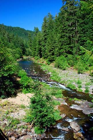
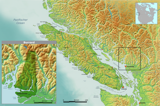
Steelhead is a rural community in British Columbia, Canada, [1] located in the northern District of Mission and east of Stave Falls.
The topic of this article may not meet Wikipedia's general notability guideline .(November 2023) |
Steelhead is a rural community in British Columbia, Canada, [1] located in the northern District of Mission and east of Stave Falls.

North Fair Oaks is a census-designated place and an unincorporated area located in San Mateo County, California adjacent to Redwood City, Atherton, and Menlo Park. As of the 2020 census the area had a total population of 14,027. Because of the large number of residents from one Mexican state the area is also known as Little Michoacán. The larger area including North Fair Oaks and adjacent parts of Redwood City has a large Latino population and is known locally as Little Mexico. The neighborhood is distinctive, as it is one out of only three communities in San Mateo County that have a majority Hispanic population.

Año Nuevo State Park is a state park of California, United States, encompassing Año Nuevo Island and Año Nuevo Point, which are known for their pinniped rookeries. Located in San Mateo County, the low, rocky, windswept point juts out into the Pacific Ocean about 55 miles (89 km) south of San Francisco and the Golden Gate. Año Nuevo State Natural Reserve, formerly a separate unit of the California state park system, was merged into Año Nuevo State Park in October 2008. The coastal geographic center, or coastal-midpoint of California is located at the Northern end of this park at N 37°09′58″, W 122°21'40", as the absolute geographic center of California falls at N 37°09′58″, W 119°26′58″W.

The Napa River is a river approximately 55 miles (89 km) long in the U.S. state of California. It drains a famous wine-growing region called the Napa Valley, in the mountains north of the San Francisco Bay. Milliken Creek and Mt. Veeder watersheds are a few of its many tributaries. The river mouth is at Vallejo, where the intertidal zone of fresh and salt waters flow into the Carquinez Strait and the San Pablo Bay.

Steamboat Creek is a short tributary of the North Umpqua River in southwestern Oregon in the United States. Approximately 35 kilometres (22 mi) long, the creek is located on a remote part of the upper North Umpqua in the Calapooia Mountains west of the Cascade Range. It rises in southeastern Lane County at 43.5601214°N 122.5519948°W and flows southwest to join the North Umpqua from the north at Steamboat.

The Tsleil-Waututh Nation, formerly known as the Burrard Indian Band or Burrard Inlet Indian Band, is a First Nations band government in the Canadian province of British Columbia. The Tsleil-Waututh Nation ("TWN") are Coast Salish peoples who speak hən̓q̓əmin̓əm̓, the Downriver dialect of the Halkomelem language, and are closely related to but politically and culturally separate from the nearby nations of the Sḵwx̱wú7mesh (Squamish) and xʷməθkʷəy̓əm (Musqueam), with whose traditional territories some claims overlap.
The Skatin First Nations, aka the Skatin Nations, are a band government of the In-SHUCK-ch Nation, a small group of the larger St'at'imc people who are also referred to as Lower Stl'atl'imx. The Town of Skatin - the St'at'imcets version of the Chinook Jargon Skookumchuck- is located 4 km south of T'sek Hot Spring- alt. spelling T'sek Hot Spring - commonly & formerly named both St. Agnes' Well & Skookumchuck Hot Springs The community is 28 km south of the outlet of Lillooet Lake on the east side of the Lillooet River. It is approximately 75 km south of the town of Pemberton and the large reserve of the Lil'wat branch of the St'at'imc at Mount Currie. Other bands nearby are Samahquam at Baptiste Smith IR on the west side of the Lillooet River at 30 km. and Xa'xtsa First Nations; the latter is located at Port Douglas, near the mouth of the Lillooet River where it enters the head of Harrison Lake. The N'Quatqua First Nation on Anderson Lake, between Mount Currie and Lillooet, was at one time involved in joint treaty negotiations with the In-SHUCK-ch but its members have voted to withdraw, though a tribal council including the In-SHUCK-ch bands and N'Quatqua remains, the Lower Stl'atl'imx Tribal Council.

The Stave River is a tributary of the Fraser, joining it at the boundary between the municipalities of Maple Ridge and Mission, about 35 kilometres (22 mi) east of Vancouver, British Columbia, Canada, in the Central Fraser Valley region.

Coquitlam Public Library is a public library that serves Coquitlam, British Columbia.

Branciforte Creek is a 5.8-mile (9.3 km) long watercourse in Santa Cruz County, California, United States. Branciforte Creek rises on the western slopes of the Santa Cruz Mountains and discharges to the San Lorenzo River, which in turn empties into the Pacific Ocean. Within the State of California Branciforte Creek is classified within the Central Coast Basin. As of the year 2002, the State of California has designated Branciforte Creek as impaired with respect to turbidity and pathogens. The Branciforte watershed consists of 6,231 acres (25.22 km2), approximately 70 percent of which is covered with mixed evergreen forest, conifer forest and other undisturbed habitats.
Cordelia Slough is a 10.8-mile-long (17.4 km) tidal watercourse which discharges to the Suisun Slough, which in turn empties into Grizzly Bay in Solano County, California. The Suisun Slough, fed by the Green Valley Creek and Red Top Creek, provides a productive habitat for a diversity of aquatic flora and fauna. In particular steelhead migrate up Cordelia Slough to spawn in its two tributaries.

Pacheco Creek is a 3.4-mile-long (5.5 km) waterway in central Contra Costa County, California. It empties into Suisun Bay.

La Honda Creek is a 7 miles (11 km) long stream on the Pacific slope of the Santa Cruz Mountains and is a tributary of San Gregorio Creek. From its source near Bear Gulch Road and Skyline Boulevard (CA 35) in San Mateo County, California, La Honda Creek's water flow south to its confluence with Alpine Creek to form San Gregorio Creek in La Honda, and thence to the Pacific Ocean.
Weeks Creek is a small creek tributary to La Honda Creek, which in turn is tributary to San Gregorio Creek in western San Mateo County, California. San Gregorio Creek drains to the Pacific Ocean at San Gregorio State Beach. The San Gregorio Creek watershed supports several species listed under the federal and State of California Endangered Species Acts. These species include—coho salmon (endangered), steelhead (threatened), Tidewater Goby, San Francisco Garter Snake, and California Red-legged frog.

Lucky Lake is a village in the Canadian province of Saskatchewan within the Rural Municipality of Canaan No. 225 and Census Division No. 7. The Village is located at the junction of Highway 42, Highway 45 and Highway 646 approximately 90 km northeast of Swift Current, Saskatchewan.
Loomis, also known as Echo, is an unincorporated community in Frontier Rural Municipality No. 19, Saskatchewan, Canada. The community is located on the intersection of Highway 18 and Highway 614, about 70 km southeast of the community of Robsart and about 38 km south of the town of Eastend.

The Katzie First Nation or Katzie Nation is the band government of the Katzie people of the Lower Fraser Valley region of British Columbia, Canada.
The Douglas First Nation, aka the Douglas Indian Band, Douglas Band, or Xa'xtsa First Nation, are a band government of the In-SHUCK-ch Nation, a subgroup of the larger St'at'imc people, also referred to as Lower Stl'atl'imx. The Douglas, Skatin and Samahquam communities are related through familial ties as well as culturally and linguistically. The In-SHUCK-ch are the southernmost of the four divisions making up the Lillooet ethnographic group. The Douglas First Nation's main community is at Xa'xtsa, a village on their main reserve at the head of Harrison Lake, near the former gold rush port-town of Port Douglas.

Schafer State Park is a public recreation area straddling the Satsop River midway between Olympia and Aberdeen in the Satsop Hills of Mason County, Washington. The 122-acre (49 ha) state park offers camping, two miles of hiking trails, fishing, swimming, birdwatching, interpretive activities, wildlife viewing, and horseshoes. The park's abundance of historic structures led to its being added to the National Register of Historic Places in 2010.
The Leq'á:mel First Nation, formerly known as Lakahahmen First Nation, is a First Nations band government whose community and offices are located in the area near Deroche, British Columbia in the Fraser Valley region in Canada, about 12 kilometres east of the District of Mission. They are a member government of the Sto:lo Nation Chiefs Council, which is one of two tribal councils of the Sto:lo.

SS Fuso Maru was a Japanese ocean liner that was torpedoed by the United States Navy submarine USS Steelhead (SS-280) in the South China Sea 280 nautical miles (520 km) northwest of Cape Mayraira, Luzon, the Philippines, at, while she was travelling in Convoy MI-11 from Moji, Japan, to Miri, Borneo.