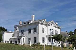
The North End Historic District is a historic district in Woonsocket, Rhode Island encompassing an affluent residential area developed predominantly between about 1880 and 1930. It is bounded by Harris Avenue on the west, Winter Street on the north, Summer and Prospect Streets to the east, and Spring and Blackstone Streets to the south. It is separated from Woonsockets commercial and industrial heart by a neighborhood of densely populated worker housing. Most of the district's 224 major buildings are of relatively high quality and in good condition, and are reflective of the architectural styles that predominated in the late 19th and early 20th centuries: Queen Anne Victorian, Colonial Revival, and Tudor Revival forms and styles are the most common seen.

The Norwood Avenue Historic District is a residential historic district in Cranston and Providence, Rhode Island. It includes all the properties along Norwood Avenue between Broad Street in Cranston and Green Boulevard in Providence. It is lined with houses built mostly between 1890 and 1930 in the Queen Anne and Colonial Revival styles.

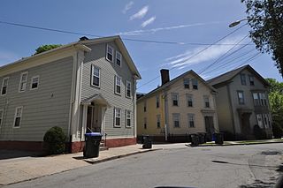
The South Central Falls Historic District is a historic district in Central Falls, Rhode Island. It is a predominantly residential area, densely populated, which was developed most heavily in the late 19th century. It is bounded roughly by Broad Street to the east, the Pawtucket city line to the south, Dexter Street to the west, and Rand Street and Jenks Park to the north. It has 377 contributing buildings, most of which were built before 1920. The district was added to the National Register of Historic Places in 1991.
The Bridgham–Arch–Wilson Streets Historic District is a predominantly residential historic district in Providence, Rhode Island. It is located southwest of downtown Providence, and was developed beginning in the 1840s as a suburban part of the city. It is roughly in the shape of a boot, roughly bounded by Cranston, Bridgham, Elmwood, and Harrison Streets. Most of the housing is architecturally reflective of the mid-19th century, with the Greek Revival, Italianate, and Second Empire styles well represented. Development in the area slowed in the late 19th and early 20th centuries, so there are only a modest number of Queen Anne, Stick style, and Colonial Revival properties. Most of the houses are either 1-1/2 or 2+1⁄2-story wood-frame structures, and are generally set on fairly small lots. There are 175 primary buildings in the district, of which more than 150 are historically significant.

The Elmwood Historic District encompasses two large residential sections of the Elmwood neighborhood of Providence, Rhode Island. The Elmwood area was mainly farmland until the mid-19th century, when its development as a residential area began, and these two sections represents well-preserved neighborhoods developed between about 1850 and 1920. The district was listed on the National Register of Historic Places in 1980.

The Hope–Power–Cooke Streets Historic District is a residential historic district on the East Side of Providence, Rhode Island. Located east of Brown University, the area is compact area developed in the mid-to-late 19th century as a residential district, with a cross-section of architectural styles from the early 19th to the early 20th century. The district is bounded on the north by Angell Street, on the east by Governor Street, on the south by Power Street, and on the west by Hope Street. Cooke Street is the main thorough fare running through the center of the district, which is six blocks long and two wide. The district abuts the Stimson Avenue Historic District, which lies immediately to its west.

Olney Street–Alumni Avenue Historic District is a residential historic district in northeastern Providence, Rhode Island. Located just north of the Moses Brown School campus, this is an enclave of 53 tasteful yet conservative houses built between about 1880 and 1938. It includes houses along Olney Street and Alumni Avenue between Hope and Arlington Streets, and includes a few houses on adjacent streets. Most of these houses are uniformly set back from the street, even though there was no zoning requiring that at the time, and are of brick and/or wood construction. They are stylistically heterogeneous, with Queen Anne and the Colonial Revival predominating.
The Power Street–Cooke Street Historic District is a residential historic district on the East Side of Providence, Rhode Island. Located east of Brown University, the area is compact area developed in the mid-to-late 19th century as a residential district, with a cross-section of architectural styles from the early 19th to the early 20th century. The district is bounded on the north by Angell Street, on the east by Governor Street, on the south by Power Street, and on the west by Hope Street. Cooke Street is the main thorough fare running through the center of the district, which is six blocks long and two wide. The district abuts the Stimson Avenue Historic District, which lies immediately to its west.

The Summit Historic District is a residential historic district in northeastern Providence, Rhode Island. It is bounded on the east by Summit Avenue, the south by Rochambeau Avenue, the west by Camp Street, and the north by Memorial Road and Creston Way. It contains 155 houses, most of which were built between 1918 and 1938. The area was annexed by Providence in 1874 and platted out of farmland in 1916, and represents a typical suburban development of the period. Most of these houses are set on lots between 4,500 and 5,500 square feet in size, although there are some double lots. Single family homes predominate, with a number of two- and three-family houses present. Architecturally the houses are heterogeneous, with styles ranging from the late Queen Anne to the Colonial and Tudor Revivals. The only significant non-residential structure in the district is Temple Beth Shalom at 120 Rochambeau Avenue, which does not contribute to its significance.
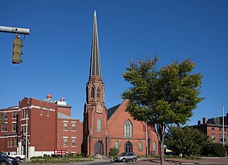
The Trinity Square Historic District is a historic district in the Elmwood neighborhood of Providence, Rhode Island. It includes four properties on the south and west side of Trinity Square, the triangular junction of Elmwood Avenue and Broad Street. The visual focal points of the district are the Grace Church Cemetery, which is located south of the square, and the Trinity United Methodist Church, an imposing Gothic Revival structure built in the mid-1860s to a design by Clifton A. Hall. North of the church stands the Clifton Hall Duplex, designed and occupied by Hall, and the James Potter House, an elaborate Queen Anne mansion built c. 1889 and designed by Stone, Carpenter & Willson.

The Wayland Historic District is a predominantly residential historic district on the east side of Providence, Rhode Island. It is a large area, covering about 122 acres (49 ha), bounded roughly on the north by Everett and Laurel Avenues, on the east by Blackstone Boulevard and Butler Avenue, on the west by Arlington Avenue, and on the south by Angell and South Angell Streets. This area, which was in the 19th century part of the Moses Brown farm, was platted for development in 1891, with most of the construction taking place in the early decades of the 20th century. Most of the residential properties in the district are single-family houses, typically built in revival styles popular at the time. They are set on similarly sized lots with fairly uniform setbacks, and were typically built without garages. There are a number of two-family houses, and a small number of apartment buildings, most of which are found on the arterial roads of the area. There are several religious buildings, including several churches; the most architecturally distinctive religious building is the Jewish Temple Beth El, built 1951–54.
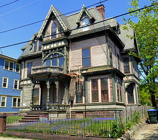
The Wesleyan Avenue Historic District is a residential historic district in the Elmwood section of Providence, Rhode Island. It includes 25 houses, on a one-block section of Wesleyan Avenue between Taylor and Broad Streets, with a few of them on the two end streets. They are large two-plus story wood-frame houses, set on modest lot, all of which were built between 1875 and 1900. The houses are in a diversity of styles popular at that time, including Second Empire, Stick style, and Queen Anne. The district includes what is one of Providence's finest Stick style houses, the Samuel Darling House at 53 Wesleyan Avenue. It was built in 1885, and displays a wealth of applied wood work, decorative shingling, and intricately carved porch details.

The South Washington Street Historic District is a historic district encompassing 200 years of residential architecture in North Attleborough, Massachusetts. It extends along South Washington Street in the central portion of the town, between Elm Street in the north, and Sutherland Street in the south and includes two properties on Hunking Street. The district was added to the National Register of Historic Places in 1995.
Edward L. Angell was an American architect who worked in Providence, Rhode Island, and New York City.

Alpheus C. Morse (1818-1893) was an American architect with offices in Providence, Rhode Island.

The Edgewood Historic District–Shaw Plat is a residential historic district in the Edgewood neighborhood of northeastern Cranston, Rhode Island. It is bounded by Broad Street on the west, Marion Avenue on the south, and Narragansett Bay on the east; it consists of the properties that line the parallel streets, Shaw and Marion Avenues, and the short section of Narragansett Boulevard that runs between Shaw and Marion Avenues. On the north, it abuts the separately-listed Edgewood Historic District–Arnold Farm Plat. The area was platted out between 1867 and 1895, with the construction of most of its housing taking place between 1867 and the start of World War II, with the most construction going on between 1895 and 1930. The district also includes the previously listed Edgewood Yacht Club. In 1853, the 25 acres of land that became the Shaw Plat was sold to Allen Shaw of Providence for $3,660.

The Edgewood Historic District–Arnold Farm Plat is a residential historic district in the Edgewood neighborhood of eastern Cranston, Rhode Island. It is bounded on the north by Albert Avenue, on the east by Narragansett Bay, on the south by Columbia Avenue, and on the west by Broad Street. The district was primarily built out as a streetcar suburb of Providence between 1890 and 1930, and feature styles from Queen Anne and Colonial Revival to Dutch Colonials and two- and three-decker multiunit houses. Prior to its development, the area had been farmed by several generations of the Arnold family.
Edward I. Nickerson (1845–1908) was an American architect from Providence, Rhode Island, known for his work in the Queen Anne style in Providence.

The Rose Land Park Plat Historic District encompasses an early 20th-century neighborhood of East Providence, Rhode Island, most of which was built by a single development group. It is located on the west side of Willett Avenue, on Florence Street, Princeton and Dartmouth Avenues, and Roseland Court. The 7-acre (2.8 ha) district includes 38 residential buildings, and was mostly built between 1928 and 1939 as a streetcar suburb of Providence by Severin Carlson and Carl Johnson. The houses are mainly wood-frame construction, and are stylistically English Revival, Colonial Revival, and traditional Cape Cod.
The Nelson House on Davis Street in Lake Providence, Louisiana was a historic mansion listed on the National Register of Historic Places on October 3, 1980.


