Related Research Articles

Treasure Island is an artificial island in San Francisco Bay, and a neighborhood in the City and County of San Francisco. Built in 1936–37 for the 1939 Golden Gate International Exposition, the island was named by Clyde Milner Vandeburg, part of the Fair's public relations team. Its World's Fair site is a California Historical Landmark. Buildings there have been listed on the National Register of Historic Places, and the historical Naval Station Treasure Island, an auxiliary air facility, are designated in the Geographic Names Information System. Treasure Island is connected to Yerba Buena Island, another (natural) auxiliary island of San Francisco, by a causeway, creating access to Interstate 80.

Mather Air Force Base was a United States Air Force Base, which was closed in 1993 pursuant to a post-Cold War BRAC decision. It was located 12 miles (19 km) east of Sacramento, on the south side of U.S. Route 50 in Sacramento County, California. Mather Field was one of 32 Air Service training camps established after the United States entry into World War I in April 1917.

Stockton Metropolitan Airport is a joint civil-military airport three miles southeast of downtown Stockton, a city in San Joaquin County, California. It is owned by the County of San Joaquin.
Ground-directed bombing (GDB) is a military tactic for airstrikes by ground-attack aircraft, strategic bombers, and other equipped air vehicles under command guidance from aviation ground support equipment and/or ground personnel. Often used in poor weather and at night, the tactic was superseded by an airborne computer predicting unguided bomb impact from data provided by precision avionics Equipment for radar GDB generally included a combination ground radar/computer/communication system and aircraft avionics for processing radioed commands.

The 1st Combat Evaluation Group was a Strategic Air Command (SAC) unit. It was formed on 1 August 1961 to merge the 3908th Strategic Standardization Group for SAC aircrew evaluation with the 1st Radar Bomb Scoring Group that had originated from the 263rd Army Air Force Base Unit which transferred from 15th AF to directly under Strategic Air Command c. 1946. The 1CEVG formed after SAC switched to low-level tactics to counter Soviet surface-to-air missiles and SAC had "developed a Radar Bomb Scoring field kit for use in NIKE Systems" in early 1960 for scoring SAC training missions against US Hercules SAM sites. The 1CEVG headquarters included an Office of History and a "standardization and evaluation school" for command examiners.

The Reeves AN/MSQ-77 Bomb Directing Central, Radar was a United States Air Force automatic tracking radar/computer system for command guidance of aircraft. It was often used during Vietnam War bomb runs at nighttime and during bad weather. Developed from the Reeves AN/MSQ-35, the AN/MSQ-77 reversed the process of Radar Bomb Scoring by continually estimating the bomb impact point before bomb release with a vacuum tube ballistic computer. Unlike "Course Directing Central" systems which guided aircraft to a predetermined release point, the AN/MSQ-77 algorithm continuously predicted bomb impact points during the radar track while the AN/MSQ-77's control commands adjusted the aircraft course. A close air support regulation prohibited AN/MSQ-77 Combat Skyspot bombing within 1,000 yd (910 m) of friendly forces unless authorized by a Forward Air Controller, and "on several occasions" strikes were as close as 273 yd (250 m).
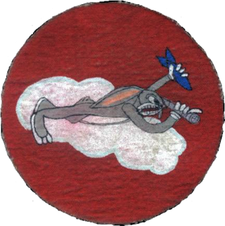
Cheli Air Force Station, in Bell, southeastern Los Angeles County, California, was a United States Air Force installation and a Cold War Radar Bomb Scoring site of the Strategic Air Command, from 1947 to 1961.
A Bombardier School was a United States Army Air Forces facility that used bombing ranges for training aircrew. After ground simulator training with the Norden bombsight, the 12- to 18-week course recorded each student's scores for approximately 160 practice bomb drops of "Bomb Dummy Units" (BDU), both in daytime and at night. The elimination rate was 12%, and graduates transferred to a Second or Third Air Force training unit to join a crew being trained for overseas duty. The bombardier trainer used was the Beech AT-11 Kansan. With the Bradley Plan increase in Eighth Air Force aircrews needed for the Combined Bomber Offensive, the 17 Army Air Forces Bombardier Schools graduated 47,236.
Radar Bomb Scoring is a combat aviation ground support operation used to evaluate Cold War aircrews' effectiveness with simulated unguided bomb drops near radar stations of the United States Navy, the USAF Strategic Air Command, and Army Project Nike units. USAF RBS used various ground radar, computers, and other electronic equipment such as jammers to disrupt operations of the bomber's radar navigator, AAA/SAM simulators to require countermeasures from the bomber, and Radar Bomb Scoring Centrals for estimating accuracy of simulated bombings. Scores for accuracy and electronic warfare effectiveness were transmitted from radar sites such as those at Strategic Range Training Complexes.
RBS Express railroad trains were 3 mobile United States Air Force radar stations for 1CEVG Radar Bomb Scoring (RBS) of Strategic Air Command bomber crews beginning in March 1961. Electronic equipment included the "MSQ-39, TLQ-11, MPS-9, and the IFF/SIF for the MSQ-39" along with support railcars, and the trains were temporarily used at various rail sites with the radar antennas emplaced using hoists built onto flatcars. Pulled by a "contracted locomotive" that left the train at the site, and a North American B-25 Mitchell was used for calibration of the radar station.

The Badlands Bombing Range (BBR) refers to Rapid City Army Air Base target ranges for World War II which included the current Air Force Retained Area, an inactive 2,486-acre (10.06 km2) United States Air Force site "20 miles southeast" of Scenic, South Dakota. The retained area is the remainder of 341,726 acres (1,382.92 km2) federally acquired in 1942 under eminent domain at the Pine Ridge Indian Reservation. In addition to use by World War II aircraft, BBR was used for a post-war Army National Guard gunnery range and a Cold War Radar Bomb Scoring site.
The AN/MPQ-2 Close Cooperation Control Unit was a truck-mounted pautomatic tracking radar/computer/communication system for aircraft command guidance, e.g., missile tracking, and for Radar Bomb Scoring. It was introduced shortly after the end of World War II. For ground directed bombing (GDB), an operator would manually plot a target on the "Blind Bombing Plotting Sheet", then use the manual "E6B computer and bombing tables" to plot the release point for striking the target, after which a radar operator used the AN/MPQ-2 to acquire a track of the bomber near an initial point during which allowed ground control of the bomb run to the release point.

The 99th Range Group is an inactive United States Air Force (USAF) unit. It was last stationed at Nellis AFB, Nevada, where it was responsible for the Nevada Test and Training Range (NTTR).

Hawthorne Bomb Plot is a Formerly Used Defense Site that had a Strategic Air Command (SAC) AUTOTRACK radar station during the Cold War. Operations began at a temporary RBS train site for RBS Express #2 was at the Hawthorne area in December 1961, and the 11th Radar Bomb Scoring Squadron subsequently established the fixed military installation for Radar Bomb Scoring in Babbitt, Nevada, the military housing community near the local Navy/Army depot.
The Salt Lake City Radar Bomb Scoring Site is a Formerly Used Defense Site that was an automatic tracking (AUTOTRACK) radar station during the Cold War. Operated by Detachment 6 of the 11th Radar Bomb Scoring Squadron which had relocated from the Phoenix semi-mobile RBS station in December 1964, the military installation evaluated practice bomb runs by Strategic Air Command simulating attacks on the metropolitan area and on the Hill Air Force Range which had been the Salt Lake City Army Air Base Gunnery Range in World War II.
The 3903rd Radar Bomb Scoring Group was a military evaluation unit under direct command of Strategic Air Command (SAC) headquarters for scoring simulated bomb runs using automatic tracking radar stations. Initially an Army Air Forces Base Unit (AAFBU) and then a squadron, the 3903rd RBS Group was personnel, assets, and detachments were redesignated the 1st Radar Bomb Scoring Group and then the 1CEVG Radar Bomb Scoring Division when the RBS Group merged with the 3908th Strategic Standardization Group in 1961, the year RBS Express trains began to be used for low-altitude Boeing B-52 Stratofortress operations..
McClellan Air Force Base Annex #1 was a military installation near McClellan Air Force Base in Sacramento County, California, that was active from 28 November 1951 to 2 July 1956. Strategic Air Command operated an automatic tracking radar station just outside the base at Whitney and Eastern Avenues.
Genesee Mountain Park Training Annex (1955–70) was a U.S. Air Force radar station, an outstation of Lowry Air Force Base. It is a Formerly Used Defense Site of 3 acres (1.2 ha) at Genesee Park (Colorado)
Havre Electronic Bomb Scoring Site is a Formerly Used Defense Site for USAF evaluation of aircrews on training missions. The site was initially established for the 1965 Fairchild Trophy, the Strategic Air Command Bombing and Navigation Competition. ; the RBS Express was stationed at a siding near Chinook, Montana; and a new "temporary mobile radar site" 35 mi (56 km) northeast of Havre, Montana, was announced in 1982. The 1983 site was in Hill County, Montana, with seven semi-trailers, and a new permanent site was approved by 1984 for also north of Havre "Upon decommissioning of [the mobile site at] Havre, MT Serial Number 7 went to Detachment 18, Forsyth, Montana for SAC Bomb-Comp 1987 and then to Detachment 20, 1 CEVG in early 1988."

Fairfax Field was a wartime (WWII) facility of the United States Army Air Forces and later, the United States Air Force. The installation was north of Kansas City, Kansas. Used as a pre-war Naval Air Station, the United States Army Air Forces leased the municipal airfield and built an Air Force Plant and modification center for North American B-25 Mitchell medium bomber production. Military use of the site continued as late as 1957 by the Strategic Air Command's 3903rd Radar Bomb Scoring Group for bombing practice.
References
- ↑ War Department General Order No. 14, December 3, 1941 (cited by The California State Military Museum)
- ↑ Lease number W-7034-QM-127, August 7, 1941 (cited by The California State Military Museum)[ verification needed ]
- ↑ Lease number W-7034-QM-131 (cited by The California State Military Museum)[ when? ]
- 1 2 3 4 5 "Stockton Ordnance Depot". Historic California Posts. The California State Military Museum. 20 February 2008. Retrieved 2013-02-07.
- ↑ "3903rd Radar Bomb Scoring Group - USAF - Korean War Project Page 1".
- ↑ Department of the Air Force General Order 25, United States Air Force, 24 March 1955 (cited by The California State Military Museum)
- ↑ USAF quitclaim to the Port of Stockton, USAF, December 14, 1956 (cited by The California State Military Museum)
- ↑ militarymuseum.org PW camps