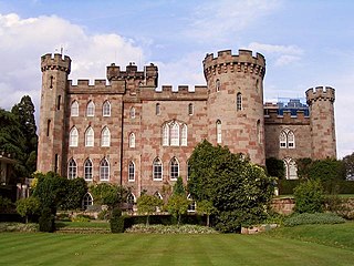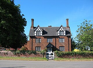
Acton is a small village and former civil parish, now in the parish of Burland and Acton, lying immediately west of the town of Nantwich, in the unitary authority area of Cheshire East and the ceremonial county of Cheshire, England. The civil parish covered 762 acres (3.08 km2) and also included the small settlement of Dorfold and part of Burford, with an estimated population of 340 in 2006. It is administered jointly with the adjacent civil parishes of Henhull and Edleston. Historically, Acton refers to a township and also to an ancient parish in the Nantwich Hundred covering a wide area to the west of Nantwich. The area is agricultural, with dairy farming the main industry. Around a third of the area falls within the Dorfold Estate. Historically, agriculture was the major employer, but it has now been overtaken by the service industries, with many residents commuting significant distances outside the parish to work.

Austerson is a civil parish in the unitary authority of Cheshire East and the ceremonial county of Cheshire, England, lying immediately south of the town of Nantwich and north of the village of Audlem. Predominantly rural with scattered farms, the civil parish includes the small settlement of Old Hall Austerson at SJ656493, about two miles south of Nantwich centre. In 2001, the total population was a little under 150, increasing to 194 at the 2011 Census. Nearby villages include Broomhall Green, Hack Green, Hankelow, Sound Heath and Stapeley.

Buerton is a village at SJ685435 and civil parish in the unitary authority of Cheshire East and the ceremonial county of Cheshire, England, about 7 miles south of the town of Nantwich and 1½ miles east of the village of Audlem, on the border with Shropshire. The parish also includes the small settlements of Hankins Heys, Moblake, Pinder's End and Three Wells, as well as parts of Chapel End, College Fields, Kinsey Heath, Longhill, Raven's Bank, Sandyford and Woolfall. In 2001, the total population was a little under 500, which had increased marginally to 503 at the 2011 Census. Nearby villages include Adderley, Audlem, Bridgemere, Hankelow, Hatherton, Hunsterson and Woore.

Burland is a village and former civil parish, now in the parish of Burland and Acton, in the unitary authority area of Cheshire East and the ceremonial county of Cheshire, England, about 2+1⁄2 miles west of Nantwich. The civil parish also included the small settlements of Burland Lower Green, Burland Upper Green, Hollin Green and Stoneley Green, as well as parts of Gradeley Green and Swanley. The eastern part of the village of Ravensmoor also falls within the civil parish.

Marbury is a small village located at SJ560457 in the civil parish of Marbury and District, formerly Marbury cum Quoisley, within the unitary authority of Cheshire East and the ceremonial county of Cheshire, England. It is administered jointly with the adjacent civil parishes of Norbury and Wirswall. The village lies around 3 miles (5 km) north east of Whitchurch in Shropshire and 7 miles (11 km) south west of Nantwich in Cheshire. Nearby villages include Malpas, No Man's Heath, Norbury, Wirswall and Wrenbury. The civil parish bordered Shropshire and covers 2,168 acres (877 ha); it also contains the small settlements of Hollins Lane, Marley Green and Quoisley, as well as parts of Hollyhurst and Willeymoor. The total population was just under 250 in 2001, and – combined with Wirswall – 352 in 2011.

Ford Green Hall is a Grade II* listed farmhouse and historic house museum in Stoke-on-Trent, Staffordshire. The oldest parts of the house date from the late 16th century, with one wing being either added or greatly repaired at some point in the early 18th century. In its grounds, there also stands an 18th-century dovecote which shares the listed building status of the main farmhouse.

Norbury is a hamlet and former civil parish, now in the parish of Marbury and District, in the Cheshire East district, in the ceremonial county of Cheshire, England. It included the small settlements of Gauntons Bank, Hurst Green, Swanwick Green, Norbury Common and Holtridge, with a total population of nearly 200 people in 2011. The hamlet of Norbury lies around 5 miles (8 km) north of Whitchurch, Shropshire. Nearby villages include No Man's Heath, Marbury and Wrenbury.

Brindley is a village and civil parish in Cheshire, England. The village lies 3¾ miles to the west of Nantwich. The parish also includes the settlements of Brindley Lea, Ryders Bank and part of Radmore Green, with a total population of about 150. Nearby villages include Barbridge, Burland, Haughton and Faddiley.

Calveley is a village and former civil parish, now in the parish of Alpraham and Calveley, in the unitary authority area of Cheshire East and the ceremonial county of Cheshire, England. The village lies 5½ miles to the north west of Nantwich. The parish also includes parts of the settlements of Barrets Green and Wardle Bank. The total population is 280 people. The area is largely agricultural and includes a short stretch of the Shropshire Union Canal. There is an Anglican parish church, a primary school and a public house. Nearby villages include Alpraham, Bunbury, Haughton and Wardle. In 2011 the parish had a population of 280.

Cholmondeley is a civil parish in Cheshire, England, north east of Malpas and west of Nantwich. It includes the small settlements of Croxton Green and Dowse Green, with a total population of a little over a hundred, increasing to 157 at the 2011 Census. Nearby villages include Bickerton to the north east, Bulkeley to the north, Chorley to the east, No Man's Heath to the south west, and Bickley Moss to the south.

Faddiley is a small village and civil parish in the unitary authority of Cheshire East and the ceremonial county of Cheshire, England. The village is located 4 miles to the west of Nantwich. The parish also includes the small settlements of Larden Green and Woodhey or Woodhey Green, with a total population of just over 150, measured at 163 during the 2011 Census. Nearby villages include Brindley, Burland, Chorley, Haughton and Ravensmoor.

Hatherton is a hamlet and civil parish in the unitary authority of Cheshire East and the ceremonial county of Cheshire, England. The hamlet is located on the B5071 at SJ687474, 2+3⁄4 miles (4.4 km) to the north east of Audlem and 3+3⁄4 miles (6.0 km) to the south east of Nantwich. The civil parish has an area of 673 hectares and also includes the small settlements of Birchall Moss, Broomlands and part of Artlebrook, with a total population of 360 in 2011. Nearby villages include Hankelow, Stapeley, Walgherton, Wybunbury, Blakenhall and Buerton. The A529 runs through the parish and the River Weaver forms the western boundary.

Hough is a village and former civil parish, now in the parish of Hough and Chorlton, in the unitary authority area of Cheshire East and the ceremonial county of Cheshire, England. The village is 3 miles (4.8 km) south of Crewe and 4 miles (6.4 km) east of Nantwich. The parish also included part of the settlement of Goodalls Corner. The total population is a little over 800, measured at 808 in the 2011 Census. Nearby villages include Basford, Chorlton, Shavington, Weston and Wybunbury.

Hunsterson is a hamlet and former civil parish, now in the parish of Doddington and District, in the unitary authority area of Cheshire East and the ceremonial county of Cheshire, England. The hamlet is located 2¾ miles to the north east of Audlem and 6 miles to the south of Crewe. The parish also included the settlements of Brown Moss, Four Lane End, Foxes Bank and Whittaker's Green. In 2011 the parish had a population of 163. Nearby villages include Audlem, Buerton, Hatherton and Hankelow.

Minshull Vernon is a hamlet and civil parish in the unitary authority of Cheshire East and the ceremonial county of Cheshire, England. The hamlet lies 3 miles (5 km) to the north west of Crewe, south east of Winsford and south west of Middlewich. The parish also includes the small settlements of Bradfield Green, Eardswick, Hoolgrave, Minshull Hill, Walley's Green and Weaver Bank. The total population of the civil parish is somewhat over 200, measured at 391 in the Census 2011. Nearby villages include Church Minshull, Warmingham and Wimboldsley.

Peckforton is a scattered settlement and civil parish in the unitary authority of Cheshire East and the ceremonial county of Cheshire, England. The settlement is located 6.5 miles (10.5 km) to the north east of Malpas and 7.5 miles (12.1 km) to the west of Nantwich. The civil parish covers 1,754 acres (710 ha), with an estimated total population of 150 in 2006. The area is predominantly agricultural. Nearby villages include Bulkeley to the south, Beeston to the north, Higher Burwardsley to the west, Spurstow to the east and Bunbury to the north east.

Stapeley is a hamlet and former civil parish, now in the parish of Stapeley and District, in the unitary authority area of Cheshire East and the ceremonial county of Cheshire, England. The hamlet lies 2¼ miles to the south east of Nantwich. The parish also included the small settlements of Broad Lane and Butt Green, and parts of Artle Brook, Haymoor Green and Howbeck Bank, as well as a recent residential development north of the A5301 adjacent to Nantwich. In 2008, the total population was estimated to be a little under 3000, increasing to 3,336 at the 2011 Census. Nearby villages include Shavington, Willaston and Wybunbury.

Stoke is a former civil parish, now in the parish of Stoke and Hurleston, in the unitary authority area of Cheshire East and the ceremonial county of Cheshire, England. The parish was predominantly rural with a total population of around 200, measured with the inclusion of Hurleston at 324 in the 2011 Census. The largest settlement was Barbridge, which lies 3½ miles to the north west of Nantwich. The parish also included the small settlements of Stoke Bank and Verona. Nearby villages include Aston juxta Mondrum, Burland, Calveley, Haughton, Rease Heath and Wardle.

Poole is a civil parish in the unitary authority of Cheshire East and the ceremonial county of Cheshire, England, which lies to the north west of Nantwich and to the west of Crewe. The Shropshire Union Canal runs through the parish. Nearby villages include Acton, Aston juxta Mondrum, Barbridge, Stoke Bank, Rease Heath and Worleston.

Hangleton Manor Inn, the adjoining Old Manor House and associated buildings form a bar and restaurant complex in Hangleton, an ancient village which is part of the English city of Brighton and Hove. The manor house is the oldest secular building in the Hove part of the city; some 15th-century features remain, and there has been little change since the High Sheriff of Sussex rebuilt it in the mid-16th century. Local folklore asserts that a 17th-century dovecote in the grounds has been haunted since a monk placed a curse on it. The buildings that comprise the inn were acquired by Hangleton Manor Ltd in 1968, and converted to an inn under the Whitbread banner. The brewery company Hall & Woodhouse have owned and operated it since 2005. English Heritage has listed the complex at Grade II* for its architectural and historical importance, and the dovecote is listed separately at Grade II.


