Stonington, Illinois

Last updated

Stonington
Village of Stonington
Nickname: 
"Home of the Wildcats"
Christian County Illinois Incorporated and Unincorporated areas Stonington Highlighted.svg
Location of Stonington in Christian County, Illinois.
Illinois in United States (US48).svg
Location of Illinois in the United States
Coordinates: 39°38′19″N89°11′31″W / 39.63861°N 89.19194°W / 39.63861; -89.19194 [1]
CountryUnited States
StateIllinois
County Christian
Government
  MayorBruce Dowdy
Area
[2]
  Total0.46 sq mi (1.18 km2)
  Land0.46 sq mi (1.18 km2)
  Water0.00 sq mi (0.00 km2)
Elevation
[1]
614 ft (187 m)
Population
 (2020)
  Total837
  Density1,831.51/sq mi (706.68/km2)
Time zone UTC-6 (CST)
  Summer (DST) UTC-5 (CDT)
ZIP Code(s)
62567
Area code 217
FIPS code 17-72949
GNIS ID2399910 [1]
Wikimedia CommonsStonington, Illinois
Website www.villageofstonington.com

Stonington is a village in Christian County, Illinois, United States. The population was 837 at the 2020 census.

Contents

History

2018 tornado

On December 1, 2018, an EF2 tornado struck the western part of the village; there were no injuries or deaths. [3]

Geography

According to the 2021 census gazetteer files, Stonington has a total area of 0.46 square miles (1.19 km2), all land. [4]

Demographics

Historical population
CensusPop.Note
1880 137
1890 27097.1%
1900 43862.2%
1910 1,118155.3%
1920 1,46631.1%
1930 1,057−27.9%
1940 1,1034.4%
1950 1,1201.5%
1960 1,076−3.9%
1970 1,0961.9%
1980 1,1848.0%
1990 1,006−15.0%
2000 960−4.6%
2010 932−2.9%
2020 837−10.2%
U.S. Decennial Census [5]

As of the 2020 census [6] there were 837 people, 317 households, and 181 families residing in the village. The population density was 1,831.51 inhabitants per square mile (707.15/km2). There were 395 housing units at an average density of 864.33 per square mile (333.72/km2). The racial makeup of the village was 93.79% White, 0.36% African American, 0.12% Native American, 0.12% Asian, 0.12% Pacific Islander, 0.24% from other races, and 5.26% from two or more races. Hispanic or Latino of any race were 1.43% of the population.

There were 317 households, out of which 22.4% had children under the age of 18 living with them, 41.96% were married couples living together, 11.04% had a female householder with no husband present, and 42.90% were non-families. 38.49% of all households were made up of individuals, and 17.98% had someone living alone who was 65 years of age or older. The average household size was 2.82 and the average family size was 2.12.

The village's age distribution consisted of 18.9% under the age of 18, 4.2% from 18 to 24, 28.2% from 25 to 44, 27.3% from 45 to 64, and 21.5% who were 65 years of age or older. The median age was 44.3 years. For every 100 females, there were 97.4 males. For every 100 females aged 18 and over, there were 98.5 males.

The median income for a household in the village was $56,094, and the median income for a family was $74,531. Males had a median income of $48,750 versus $37,500 for females. The per capita income for the village was $30,187. About 12.2% of families and 8.8% of the population were below the poverty line, including 11.0% of those under age 18 and 17.4% of those age 65 or over.

Notable people

Related Research Articles

<span class="mw-page-title-main">Caledonia, Illinois</span> Village in Illinois, United States

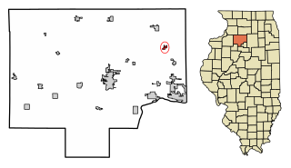
Caledonia is a village in Caledonia Township, Boone County, Illinois, United States. It is part of the Rockford, Illinois Metropolitan Statistical Area. The population was 183 at the 2020 census.

<span class="mw-page-title-main">Arlington, Illinois</span> Village in Illinois, United States

Arlington is a village in Bureau County, Illinois, United States. The population was 169 at the 2020 census. It is part of the Ottawa Micropolitan Statistical Area, located east of the Quad Cities, north of Peoria and Galesburg, west of LaSalle and Peru, and southwest of Rockford and Chicago.

<span class="mw-page-title-main">Gifford, Illinois</span> Village in Illinois, United States

Gifford is a village in Champaign County, Illinois, United States. The population was 911 at the 2020 Census.

<span class="mw-page-title-main">Pesotum, Illinois</span> Village in Illinois, United States

Pesotum is a village in Champaign County, Illinois, United States. The population was 551 at the 2010 census.

<span class="mw-page-title-main">Taylorville, Illinois</span> City in Illinois, United States

Taylorville is a city in and the county seat of Christian County, Illinois, United States. The population was 10,506 at the 2020 census, making it the county's largest city.

<span class="mw-page-title-main">New Baden, Illinois</span> Village in Illinois, United States

New Baden is a village in Clinton County, Illinois, United States. The population was 3,428 at the 2020 census.

<span class="mw-page-title-main">Richton Park, Illinois</span> Village in Illinois, United States

Richton Park is a village and a south suburb of Chicago in Cook County, Illinois, United States. The population was 12,775 at the 2020 census.

<span class="mw-page-title-main">Freeman Spur, Illinois</span> Village in Illinois, United States

Freeman Spur is a village in Williamson and Franklin Counties, Illinois, United States. The population was 268 at the 2020 census.

<span class="mw-page-title-main">Banner, Illinois</span> Village in Illinois, United States

Banner is a village in Fulton County, Illinois, United States. The population was 169 at the 2020 census.

<span class="mw-page-title-main">Bryant, Illinois</span> Village in Illinois, United States

Bryant is a village in Fulton County, Illinois, United States. The population was 168 at the 2020 census, down from 255 at the 2000 census. The village was struck by an EF-3 tornado on April 4, 2023.

<span class="mw-page-title-main">Table Grove, Illinois</span> Village in Illinois, United States

Table Grove is a village in Fulton County, Illinois, United States. Its population was 353 as of the 2020 census. The village was struck by an EF-1 tornado on April 4, 2023.

<span class="mw-page-title-main">Coal City, Illinois</span> Village in Illinois, United States

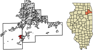
Coal City is a village in Grundy and Will Counties in the U.S. state of Illinois. It is considered a fringe town of the Chicago metropolitan area. The population was 5,705 at the 2020 census.

<span class="mw-page-title-main">Diamond, Illinois</span> Village in Illinois, United States

Diamond is a village in Grundy and Will Counties, Illinois. The population was 2,640 at the 2020 census.

<span class="mw-page-title-main">Godley, Illinois</span> Village in Illinois, United States

Godley is a village in Grundy and Will counties, Illinois, United States. The population was 566 at the 2020 census.

<span class="mw-page-title-main">Vergennes, Illinois</span> Village in Illinois, United States

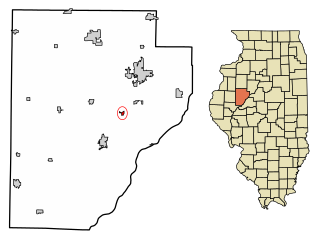
Vergennes is a village in Jackson County, Illinois, United States. The population was 298 at the 2010 census, down from 491 at the 2000 census.

<span class="mw-page-title-main">Grant Park, Illinois</span> Village in Illinois, United States

Grant Park is a village in northeastern Kankakee County, Illinois, United States. Grant Park was incorporated in 1883. In 2010, Grant Park had a population of 1,331. It is part of the Kankakee–Bradley Metropolitan Statistical Area. Much of the town was destroyed by a cyclone in 1912, according to Frank Leslie's Weekly magazine, which ran pictures.

<span class="mw-page-title-main">North Utica, Illinois</span> Village in Illinois, United States

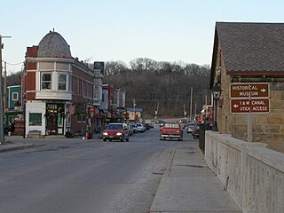
North Utica, often known as Utica, is a village in Utica Township, LaSalle County, Illinois. The population was 1,323 at the 2020 census. It is part of the Ottawa Micropolitan Statistical Area.

<span class="mw-page-title-main">New Minden, Illinois</span> Village in Illinois, United States

New Minden is a village in Washington County, Illinois, United States. The population was 215 at the 2010 census. It possessed a post office from 1868 to 1976.

<span class="mw-page-title-main">Bay View Gardens, Illinois</span> Village in Illinois, United States

Bay View Gardens is a village in Woodford County, Illinois, United States. The population was 378 at the 2010 census, up from 366 in 2000. The village is part of the Peoria, Illinois Metropolitan Statistical Area.

<span class="mw-page-title-main">Hazel Green, Wisconsin</span> Village in Wisconsin, United States

Hazel Green is a village in Grant and Lafayette counties in the U.S. state of Wisconsin. The population was 1,256 at the 2010 census. Of this, 1,243 were in Grant County, and only 13 were in Lafayette County. The village is located mostly within the Town of Hazel Green in Grant County; only a small portion extends into the Town of Benton in Lafayette County.

References

  1. 1 2 3 U.S. Geological Survey Geographic Names Information System: Stonington, Illinois
  2. "2020 U.S. Gazetteer Files". United States Census Bureau. Retrieved March 15, 2022.
  3. US Department of Commerce, NOAA. "Tornado Outbreak of December 1, 2018". www.weather.gov.
  4. Bureau, US Census. "Gazetteer Files". Census.gov. Retrieved June 29, 2022.
  5. "Census of Population and Housing". Census.gov. Retrieved June 4, 2015.
  6. "Explore Census Data". data.census.gov. Retrieved June 28, 2022.
  7. 'Illinois Blue Book 1931-1932,' Biographical Sketch of Roy A. Corzine, pg. 292-293