
Naracoorte is a town in the Limestone Coast region of South Australia, approximately 336 kilometres south-east of Adelaide and 100 kilometres north of Mount Gambier on the Riddoch Highway (A66).
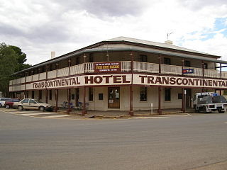
Quorn is a small town and railhead in the Flinders Ranges in the north of South Australia, 39 kilometres (24 mi) northeast of Port Augusta. At the 2016 census, the locality had a population of 1,230, of which 1,131 lived in its town centre.

The Adelaide Park Lands are the figure-eight of land spanning both banks of the River Torrens between Hackney and Thebarton and separating the City of Adelaide area from the surrounding suburbia of greater metropolitan Adelaide, the capital city of South Australia. They were laid out by Colonel William Light in his design for the city, and originally consisted of 2,300 acres (930 ha) "exclusive of 32 acres (13 ha) for a public cemetery". One copy of Light's plan shows areas for a cemetery and a Post and Telegraph Store on West Tce, a small Government Domain and Barracks on the central part of North Tce, a hospital on East Tce, a Botanical Garden on the River Torrens west of North Adelaide, and a school and a storehouse south-west of North Adelaide.
The Electricity Trust of South Australia (ETSA) was the South Australian Government-owned monopoly vertically integrated electricity provider from 1946 until its privatisation in 1999.

Adelaide city centre is the inner city locality of Greater Adelaide, the capital city of South Australia. It is known by locals simply as "the City" or "Town" to distinguish it from Greater Adelaide and from the City of Adelaide local government area. The population was 15,115 in the 2016 census.

Pulteney Street is a main road which runs north-south through the middle of the eastern half of the Adelaide city centre, in Adelaide, South Australia. It runs north-south from North Terrace, through Hindmarsh and Hurtle Squares, to South Terrace, where it becomes Unley Road, and subsequently,, becomes Belair Road.
The Street Naming Committee was set up to decide the names of the streets, the squares and the river of the new settlement of Adelaide, South Australia, as it had been laid out by Colonel William Light in 1837. Light's map corresponds to the modern Adelaide city centre and North Adelaide. The committee met on 23 May 1837.
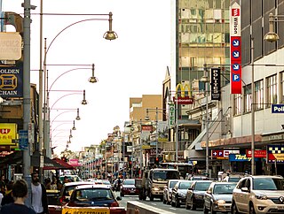
Hindley Street is located in the north-west quarter of the centre of Adelaide, the capital of South Australia. It runs between King William Street and West Terrace. The street was named after Charles Hindley, a British parliamentarian and social reformist.

Dudley Park, is a suburb of Adelaide, South Australia, located approximately 3 kilometres north-west of the CBD. The suburb is bordered by Regency Road (north), Simpson Avenue (south), the Adelaide-Gawler railway line (east), and a line directly north-south from the Harrison Road-Simpson Avenue intersection to Regency Road (west).
The Tandanya National Aboriginal Cultural Institute, usually referred to as Tandanya, is an art museum located on Grenfell Street in Adelaide, South Australia. It specialises in promoting Indigenous Australian art, including visual art, music and storytelling. It is the oldest Aboriginal-owned and -run cultural centre in Australia.

Gilles Street is a street in the south-eastern sector of the centre of Adelaide, South Australia. It runs east–west between East Terrace and King William Street, crossing Hutt Street and Pulteney Street. It was named after Osmond Gilles, an early treasurer of the colony of South Australia on 23 May 1837.
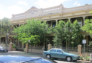
Carrington Street is a street in the south-eastern sector of the centre of Adelaide, South Australia. It runs east–west, from East Terrace to King William Street, blocked at Hutt Street and crossing Pulteney Street at Hurtle Square. It is one of the narrow streets of the Adelaide grid, at 1 chain wide.

Pirie Street is a road on the east side of the Adelaide city centre, South Australia. It runs east–west, between East Terrace and King William Street. After crossing King William Street, it continues as Waymouth Street. It forms the southern boundary of Hindmarsh Square which is in the centre of the north-east quadrant of the city centre.

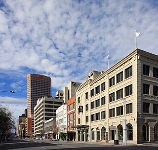
Grenfell Street is a major street in the north-east quarter of the Adelaide city centre, South Australia. The street runs west-east from King William Street to East Terrace. On the other side of King William Street, it continues as Currie Street. Its intersection with Pulteney Street is encircled by Hindmarsh Square.

East Terrace marks the eastern edge of the Adelaide city centre. It is one of the main north–south thoroughfares through the east side of the city. Although the terrace essentially runs north–south between North Terrace and South Terrace, unlike Adelaide's other three terraces, its path is far from a straight line; travelling the entire length of East Terrace requires turning at right angles at most intersections from Pirie Street onwards. These days however, the traffic flow, after a swerve to the east between Grenfell and Pirie Streets, continues southwards over the Pirie intersection into Hutt Street and on down to South Terrace.
Thomas Bewes Strangways, generally called "Bewes Strangways" and "T. Bewes Strangways", was an explorer, early settler and Colonial Secretary of South Australia.
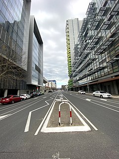
Angas Street is a main street in the CBD of the centre of Adelaide, South Australia. The rear of St Aloysius College faces the street, and various law courts are on the street, including the Dame Roma Mitchell Building. The South Australia Police headquarters and South Australian Metropolitan Fire Service Adelaide station are further down the street.
Currie Street is a main street in the Adelaide city centre, South Australia. It runs east–to–west from King William Street, through Light Square, to West Terrace on the western edge of the city centre.

Wakefield Street is a main thoroughfare intersecting the centre of the South Australian capital, Adelaide from east to west.
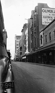
Gawler Place is a single-lane road in the city centre of Adelaide, the capital of South Australia. It runs north to south from North Terrace to Wakefield Street, parallel to and approximately midway between King William and Pulteney Streets.
