Related Research Articles

The Snoqualmie River is a 45-mile (72 km) long river in King County and Snohomish County in the U.S. state of Washington. The river's three main tributaries are the North, Middle, and South Forks, which drain the west side of the Cascade Mountains near the town of North Bend and join near the town of Snoqualmie just above the Snoqualmie Falls. After the falls the river flows north through rich farmland and the towns of Fall City, Carnation, and Duvall before meeting the Skykomish River to form the Snohomish River near Monroe. The Snohomish River empties into Puget Sound at Everett. Other tributaries of the Snoqualmie River include the Taylor River and the Pratt River, both of which enter the Middle Fork, the Tolt River, which joins at Carnation, and the Raging River at Fall City.

The River Esk, also known as the Border Esk, is a river in Dumfries and Galloway, Scotland, that enters the English county of Cumbria and flows into the Solway Firth.
Achairn Burn, known also as Haster Burn, is one of the major tributaries of Wick River, in Caithness, in the Highland area of Scotland. The burn's source is in headwaters flowing from the northern slope of the Hill of Toftgunn, which rises to over 170 metres, and in Camster Loch, which is at nearly 120 metres, between the Hill of Toftgunn and Ballharn Hill. The same area feeds also another major tributary of Wick River, the Camster/Rowans-Strath Burn. Achairn Burn enters Wick River at Mary Ford, about 10 kilometres to the northeast of the burn's source. Its entire course is within Caithness, as is the whole of the catchment basin of Wick River.

The River Dwyryd is a river in Gwynedd, Wales which flows principally westwards; draining to the sea into Tremadog Bay, south of Porthmadog.
Forsinard is a hamlet in the county of Sutherland in the Highland area of Scotland. It is located on the A897 road in Strath Halladale. It is served by a railway station on the Far North Line. The local hotel closed several years ago, but there is now a b&b just across the level crossing.

White Rock Creek is a 30-mile (48.3 km) creek occupying a chain of four sub-watersheds [1] within the Trinity River Headwaters watershed. From its source near Frisco, Texas at 33°07'54"N/96°46'50"W, this creek runs south-by-south-east through suburban Dallas for 23.5 miles (37.8 km) where it widens into White Rock Lake, then continues south for another 8 miles (12.9 km) to its mouth at 32°43'25"N/96°44'02"W on the Trinity River, of which it is a major tributary.

The A897 single track road is entirely within the Highland council area of Scotland. It runs generally north from the A9 at Helmsdale to the A836 near Halladale Bridge, east of Melvich. The road passes through or near Kildonan, Kinbrace and Forsinard, and has a junction with the B871 at Kinbrace. It also passes through Achiemore.

The River Wiske is a tributary of the River Swale in Yorkshire, England. The Wiske gives its name to several villages it passes through. The name Wiske is derived from an Old English word wisca meaning a water meadow. It was once known as the Foulbroke, a name for which some writers commented that it was well deserved.
The Econlockhatchee River is an 87.7-kilometer-long (54.5 mi) north-flowing blackwater tributary of the St. Johns River. The Econ River flows through Osceola, Orange, and Seminole counties in Central Florida, just east of the Orlando Metropolitan Area. It is a designated Outstanding Florida Waters.

Melvich is a village in the county of Sutherland on the north coast of Scotland. It is situated on the A836 road, near the mouth of the River Halladale. It has a successful Gaelic choir. The A897 road which runs from Helmsdale, through the Strath of Kildonan and past Kinbrace, terminates at Melvich.

The Sol Duc River is a river in the U.S. state of Washington. About 78 miles (126 km) long, it flows west through the northwest part of the Olympic Peninsula, from the Olympic Mountains of Olympic National Park and Olympic National Forest, then through the broad Sol Duc Valley. Near the Pacific Ocean the Sol Duc River joins the Bogachiel River, forming the Quillayute River, which flows about 4 miles (6.4 km) to the Pacific Ocean at La Push. Although the Quillayute River is short, its large tributary rivers—the Sol Duc, Bogachiel, Calawah, and Dickey Rivers—drain the largest watershed of the northern Olympic Peninsula, 629 square miles (1,630 km2). The Sol Duc's watershed is the largest of the Quillayute's tributaries, at 219 square miles (570 km2).

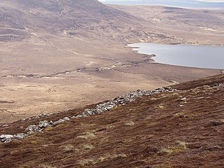
Achiemore is a hamlet in Strath Halladale in Sutherland, in the Highland council area of Scotland. Achiemore is situated to the north of Smigel Burn on the right bank of the Halladale River just beyond where the Allt an Tigh-choinneirnh flows and Upper Bighouse. The village and station of Forsinard is 15 km to the south, and Melvich, on the north coast, is roughly 4.5 miles (7 km) to the north. Culfern is just to the north and contains ruins. The A897 road passes through Achiemore.
The Afon Llynfi is a short river in the county of Powys, south Wales. A tributary of the River Wye, it runs approximately south to north just to the west of the Black Mountains and partly within the Brecon Beacons National Park. The river rises as a small stream to the west of the village of Bwlch and flows north for two miles into Llangorse Lake. It leaves the lake just to the southwest of the village of Llangors and follows a course past the hamlets of Trefecca and Tredustan. The river then travels between the twin villages of Talgarth and Bronllys, forming the boundary of the national park in part. It then flows northeast past the village of Three Cocks before entering the River Wye just upstream of Glasbury Bridge.
The Afon Marlais is a right-bank tributary of the River Tâf in Pembrokeshire, West Wales. It flows through the Vale of Lampeter to join the Tâf just west of Whitland. Its length is approximately 10 kilometres (6.2 mi). The name derives from the Welsh 'marw glais' and signifies a 'stagnant stream'.

The River Helmsdale is one of the major east-flowing rivers of Sutherland in the Highlands of Scotland. It flows broadly southeastwards from Loch Badanloch down the Strath of Kildonan, gathering the waters of the Bannock Burn on its left and the Abhainn na Frithe on its right before discharging into the Moray Firth on the North Sea at the town of Helmsdale. Other significant tributaries of the Helmsdale include the left-bank Suisgill Burn and the right-bank Craggie Water. Loch Achnamoine which is just over 1 km in length, lies on the line of the river 1 mi / 1.5 km downstream of Loch Badanloch. Loch Badanloch is one of a complex of three interconnecting lochs - the other two being Loch nan Clàr and Loch Rimsdale which gather waters from the moors on the southern edge of the Flow Country via the Allt an Lòin Tharsuinn, Allt Lòn a' Chùil and Rimsdale Burn.

The River Brora is an east-flowing river in Sutherland in the Highlands of Scotland. It is formed where its headwater streams, the Féith Osdail, Allt Gobhlach and Allt nan Con-uisge meet at Dalnessie, then flows southeastwards down Strath Brora to Dalreavoch. The river then briefly turns northeast and then east, before turning southeastwards once again to pass through the three distinct basins of Loch Brora to enter the Moray Firth on the North Sea at the town of Brora. Its one principal tributary is the Black Water which enters on its left bank at Balnacoil. The Black Water is itself fed by the River Skinsdale and the Coirefrois Burn.

The River Garry is a major tributary of the River Tummel, itself a tributary of the River Tay, in the traditional county of Perthshire in the Scottish Highlands. It emerges from the northeastern end of Loch Garry (56.8193°N 4.2311°W), just to the southeast of the Pass of Drumochter, and flows southeastwards and eastwards down Glen Garry to the narrow Pass of Killiecrankie beyond which it joins the Tummel (56.7182°N 3.7790°W).

Strath of Kildonan, also known as Strath Ullie,, is a strath in Sutherland, in the north of Scotland. It extends in a north-westerly direction from Helmsdale towards Kinbrace.
Dunbeath Water is a short river in Caithness in northern Scotland. It rises at Loch Braigh na h-Aibhne in the Flow Country and initially flows northeast before turning generally south-southeastward to flow through Dunbeath and into the Moray Firth at Dunbeath Bay. Its main tributaries in its upper catchment are the left-bank ones of Allt a' Bhuic which drains Loch Dubh and the Raffin Burn which drains Loch Breac. On the western edge of Dunbeath, the Burn of Houstry, fortified by the Allt an Learanaich also enter on the north bank. The river is crossed by the old bridge and a new bridge carrying the modern A9 road northwards. A small harbour has been developed at the river mouth.
Berriedale Water is a short river in Caithness in northern Scotland. It arises as the Feith Gaineimh Mhor, Feith Chaorunn Mhor and Feith Fhuaran come together at the southern edge of the Flow Country after which it flows generally eastwards to Braemore. Downstream of Braemore it curves to the south within an increasingly narrow valley which continues to the coast at the estate village of Berriedale. It is joined at this point by the Langwell Water, the headwater streams of which lie just to the south of those of Berriedale Water. Like the lower stretches of Berriedale Water, the valley sides become more wooded towards the coast. The 706m high hill of Morven lies on the watershed between the two rivers. The two rivers are crossed by the A9 road at their confluence only a few hundred metres short of the Moray Firth. The remains of Berriedale Castle stand above the mouth on the south side.
References
- ↑ 449 Strath Halladale & Strathy Point (Map) (A ed.). 1:25,000. Explorer. Ordnance Survey. 2003. ISBN 0319233952.