Stroheim

Last updated

Stroheim
Stroheim Ansicht.jpg
Coat of arms Stroheim.svg
Coat of arms
Austria adm location map.svg
Red pog.svg
Stroheim
Location within Austria
Coordinates: 48°20′20″N13°57′30″E / 48.33889°N 13.95833°E / 48.33889; 13.95833 Coordinates: 48°20′20″N13°57′30″E / 48.33889°N 13.95833°E / 48.33889; 13.95833
Country Austria
State Upper Austria
District Eferding
Government
   Mayor Franz Breuer (ÖVP)
Area
[1]
  Total28.75 km2 (11.10 sq mi)
Elevation
489 m (1,604 ft)
Population
(2018-01-01) [2]
  Total1,555
  Density54/km2 (140/sq mi)
Time zone UTC+1 (CET)
  Summer (DST) UTC+2 (CEST)
Postal code
4074
Area code 07272
Vehicle registration EF
Website www.stroheim.at

Stroheim is a municipality in the district of Eferding in the Austrian state of Upper Austria.

Austria Federal republic in Central Europe

Austria, officially the Republic of Austria, is a country in Central Europe comprising 9 federated states. Its capital, largest city and one of nine states is Vienna. Austria has an area of 83,879 km2 (32,386 sq mi), a population of nearly 9 million people and a nominal GDP of $477 billion. It is bordered by the Czech Republic and Germany to the north, Hungary and Slovakia to the east, Slovenia and Italy to the south, and Switzerland and Liechtenstein to the west. The terrain is highly mountainous, lying within the Alps; only 32% of the country is below 500 m (1,640 ft), and its highest point is 3,798 m (12,461 ft). The majority of the population speaks local Bavarian dialects as their native language, and German in its standard form is the country's official language. Other regional languages are Hungarian, Burgenland Croatian, and Slovene.

Upper Austria State of Austria

Upper Austria is one of the nine states or Bundesländer of Austria. Its capital is Linz. Upper Austria borders on Germany and the Czech Republic, as well as on the other Austrian states of Lower Austria, Styria, and Salzburg. With an area of 11,982 km2 (4,626 sq mi) and 1.437 million inhabitants, Upper Austria is the fourth-largest Austrian state by land area and the third-largest by population.

Geography

Stroheim lies in the Hausruckviertel on a ridge overlooking the Eferding Basin. About 29 percent of the municipality is forest and 63 percent farmland.

Hausruckviertel geographic region

The Hausruckviertel is an Austrian region belonging to the state of Upper Austria: it is one of four "quarters" of Upper Austria the others being Traunviertel, Mühlviertel, and Innviertel. It is so-called because of the range of hills, the Hausruck, that pass through the region.

Related Research Articles

Prambachkirchen Place in Upper Austria, Austria

Prambachkirchen is a town in the district of Eferding in the Austrian state of Upper Austria.

Hartkirchen Place in Upper Austria, Austria

Hartkirchen is a municipality in the district of Eferding in the Austrian state of Upper Austria.

Eferding Place in Upper Austria, Austria

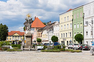
Eferding  is the capital of the Eferding district in the Austrian state of Upper Austria.

Dünserberg Place in Vorarlberg, Austria

Dünserberg is a municipality in the district of Feldkirch in the Austrian state of Vorarlberg.

Burgkirchen, Austria Place in Upper Austria, Austria

Burgkirchen is a municipality in the district Braunau am Inn in the Austrian state of Upper Austria.

Höhnhart Place in Upper Austria, Austria

Höhnhart is a municipality in the district of Braunau am Inn in the Austrian state of Upper Austria.

Pischelsdorf am Engelbach Place in Upper Austria, Austria

Pischelsdorf am Engelbach is a municipality in the district of Braunau am Inn in the Austrian state of Upper Austria.

Roßbach, Austria Place in Upper Austria, Austria

Roßbach is a municipality in the district of Braunau am Inn in the Austrian state of Upper Austria.

Überackern Place in Upper Austria, Austria

Überackern is a municipality in the district of Braunau am Inn in the Austrian state of Upper Austria.

Fraham Place in Upper Austria, Austria

Fraham is a municipality in the district of Eferding in the Austrian state of Upper Austria.

Alkoven Place in Upper Austria, Austria

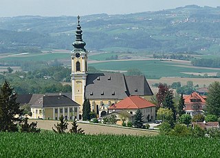
Alkoven is a municipality in the district of Eferding in the Austrian state of Upper Austria.

Haibach ob der Donau Place in Upper Austria, Austria

Haibach ob der Donau is a municipality in the district of Eferding in the Austrian state of Upper Austria, Austria. It is situated near the Danube.

Hinzenbach Place in Upper Austria, Austria

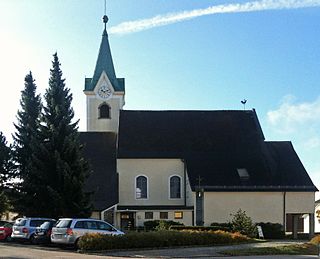
Hinzenbach is a municipality in the district of Eferding in the Austrian state of Upper Austria.

Pupping Place in Upper Austria, Austria

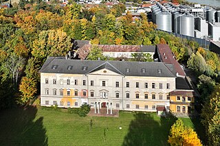
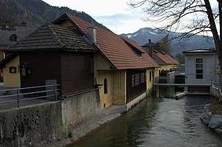
Pupping is a municipality in the district of Eferding in the Austrian state of Upper Austria. St. Wolfgang of Regensburg died here in the Chapel of Saint Othmar while on his way to Hungary for a mission.

Scharten Place in Upper Austria, Austria

Scharten is a municipality in the district of Eferding in the Austrian state of Upper Austria.

Sankt Marienkirchen an der Polsenz Place in Upper Austria, Austria

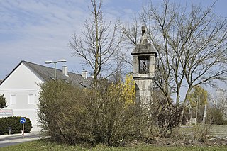
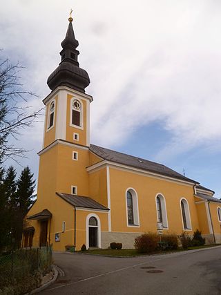
Sankt Marienkirchen an der Polsenz is a municipality in the district of Eferding in the Austrian state of Upper Austria.

Haslach an der Mühl Place in Upper Austria, Austria

Haslach an der Mühl is a municipality in the district of Rohrbach in the Austrian state of Upper Austria.

Altschwendt Place in Upper Austria, Austria

Altschwendt is a municipality in the district of Schärding in the Austrian state of Upper Austria.

Ampflwang im Hausruckwald Place in Upper Austria, Austria

Ampflwang im Hausruckwald is a municipality in the district of Vöcklabruck in the Austrian state of Upper Austria.

Sankt Lorenz Place in Upper Austria, Austria

Sankt Lorenz is a municipality in the district of Vöcklabruck in the Austrian state of Upper Austria.

References

  1. "Dauersiedlungsraum der Gemeinden Politischen Bezirke und Bundesländer - Gebietsstand 1.1.2018". Statistics Austria. Retrieved 10 March 2019.
  2. "Einwohnerzahl 1.1.2018 nach Gemeinden mit Status, Gebietsstand 1.1.2018". Statistics Austria. Retrieved 9 March 2019.