
Edlingham Castle is a small castle ruin, having scheduled monument and Grade I listed building status, in the care of English Heritage. It is located in a valley to the west of Alnwick, Northumberland, England. It has been described as "...one of the most interesting in the county", by Nikolaus Pevsner, the architectural historian. Edlingham itself is little more than a hamlet with a church alongside the castle.

Abbotsbury is a village and civil parish in the English county of Dorset. The village is located around 7+1⁄2 miles (12.1 km) west southwest of Dorchester and 1 mile (1.6 km) inland from the English Channel coast. In the 2021 census the civil parish had a population of 451.
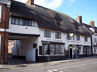
Sturminster Newton is a town and civil parish situated on the River Stour in the north of Dorset, England. The town is at the centre of the Blackmore Vale, a large dairy agriculture region around which the town's economy is built, and is known as 'the heart of the Blackmore vale'.

Glastonbury Abbey was a monastery in Glastonbury, Somerset, England. Its ruins, a grade I listed building and scheduled ancient monument, are open as a visitor attraction.

Buckland Newton is a village and civil parish in Dorset, England. It is situated beneath the scarp slope of the Dorset Downs, 7+1⁄2 miles (12.1 km) south of Sherborne. In the 2011 census the civil parish had a population of 622. The village covers around 6000 acres.

Okeford Fitzpaine is a village and civil parish in the English county of Dorset, situated in the Blackmore Vale three miles south of the town of Sturminster Newton. It is sited on a thin strip of greensand under the scarp face of the Dorset Downs. In the 2011 census the civil parish—which includes the village of Belchalwell to the west and most of the hamlet of Fiddleford to the north—had 404 dwellings, 380 households and a population of 913.

The solar was a room in many English and French medieval manor houses, great houses and castles, mostly on an upper storey, designed as the family's private living and sleeping quarters. Within castles they are often called the "Lords' and Ladies' Chamber" or the "Great Chamber".

Restormel Castle lies by the River Fowey near Lostwithiel in Cornwall, England, UK. It is one of the four chief Norman castles of Cornwall, the others being Launceston, Tintagel and Trematon. The castle is notable for its perfectly circular design. Once a luxurious residence of the Earl of Cornwall, the castle was all but ruined by the 16th century. It was briefly reoccupied and fought over during the English Civil War, but was subsequently abandoned. It is now in the care of English Heritage and open to the public.
Whitsbury is a village and civil parish in Hampshire, England, close to Fordingbridge. Whitsbury is a part of a group of villages on the edge of the Cranborne Chase and West Wiltshire Downs Area of Outstanding Natural Beauty.

Weeting Castle is a ruined, medieval manor house near the village of Weeting in Norfolk, England. It was built around 1180 by Hugh de Plais, and comprised a three-storey tower, a substantial hall, and a service block, with a separate kitchen positioned near the house. A moat was later dug around the site in the 13th century. The house was not fortified, although it drew on architectural features typically found in castles of the period, and instead formed a very large, high-status domestic dwelling. It was probably intended to resemble the hall at Castle Acre Castle, owned by Hugh's feudal lord, Hamelin de Warenne.

Fiddleford Manor is a medieval manor house located near Sturminster Newton, Dorset. It is thought to have been originally built around 1370 for William Latimer, the sheriff of Somerset and Dorset, after the manor passed to him in 1355. The house is now owned by English Heritage and open for the public to visit throughout the year; however, there is an adjoining building to the north that continues to serve as a private residence and is not open to the public.

Beverston Castle, also known as Beverstone Castle or Tetbury Castle, was constructed as a medieval stone fortress in the village of Beverston, Gloucestershire, England. The property is a mix of manor house, various small buildings, extensive gardens and the medieval ruins of the fortified building. The castle was founded in 1229 by Maurice de Gaunt.

Gleaston Castle is a medieval building in a valley about 1 kilometre (0.62 mi) north-east of the village of Gleaston. The village lies between the towns of Ulverston and Barrow-in-Furness in the Furness peninsula, Cumbria, England. Gleaston Castle has a quadrilateral plan, with a tower at each corner. The largest of these, the north-west tower, probably housed a hall.

The Grade I listed buildings in Somerset, England, demonstrate the history and diversity of its architecture. The ceremonial county of Somerset consists of a non-metropolitan county, administered by Somerset County Council, which is divided into five districts, and two unitary authorities. The districts of Somerset are West Somerset, South Somerset, Taunton Deane, Mendip and Sedgemoor. The two administratively independent unitary authorities, which were established on 1 April 1996 following the breakup of the county of Avon, are North Somerset and Bath and North East Somerset. These unitary authorities include areas that were once part of Somerset before the creation of Avon in 1974.

The Manor Farmhouse in Meare, Somerset, England, was built in the 14th century as the summer residence of the Abbots from Glastonbury Abbey and is now a farmhouse. Along with its outbuildings the farmhouse has been designated as a Grade I listed building.

Hammoon is a small village and civil parish in the English county of Dorset, sited on a river terrace of alluvial silt by the River Stour, about two miles east of the small town of Sturminster Newton. Its name is derived from the Old English ham, meaning dwelling, and the surname of the Norman lord of the manor. In 2001 the parish had 19 households and a population of 49. In 2013 the estimated population of the parish was 40.
There are over 670 scheduled monuments in the ceremonial county of Somerset in South West England. The county consists of a non-metropolitan county, administered by Somerset County Council, which is divided into five districts, and two unitary authorities. The districts of Somerset are West Somerset, South Somerset, Taunton Deane, Mendip and Sedgemoor. The two administratively independent unitary authorities, which were established on 1 April 1996 following the breakup of the county of Avon, are North Somerset and Bath and North East Somerset. These unitary authorities include areas that were once part of Somerset before the creation of Avon in 1974.
Dungeon Hill is an Iron Age hillfort, about 1+1⁄4 miles north of the village of Buckland Newton in Dorset, England. It is a scheduled monument.

Banbury Hillfort, or Banbury Hill Camp, is an Iron Age hillfort, about 1.25 miles (2.0 km) south of Sturminster Newton and 1 mile (1.6 km) north-west of the village of Okeford Fitzpaine in Dorset, England.
