
Captain George Vancouver was a British officer of the Royal Navy, best known for his 1791–95 expedition, which explored and charted North America's northwestern Pacific Coast regions, including the coasts of contemporary British Columbia, Canada and Alaska, Washington, and Oregon, United States. He also explored the Hawaiian Islands and the southwest coast of Australia.

Douglas Island is a tidal island in the U.S. state of Alaska, just west of downtown Juneau and east of Admiralty Island. It is separated from mainland Juneau by the Gastineau Channel.

Stephens Passage is a channel in the Alexander Archipelago in the southeastern region of the U.S. state of Alaska. It runs between Admiralty Island to the west and the Alaska mainland and Douglas Island to the east, and is about 170 km (105 mi) long. Juneau, the capital of Alaska, is near the north end, on Gastineau Channel.
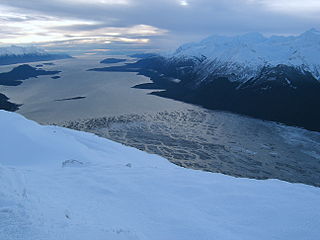
Chilkat Inlet is an inlet in Lynn Canal in the Southeast region of the U.S. state of Alaska that includes the delta for the Chilkat River and borders Haines and the Chilkat Peninsula. It was first charted in 1794 by Joseph Whidbey, master of HMS Discovery during George Vancouver's 1791–1795 expedition.

The Chilkat Peninsula is a peninsula in Lynn Canal, Southeast Alaska that divides the Chilkoot and Chilkat Inlets and divides the Chilkat and Chilkoot watersheds. The peninsula extends into Lynn Canal as well. It was first charted in 1794 by Joseph Whidbey, master of HMS Discovery during George Vancouver's 1791–1795 expedition.

Chilkoot Inlet is an inlet in the Southeast region of the U.S. state of Alaska, located on the eastern side of the Chilkat Peninsula in Lynn Canal. Chilkoot Inlet is the terminus of the Chilkoot River and its watershed, and also home to Lutak, Alaska. It was first charted in 1794 by Joseph Whidbey, master of HMS Discovery during George Vancouver's 1791–1795 expedition.

Lincoln Island is a wooded island in Lynn Canal in Alaska, United States. Located at 58°29′41″N134°59′40″W, the island is one kilometer northwest of larger Shelter Island and some 200 meters southeast of smaller Ralston Island. It is part of the Juneau City and Borough. The first European to sight the island was Joseph Whidbey, master of HMS Discovery during George Vancouver's 1791–1795 expedition, in 1794. It was named in 1868 by Commander R. W. Meade, USN, presumably for Abraham Lincoln.
Couverden Island is a small island located at the western entrance of Lynn Canal in Alaska. The first European to see it was Joseph Whidbey in 1794, master of the Discovery during George Vancouver's 1792-1794 exploration of the Pacific Northwest. The south point of the island was named by Vancouver Point Couverden, "which I called after the seat of my ancestors". The name was apparently later transferred to the island. The island is located in Haines Borough in southeastern Alaska.
Devastation Channel is a channel in the North Coast region of the Canadian province of British Columbia. It lies between Hawkesbury Island and the mainland. It was named in 1863 by Captain Daniel Pender after the H.M. paddle-sloop Devastation. It was first charted in 1793 by Joseph Whidbey, master of the Discovery during George Vancouver's 1791-95 expedition.
Ursula Channel is a channel in the North Coast region of the Canadian province of British Columbia. It separates the east coast of Gribbell Island from the mainland. It was first charted in 1793 by Joseph Whidbey, master of the Discovery during George Vancouver’s 1791-95 expedition.
Bell Island is an island in the Alexander Archipelago in Southeast Alaska, United States. It is 14 kilometres (8.7 mi) long, lying in Behm Canal, north of Revillagigedo Island. George Vancouver first visited the island on August 12, 1793, in the evening dining on its south coast. He suspected that it was an island, but this was not proven until later in the same month, when Joseph Whidbey, master of HMS Discovery, charted its entire coastline. Vancouver later named it "Bell's Island" after one of his crew, Midshipman Bell.
Affleck Canal is an inlet in Southeast Alaska, United States It extends 32 kilometres (20 mi) north from Sumner Strait, nearly cutting Kuiu Island in two. It was first charted in 1793 by Joseph Whidbey, master of HMS Discovery during George Vancouver's 1791–1795 expedition. Vancouver named it for Admiral Philip Affleck, RN.

Shelter Island is an island in the Alexander Archipelago, southeast of Lincoln Island and northwest of Juneau, Alaska, U.S. It trends northwest between Favorite and Saginaw channels. It was named in 1869 by Commander R. W. Meade of the United States Navy. The first European to sight the island was Joseph Whidbey, master of HMS Discovery during George Vancouver's 1791–95 expedition, in 1794.
Favorite Channel is a channel in Southeast Alaska, northwest of Juneau, Alaska, United States. It is 25 kilometres (16 mi) long, extending northwest from Stephens Passage to Lynn Canal, separating Lincoln and Shelter islands from the mainland to the east. It was named in 1880 by U.S. Navy officers after the 80-foot (24 m) steamboat Favorite, which was chartered by the Navy for surveying work in Alaska, later being used to carry out trading and fishing for the herring plant at Killisnoo. The first European to traverse and chart the channel was Joseph Whidbey, master of HMS Discovery during George Vancouver's 1791–95 expedition, in 1794.

Seymour Canal is an inlet penetrating deep into the southeastern part of Admiralty Island, Southeast Alaska, United States. The inlet was first charted in 1794 by Joseph Whidbey, master of HMS Discovery during George Vancouver's 1791–95 expedition. Vancouver later named it "Seymour's Channel". Two large islands are located within it: Swan Island to the north, and Tiedeman Island just to its south.

The Glass Peninsula is a peninsula extending southeast from Admiralty Island, between Seymour Canal and Stephens Passage, Southeast Alaska, United States. It was named by the United States Coast and Geodetic Survey for United States Navy Commander Henry Glass, who had made surveys in the area in 1881. It was first charted in 1794 by Joseph Whidbey, master of HMS Discovery, during George Vancouver's 1791–1795 expedition.
Swan Island is an island in the Alexander Archipelago, east of Admiralty Island, near the head of Seymour Canal, Southeast Alaska, United States. To its south is Tiedeman Island. It was named in 1890 by Lieutenant Commander Mansfield of the United States Navy. The first European to discover and chart the island was Joseph Whidbey, master of HMS Discovery during George Vancouver's 1791–1795 expedition, in 1794.
Tiedeman Island is an island in the Alexander Archipelago, east of Admiralty Island, about two-thirds up from the entrance of Seymour Canal, Southeast Alaska, United States. To its north is Swan Island. It was named by William Healy Dall of the U.S. Coast and Geodetic Survey, and published in the 1883 Coast Pilot. The first European to discover and chart the island was Joseph Whidbey, master of HMS Discovery during George Vancouver's 1791–1795 expedition, in 1794.
Ralston Island is a small island in the Alexander Archipelago, northwest of Lincoln Island and northwest of Juneau, Alaska, United States. It was named in 1868 by Commander R. W. Meade, USN, for W. C. Ralston; the name was published by the U. S. Coast and Geodetic Survey in the 1883 Coast Pilot. The first European to sight the island was Joseph Whidbey, master of HMS Discovery during George Vancouver's 1791–95 expedition, in 1794.
Wintersville is an unincorporated community in Sullivan County, in the U.S. state of Missouri.


