
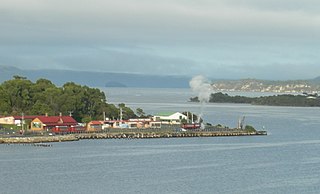
Sullivans Cove is on the River Derwent adjacent to the Hobart City Centre in Tasmania. It was the site of initial European settlement in the area, and the location of the earlier components of the Port of Hobart.
Sullivans Cove is on the River Derwent adjacent to the Hobart City Centre in Tasmania. It was the site of initial European settlement in the area, and the location of the earlier components of the Port of Hobart.
The cove was the initial landing site of what is now the city of Hobart. It was founded on 21 February 1804 by Lieutenant Governor David Collins, who travelled to the shore via what was then a rocky island named Hunter Island. The connection to the shore was developed and is now known as Hunter Street. The island now has a building directly above it.
Although the first European settlement in the state was further up the river at Risdon Cove by John Bowen a year earlier, that settlement was abandoned and relocated to join the Sullivans Cove settlers.
Collins named Sullivans Cove after John Sullivan, Permanent Under Secretary to the Colonies.

By 1916, several piers had been constructed: from north to south: [1]
In 1933, the Argyle Street and Elizabeth Street Piers were replaced with a single concrete-reinforced structure at Elizabeth Street Pier. [5] [8]
In 1947 there was a proposal to replace Queens and Kings Pier with an extra wide pier, but this was never realised. [9]
In 1948, Ocean Pier was destroyed by a fire. [2] [10]
Kings Pier was demolished and replaced with a marina for commercial and private craft, around 1970. [11] This marina increased in size in 2003. [12]
Sullivans Cove holds large historical and sentimental value for the city. The cove area itself is now known as Macquarie Wharf and serves as the main port for the city. Many of the original buildings along the esplanade are still standing.
The University of Tasmania's School of the Arts building is based on Hunter Street.
A serviced apartment building, ZeroDavey, has drawn criticism for its Davey Street facade, being condemned by the local community as aesthetically unpleasing consisting of a grey concrete prefabricated wall with jarring blue metal ledges, as opposed to the rest of the building having a sandstone facade to blend with the heritage Hunter Street buildings next door.

During 2004 there has also been discussions about a proposal for a tourist tram from Sullivans Cove to the CBD, and possibly to North Hobart.
An international design competition was held for the Hobart waterfront in 2006. It attracted 280 entries from over 50 countries. Three winners were announced on January 26, 2007. [13]
With the change in the cove's primary activity from a freight port to tourism and recreational uses, many of the sheds in the area have been either re-purposed or replaced – notably, all buildings keep the former gabled roof architecture. [14] These buildings include:
Additional development in the immediate area include a $100m redevelopment of Parliament Square, behind Parliament House. [19]

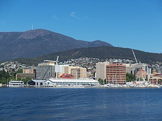
Hobart is the capital and most populous city of the island state of Tasmania, Australia. Home to almost half of all Tasmanians, it is the southernmost and least-populated Australian state capital city, and second-smallest if territories are taken into account, before Darwin, Northern Territory. Hobart is located in Tasmania's south-east on the estuary of the River Derwent, making it the most southern of Australia's capital cities. Its skyline is dominated by the 1,271-metre (4,170 ft) kunanyi/Mount Wellington, and its harbour forms the second-deepest natural port in the world, with much of the city's waterfront consisting of reclaimed land. The metropolitan area is often referred to as Greater Hobart, to differentiate it from the City of Hobart, one of the seven local government areas that cover the city. It has a mild maritime climate.

Davey Street is a major one way street passing through the outskirts of the Hobart City Centre in Tasmania, Australia. Davey street is named after Thomas Davey, the first Governor of Van Diemen's Land. The street forms a one-way couplet with nearby Macquarie Street connecting traffic from the Southern Outlet in the south with traffic from the Tasman Highway to the east and the Brooker Highway to the north of the city. With annual average daily traffic of 37,200, the road is one of the busier streets in Hobart.
Regatta Point is the location of a port and rail terminus on Macquarie Harbour.

TheMercury is a daily newspaper, published in Hobart, Tasmania, Australia, by Davies Brothers Pty Ltd, a subsidiary of News Corp Australia, itself a subsidiary of News Corp. The weekend issues of the paper are called Mercury on Saturday and Sunday Tasmanian. The current editor of TheMercury is Craig Herbert.
The Strahan–Zeehan Railway, also known as the "Government Railway", was a railway from Strahan to Zeehan on the west coast of Tasmania.

Elizabeth Street is the major street which runs southeast to northwest through the city and suburbs of Hobart, Tasmania, Australia.
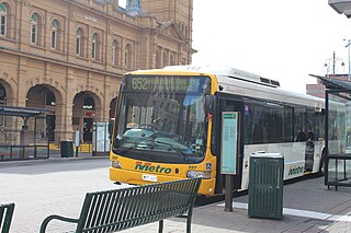
The Hobart Bus Mall is the main urban bus interchange for Metro Tasmania in the Hobart central business district. Situated on Elizabeth Street, it serves daily commuters from suburbs, nearby cities, and towns including Clarence, Glenorchy, Richmond, Cambridge and Kingborough. The interchange spans Elizabeth Street between Macquarie and Collins streets, with additional bus stops at Franklin Square and one on Liverpool Street near the Elizabeth Street Mall's north end. The interchange is within 500 metres (1,600 ft) of connecting coach services on Murray Street, ferry services and airport bus services at Brooke Street Pier.
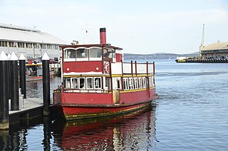
Ferries in Hobart are a form of public transport in the city of Hobart, Tasmania, though they have not provided a major alternative public transport service for commuters and tourists in Hobart and other localities in and around the Derwent River in recent decades.
Hobart City Centre is a suburb surrounded by metropolitan Hobart, which comprises the original settlement, the central business district, and other built-up areas. It is the oldest part of Hobart and includes many of the city's important institutions and landmarks, such as Parliament, the Supreme Court, Franklin Square, the Elizabeth Street Mall, the Royal Hobart Hospital, the Theatre Royal, Odeon Theatre, State Library, the NAB Building, the Museum, and the Cenotaph. The city centre is located in the local government areas of the City of Hobart.

The Hotel Grand Chancellor Hobart is a twelve-storey hotel located on the waterfront of Hobart, Tasmania, Australia.
Francis was a 41 tons (bm) colonial schooner that was partially constructed at the Deptford Dockyard, England, and sent in frame aboard the Pitt to Australia to be put together for the purposes of exploration. The vessel had originally been designed for George Vancouver’s discovery voyage of the west coast of North America.

Kelly's Steps is an architectural landmark in Hobart, Tasmania. The steps, named after early Australian explorer and whaler James Kelly, connect the suburb of Battery Point to Salamanca Place. At the time Kelly constructed the steps in 1839, Battery Point was on a cliff that overlooked wharfs of Sullivans Cove. The steps were cut into the stone of the cliffs. The warehouses that lined the wharfs on what is now Salamanca Place were built with stone quarried from the cliffs. The steps lead up to Kelly Street, Battery Point. At the foot of the steps, Kelly's Lane leads to Salamanca Place.

Franklin Square is a 1.6-acre (0.63-hectare) oak-lined public square located in the Hobart City Centre in Tasmania, Australia. It is named for Sir John Franklin, an Arctic explorer and former Lieutenant-Governor of Van Diemen's Land. The centrepiece of the park is a statue of Franklin, with an epitaph written by Alfred, Lord Tennyson. As the city's most central urban parkland and transportation hub, Franklin Square is frequently utilised for festive markets, public gatherings and as a place for public protest.

Henry Hunter (1832–1892) was a prominent architect and civil servant in Tasmania and Queensland, Australia. He is best known for his work on churches. During his life was also at various times a state magistrate of Tasmania, a member of the Tasmanian State Board of Education, the Hobart Board of Health, a Commissioner for the New Norfolk Insane Asylum and President of the Queensland Institute of Architects.

The Brooke Street Pier is a floating pontoon building at Sullivans Cove in the waterfront area of the city of Hobart, Tasmania, Australia. It was constructed in 2014–15 at a cost of A$13 million. It weighs 5,300 tonnes and was Australia's largest floating building upon completion. It is connected to the Hobart shore at Franklin Wharf, near the base of Brooke Street. Primarily a ferry terminal, the architect has described it as a "tourism transport hub".
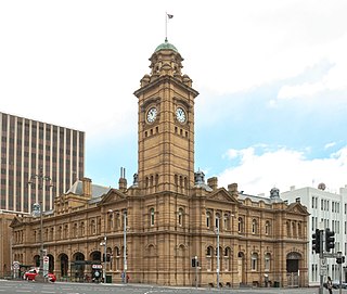
General Post Office is a landmark building located on the corner of Elizabeth Street and Macquarie Street in Hobart, Tasmania, Australia. It stands next to the former Mercury Building and has served as the headquarters of the Tasmanian Postal system since its construction in 1905, though mail processing has now been moved to Glenorchy.

Robert William Morris-Nunn is an Australian architect.

Ingle Hall is a landmark building in Hobart, Tasmania on the corner of Macquarie and Argyle Streets. It has served numerous purposes over its history and is vacant; it was most recently used as The Mercury print museum. It is unknown when the building was built as it predates any government record holding by the state of Tasmania, which began in 1822. It is named for John Ingle, one of the two possible first inhabitants of the building.

Sydney Cove West Archaeological Precinct is a heritage-listed precinct that contains The Rocks police station, the Museum of Contemporary Art Australia, car park, parks, shops and roads located at 112–156 George Street, in the inner city Sydney suburb of The Rocks in the City of Sydney local government area of New South Wales, Australia. The precinct previously contained a commissariat store, Maritime Services Board offices, dockyard and Department of Labour & Industry offices. Buildings in the precinct were developed in various stages since 1797 to date, with heritage-listed buildings dating from 1797 to 1939. The precinct is also known as the Museum of Contemporary Art, Maritime Services Board, Colonial Government naval dockyard, Commissariat Stores, Colonial Hospital, Kings and Queens Wharf and First Fleet Park. The property is owned by Property NSW, an agency of the Government of New South Wales. It was added to the New South Wales State Heritage Register on 5 August 2011.

Princes Wharf is a wharf in the historic port area of Sullivans Cove in Hobart, Tasmania in Australia. The wharf area includes Princes Wharf No 1 Shed that is a multi-purpose community events centre, and has been home to the Taste of Tasmania Festival. The wharf is also the location of the University of Tasmania's Institute for Marine and Antarctic Studies.