Summer Shade, Kentucky

Last updated

Summer Shade, Kentucky
USA Kentucky location map.svg
Red pog.svg
Summer Shade
Usa edcp location map.svg
Red pog.svg
Summer Shade
Coordinates: 36°53′3″N85°42′9″W / 36.88417°N 85.70250°W / 36.88417; -85.70250
Country United States
State Kentucky
County Metcalfe
Area
[1]
  Total2.04 sq mi (5.28 km2)
  Land2.03 sq mi (5.27 km2)
  Water0.01 sq mi (0.01 km2)
Elevation
896 ft (273 m)
Population
 (2020) [2]
  Total294
  Density144.54/sq mi (55.82/km2)
Time zone UTC-6 (Central (CST))
  Summer (DST) UTC-5 (CST)
ZIP code
42166
FIPS code 21-74586
GNIS feature ID504782 [3]

Summer Shade is an unincorporated community and census-designated place (CDP) in Metcalfe County, Kentucky, United States. As of the 2020 census, the population was 294. [2]

Contents

History

Originally the area was known as "Sartain Precinct" and later as "Glover's Creek"; W.M. Riggs, the postmaster, changed the name to Summer Shade in 1872.

Geography

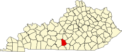
Summer Shade is located in southwestern Metcalfe County. Kentucky Route 90 (KY 90), connecting Glasgow to Burkesville and the Dale Hollow Lake area, runs through Summer Shade. Glasgow is 14 miles (23 km) to the northwest, while Burkesville is 23 miles (37 km) to the southeast. KY 640 leads north from Summer Shade 11 miles (18 km) to Wisdom and 17 miles (27 km) to Knob Lick. KY 163 passes just east of the community, leading north 8 miles (13 km) to Edmonton, the Metcalfe county seat, and south 12 miles (19 km) to Tompkinsville.

According to the U.S. Census Bureau, the Summer Shade CDP has an area of 2.04 square miles (5.3 km2), of which 0.005 square miles (0.013 km2), or 0.25%, are water. [1] The community sits on a ridge that drains to the west and north to Glover Creek and south to Nobob Creek. Both creeks flow west toward Skaggs Creek, a tributary of the Barren River and part of the Green River watershed.

The rural-dominated area is home to the Kingsford Charcoal factory. Located 2 miles (3 km) east of Summer Shade on KY 90 near Beaumont, it identifies itself as a Summer Shade-based business.

Climate

The climate in this area is characterized by hot, humid summers and generally mild to cool winters. According to the Köppen Climate Classification system, Summer Shade has a humid subtropical climate, abbreviated "Cfa" on climate maps. [4]

Demographics

Historical population
CensusPop.Note
2020 294
U.S. Decennial Census [5]

Education

There was one school in Summer Shade that was known as Summer Shade Elementary School. It went from grades K-6. Currently, students go to Metcalfe County Elementary in Edmonton.

Notable people

Related Research Articles

<span class="mw-page-title-main">Metcalfe County, Kentucky</span> County in Kentucky, United States

Metcalfe County is a county located in the U.S. state of Kentucky. Its county seat and only municipality is Edmonton. The county was founded in May 1860 and named for Thomas Metcalfe, Governor of Kentucky from 1828 to 1832. Metcalfe County is part of the Glasgow, KY Micropolitan Statistical Area, which is also included in the Bowling Green-Glasgow, KY Combined Statistical Area.

<span class="mw-page-title-main">Henryville, Indiana</span> Census-designated place in Indiana, United States

Henryville is a census-designated place (CDP) in Monroe Township, Clark County, in the U.S. state of Indiana. The population was 1,905 at the 2010 census.

<span class="mw-page-title-main">Glasgow, Kentucky</span> City in Kentucky, United States

Glasgow is a home rule-class city in Barren County, Kentucky, United States. It is the seat of its county. Glasgow is the principal city of the Glasgow micropolitan area, which comprises Barren and Metcalfe counties. The population was 15,014 at the 2020 U.S. census.

<span class="mw-page-title-main">Burkesville, Kentucky</span> City in Kentucky, United States

Burkesville is a home rule-class city in Cumberland County, Kentucky, in the United States. Nestled among the rolling foothills of Appalachia and bordered by the Cumberland River to the south and east, it is the seat of its county. The population was 1,521 at the 2010 census.

<span class="mw-page-title-main">Greensburg, Kentucky</span> City in Kentucky, United States

Greensburg is a home rule-class city in and the county seat of Green County, Kentucky, United States. The population was 2,163 at the 2010 census, down from 2,396 at the 2000 census.

<span class="mw-page-title-main">Wallins Creek, Kentucky</span> Census-designated place in Kentucky, United States

Wallins Creek is an unincorporated community and census-designated place (CDP) in Harlan County, Kentucky, United States. The population was 156 at the 2010 census, when it was still a city, having dropped from 257 at the 2000 census.

<span class="mw-page-title-main">Cynthiana, Kentucky</span> City in Kentucky, United States

Cynthiana is a home rule-class city in Harrison County, Kentucky, in the United States. The population was 6,402 at the 2010 census. It is the seat of its county.

<span class="mw-page-title-main">Vanceburg, Kentucky</span> City in Kentucky, United States

Vanceburg is a home rule-class city in Lewis County, Kentucky, United States, along the Ohio River. The population was 1,428 at the 2020 census. It is the county seat of Lewis County.

<span class="mw-page-title-main">Pine Knot, Kentucky</span> Census-designated place in Kentucky, United States

Pine Knot is an unincorporated community and census-designated place (CDP) in McCreary County, Kentucky, United States. The population was 1,380 at the 2020 census, down from 1,621 in 2010.

<span class="mw-page-title-main">Stearns, Kentucky</span> Census-designated place in Kentucky, United States

Stearns is an unincorporated community and census-designated place (CDP) in McCreary County, Kentucky, United States. The population was 1,365 at the 2020 census. It was founded by Justus Smith Stearns.

<span class="mw-page-title-main">Edmonton, Kentucky</span> City in Kentucky, United States

Edmonton is a home rule-class city in and the county seat of Metcalfe County, Kentucky, United States. It is part of the Glasgow Micropolitan Statistical Area. The population was 1,671 at the 2020 census.

<span class="mw-page-title-main">Linn, Texas</span> Census-designated place in Texas

Linn, formerly San Manuel-Linn, is an unincorporated community and census-designated place (CDP) in Hidalgo County, Texas, United States. The population was 801 at the 2010 census, down from 958 at the 2000 census. It is part of the McAllen–Edinburg–Mission Metropolitan Statistical Area.

Leola is a census-designated place (CDP) in Lancaster County, Pennsylvania, United States. It includes the unincorporated communities of Leola, Leacock, and Bareville, and prior to 2010 was known as the Leacock-Leola-Bareville census-designated place. Originally named "Mechanicsburg", its present name is a portmanteau of "Leacock" and the "Glenola" train station that once served the town. As of the 2010 census, the population of the CDP was 7,214.

<span class="mw-page-title-main">Oneida, Kentucky</span> Unincorporated community in Kentucky, United States

Oneida is an unincorporated community and census-designated place (CDP) in Clay County, Kentucky, United States. Its population was 238 at the 2020 census. It is the home of Oneida Baptist Institute. Goose Creek, the Red Bird River, and Bullskin Creek confluence to form the South Fork of the Kentucky River a few hundred yards from the center of the town.

<span class="mw-page-title-main">Kentucky Route 90</span> State highway in Kentucky, USA

Kentucky Route 90 is a major east–west state highway in southern Kentucky. The route is 134.734 miles (216.833 km) long, and it traverses Barren, Metcalfe, Cumberland, Clinton, Wayne, Pulaski, McCreary and Whitley Counties in southern Kentucky. It runs from the KY 70 junction near Interstate 65 in Cave City to US 25W about 8 miles (13 km) from Interstate 75.

<span class="mw-page-title-main">Deputy, Indiana</span> Census-designated place in Indiana, United States

Deputy is an unincorporated community and census-designated place (CDP) in Graham Township, Jefferson County, Indiana, United States. By road it is approximately 18 miles (29 km) northwest of Madison, the county seat. As of the 2010 census it had a population of 86.

Artemus is an unincorporated community and census-designated place in Knox County, Kentucky, United States. As of the 2010 United States Census the population was 590.

Dunmor is an unincorporated community and census-designated place (CDP) in Muhlenberg and Logan counties, Kentucky, United States. As of the 2020 census it had a population of 322.

<span class="mw-page-title-main">Wisdom, Kentucky</span> Unincorporated community in Kentucky, United States

Wisdom is an unincorporated community located in Metcalfe County, Kentucky, United States. It was also known as Nicols and Old Randolph.

The Roller Coaster Yard Sale, sometimes referred to as the Roller Coaster Fair, is an outdoor second-hand sale held annually for three days beginning the first Thursday in October. It takes place along several U.S. and state routes in southern Kentucky and northern middle Tennessee.

References

  1. 1 2 "2022 U.S. Gazetteer Files: Kentucky". United States Census Bureau. Retrieved May 18, 2023.
  2. 1 2 "P1. Race – Summer Shade CDP, Kentucky: 2020 DEC Redistricting Data (PL 94-171)". U.S. Census Bureau. Retrieved May 18, 2023.
  3. U.S. Geological Survey Geographic Names Information System: Summer Shade, Kentucky
  4. Climate Summary for Summer Shade, Kentucky
  5. "Census of Population and Housing". Census.gov. Retrieved June 4, 2016.