
The Ontario Northland Railway is a Canadian railway operated by the Ontario Northland Transportation Commission, a provincial Crown agency of the government of Ontario.
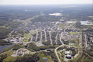
Kirkland Lake is a town and municipality in Timiskaming District of Northeastern Ontario. The 2016 population, according to Statistics Canada, was 7,981.

Timiskaming is a district and census division in Northeastern Ontario in the Canadian province of Ontario. The district was created in 1912 from parts of Algoma, Nipissing, and Sudbury districts. In 1921, Cochrane District was created from parts of this district and parts of Thunder Bay District.

Cochrane is a town in northeastern Ontario, Canada. It is located east of Kapuskasing, northeast of Timmins, south of Moosonee, and north of Iroquois Falls. It is about a one-hour drive from Timmins, the major city of the region. It is the seat of Cochrane District. The town's population is made up of about half anglophone and half francophone residents.

Cobalt is a town in Timiskaming District, Ontario, Canada. It had a population of 1,118 at the 2016 Census. The population is now closer to 943.
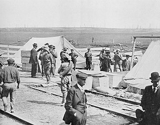
The great Matheson Fire was a deadly forest fire that passed through the region surrounding the communities of Black River-Matheson and Iroquois Falls, Ontario, Canada, on July 29, 1916.
The Nipissing Central Railway (NCR), sometimes known as the Temiskaming Streetcar Line, is a former interurban streetcar system connecting New Liskeard, Haileybury and Cobalt on the western bank of Lake Temiskaming in northern Ontario from 1910 to 1935. As the line had a federal charter, the operating company continues to be used to operate the Ontario Northland Railway freight spur line between Swastika, Ontario and Rouyn-Noranda, Quebec, avoiding the need to re-charter either end in its respective provinces.

Englehart is a town in the Canadian province of Ontario, located on the Blanche River in the Timiskaming District.

Temagami, formerly spelled Timagami, is a municipality in northeastern Ontario, Canada, in the Nipissing District with Lake Temagami at its heart.

The Porcupine Gold Rush was a gold rush that took place in Northern Ontario starting in 1909 and developing fully by 1911. A combination of the hard rock of the Canadian Shield and the rapid capitalization of mining meant that smaller companies and single-man operations could not effectively mine the area, as opposed to earlier rushes where the gold could be extracted through placer mining techniques. Although a number of prospectors made their fortune, operations in the area are marked largely by the development of larger mining companies, and most people involved in the mining operations were their employees.

Chamberlain is a township in the Canadian province of Ontario, located within the Timiskaming District.
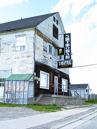
Val Gagné is an unincorporated rural community in the township of Black River-Matheson, Cochrane District, Ontario, Canada. It is located 1.5 km (0.93 mi) east of Highway 11, between Matheson and Iroquois Falls. For many years the community was accessible by train. The Ontario Northland Railway's Northlander from Toronto to Cochrane, which passed through Val Gagné, made its final passenger run in 2012. An Ontario Northland bus now stops at Val Gagné.

The Northlander was a passenger train operated by the provincially-owned Ontario Northland Railway in southwest and northeast Ontario, Canada. In 2012, rail service was discontinued and replaced with express bus service. Rail service will be reinstated in 2026 with an expanded route, greater frequency, new Siemens Venture train sets manufactured by Siemens Mobility Ltd., and various track and station upgrades. The new bi-directional route will run up to seven days a week from Toronto Union Station to Timmins, with an additional new rail connection from Timmins to Cochrane and express bus service from Matheson to Cochrane Station.

The Ontario Northland Transportation Commission (ONTC), or simply Ontario Northland, is a Crown agency of the Government of Ontario responsible for providing transportation services for passengers and goods in Northern Ontario. It reports to the Legislative Assembly of Ontario through the Minister of Transportation.

Ontario Northland Motor Coach Services is an intercity bus service operated by the Ontario Northland Transportation Commission, a Crown agency of the government of Ontario, Canada. Ontario Northland Motor Coach Services operates passenger and parcel transportation service in northern Ontario, with additional routes connecting northern Ontario to the Greater Toronto Area, Winnipeg, and Ottawa.
The Cobalt silver rush was a silver rush in Ontario, Canada that began in 1903 when huge veins of silver were discovered by workers on the Temiskaming and Northern Ontario Railway (T&NO) near the Mile 103 post. By 1905 a full-scale silver rush was underway, and the town of Cobalt, Ontario sprang up to serve as its hub. By 1908 Cobalt produced 9% of the world's silver, and in 1911 produced 31,507,791 ounces of silver. However, the good ore ran out fairly rapidly, and most of the mines were closed by the 1930s. There were several small revivals over the years, notably in World War II and again in the 1950s, but both petered out and today there is no active mining in the area. In total, the Cobalt area mines produced 460 million ounces of silver.
South River Railway Station is located in the community of South River in Ontario. The station was originally constructed by the Northern and Pacific Junction Railway, a subsidiary of the Northern and Northwestern Railway, in 1884. It was subsequently owned and operated by the Grand Trunk Railway and Canadian National Railways. It was a significant station stop along the historic route connecting Toronto to North Bay, and the Canadian Pacific Railway (1885). Transcontinental trains traveling between Toronto and Vancouver once frequented the station. It is likely the oldest wooden railway station in north-eastern Ontario. It is now a community heritage building in the town of South River.
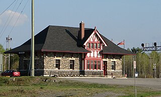
Temagami station is a railway station in Temagami, Ontario, Canada.
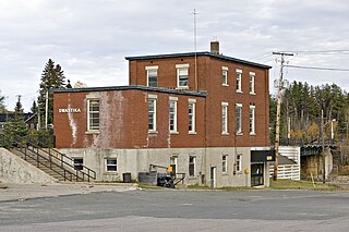
Swastika station is located in the community of Swastika, Ontario, Canada. It was established in 1908, along the Temiskaming and Northern Ontario Railway which is now the Ontario Northland Railway line.
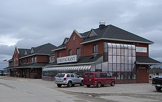
Cochrane Station is an inter-city railway and bus station located in the town of Cochrane, Ontario Canada operated by the Ontario Northland Railway (ONR). It is the southern terminus of the Polar Bear Express service to Moosonee and former northern terminus of the discontinued Northlander route. The station is located in downtown Cochrane, south of the intersection of Railway Street and 7th Avenue. Its main entrance faces north to Railway Street. South of the station building, trains call at a low level platform adjacent to the ONR Island Falls Subdivision.


