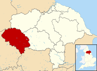
Craven was a non-metropolitan district in the west of North Yorkshire, centred on the market town of Skipton.

Barnoldswick is a market town and civil parish in the Borough of Pendle, in the administrative county of Lancashire, England. It is within the boundaries of the historic West Riding of Yorkshire. Barnoldswick and the surrounding areas of West Craven have been administered since 1974 as part of the modern administrative county of Lancashire. This was when West Riding County Council and Barnoldswick Urban District Council were abolished and the town was transferred to the Borough of Pendle.

The Borough of Harrogate was a local government district with borough status in North Yorkshire, England, from 1974 to 2023. Its council was based in the town of Harrogate, but it also included surrounding settlements, including the cathedral city of Ripon, and almost all of the Nidderdale Area of Outstanding Natural Beauty. At the 2011 Census, the borough had a population of 157,869.
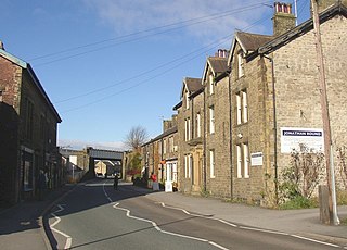
Hellifield is a village and civil parish in the Craven district of North Yorkshire, England. Historically part of the West Riding of Yorkshire, the village was once an important railway junction on the Settle-Carlisle Railway between the Midland Railway and the Lancashire and Yorkshire Railway, but Hellifield railway station is now a shadow of its former glory. It is situated on the A65, between Skipton and Settle. Hellifield had a population of 1,060 residents at the 2001 census, increasing to 1,426 at the 2011 census.

Hetton is a small Dales village in the civil parish of Hetton-cum-Bordley, in the North Yorkshire district of North Yorkshire, England, situated 5.75 miles north of Skipton by the B6265 road. It is the largest settlement in the parish of Hetton-cum-Bordley. The population of the former civil parish of Hetton taken at the 2011 Census was 155.
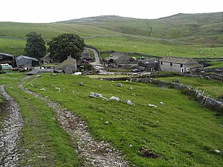
Bordley is a village in the civil parish of Hetton-cum-Bordley, in North Yorkshire, England, within the Yorkshire Dales National Park and 12 miles (19 km) north of Skipton. According to the 2001 census the parish had a population of 23.

Nappa is a hamlet in the civil parish of Hellifield, in North Yorkshire, England. It is on the A682 road and 6 miles (9.7 km) north-west of Barnoldswick and 10.5 miles (17 km) west of Skipton. The population was estimated at 10 in 2010.

Otterburn is a village and civil parish in the Craven district of North Yorkshire, England. It is at OS Grid Reference SD8857, near Airton, Calton and the A65. The village is 9 miles (14 km) north west of Skipton and 1.9 miles (3 km) east of Hellifield.

Gisburn is a village and civil parish within the Ribble Valley borough of Lancashire, England. Historically within the West Riding of Yorkshire, it lies 8 miles (13 km) northeast of Clitheroe and 11 miles (18 km) west of Skipton. The civil parish had a population of 506, recorded in the 2001 census, increasing to 521 at the 2011 Census.

Tosside is a small village on the modern border of North Yorkshire and Lancashire in Northern England. It lies within the Forest of Bowland, and is between the villages of Slaidburn in Lancashire and Wigglesworth in North Yorkshire. It lies 11.5 miles north of Clitheroe and 17 miles north-west of Skipton. The village is 870 feet (270 m) above sea level and lies at 54.0001°N / 2.35436°W on the B6478 road.

Newsholme is a small village and civil parish in the Ribble Valley, Lancashire, England, but lies within the historic West Riding of Yorkshire. According to the 2001 census, the parish had a population of 50, however the United Kingdom Census 2011 grouped the parish with Horton and Paythorne, giving a total of 253. Today it lies near the boundary with North Yorkshire on the A682, 4 miles (6 km) north of Barnoldswick and 12 miles (19 km) west of Skipton.

Rimington is a rural village and civil parish in the Ribble Valley, Lancashire, England. The population of the civil parish was 382 at the 2001 Census, however at the 2011 Census Middop was included with Rimington giving a total of 480. It is east of Clitheroe and south of the A59 road. The village consists of the hamlets of Howgill, Martin Top, Newby, and Stopper Lane, and is in the historic West Riding of Yorkshire.

Sawley is a village and civil parish in the Borough of Ribble Valley in Lancashire, England. The population of the civil parish was 305 at the 2001 Census, rising to 345 at the 2011 census. It is situated north-east of Clitheroe, on the River Ribble. It was historically part of the West Riding of Yorkshire.

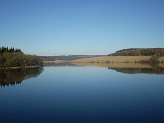
Paythorne is a small village and civil parish in Ribble Valley, Lancashire, England. It is situated alongside the River Ribble, north-east of Clitheroe, and on the boundary with North Yorkshire. Other parishes adjacent to Paythorne are Halton West, Nappa, Newsholme, Horton, Gisburn, Sawley, Bolton-by-Bowland and Gisburn Forest. The nearest town is Barnoldswick, situated 7 kilometres (4.3 mi) south-east of the village. Paythorne is on the edge of the Forest of Bowland Area of Outstanding Natural Beauty, although only a small area in the west of the parish is within the area's boundary. The Ribble Way long-distance walk passes through the village.

Malham Moor is a civil parish in the Craven district of North Yorkshire, England. Its population was estimated at 70 in 2015.

Horton, historically known as Horton-in-Craven, is a village and a civil parish in the Ribble Valley district of the English county of Lancashire. Population details are now included in the civil parish of Newsholme. It is near the town of Barnoldswick. Horton has a place of worship, anciently called a chapelry or chapel of ease. For transport, there is the A59 nearby.
Easington is a civil parish within the Ribble Valley district of Lancashire, England, with a population in 2001 of 52. The Census 2011 population details have been grouped with the parish of Slaidburn. Before 1974, it formed part of Bowland Rural District in the West Riding of Yorkshire. It covers just over 9000 acres.

Gisburn Forest is a civil parish in the Ribble Valley, in Lancashire, England. Mainly lying within the Forest of Bowland Area of Outstanding Natural Beauty, the parish includes the larger part of the village of Tosside and the hamlet of Grunsagill to the south. Historically, the parish lay within the West Riding of Yorkshire. It had a population of 151 at the 2011 Census.

Middop is a rural hamlet and civil parish in Lancashire, England. It is in Ribble Valley district. Middop is near the villages of Rimington and Gisburn and approximately 8 miles (13 km) north-east of its post town, Clitheroe. In the 2001 United Kingdom census, Middop had a population of 43. Owing to the limited population from the 2011 Census details are included in the parish of Rimington.

Flasby is a hamlet in the Yorkshire Dales in North Yorkshire, England. It is one of the two settlements, with Winterburn, in the civil parish of Flasby with Winterburn, part of the Craven district. The population of the civil parish was estimated at 80 in 2012, measured at 207 in the 2011 Census.

