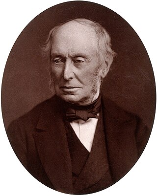
William George Armstrong, 1st Baron Armstrong, was an English engineer and industrialist who founded the Armstrong Whitworth manufacturing concern on Tyneside. He was also an eminent scientist, inventor and philanthropist. In collaboration with the architect Richard Norman Shaw, he built Cragside in Northumberland, the first house in the world to be lit by hydroelectricity. He is regarded as the inventor of modern artillery.

Newcastle upon Tyne, or simply Newcastle, is a city and metropolitan borough in Tyne and Wear, England. The city is located on the River Tyne's northern bank and forms the largest part of the Tyneside built-up area. Newcastle is also the most populous city of North East England. Newcastle developed around a Roman settlement called Pons Aelius and the settlement later took the name of a castle built in 1080 by William the Conqueror's eldest son, Robert Curthose.

The Tyne Bridge is a through arch bridge over the River Tyne in North East England, linking Newcastle upon Tyne and Gateshead. The bridge was designed by the engineering firm Mott, Hay and Anderson, who later designed the Forth Road Bridge, and was built by Dorman Long and Co. of Middlesbrough. The bridge was officially opened on 10 October 1928 by King George V and has since become a defining symbol of Tyneside. It is ranked as the tenth tallest structure in Newcastle.
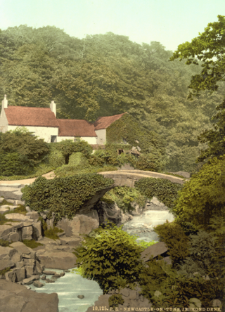
Jesmond Dene, a public park in the east end of Newcastle upon Tyne, England, occupies the narrow steep-sided valley of a small river known as the Ouseburn, flowing south to join the River Tyne: in north-east England, such valleys are commonly known as denes: the name 'Jesmond' meaning 'mouth of the Ouseburn'.

The High Level Bridge is a road and railway bridge spanning the River Tyne between Newcastle upon Tyne and Gateshead in North East England. It is considered the most notable historical engineering work in the city. It was built by the Hawks family from 5,050 tons of iron. George Hawks, Mayor of Gateshead, drove in the last key of the structure on 7 June 1849, and the bridge was officially opened by Queen Victoria later that year.

Newcastle Central Station is a major railway station in Newcastle upon Tyne. It is located on the East Coast Main Line, around 268 miles (432 km) north of London King's Cross. It is the primary national rail station serving Newcastle upon Tyne, with local rail services provided by the Tyne and Wear Metro network to which the station is connected to by Central Station Metro station, situated beneath the national rail station.

The Barton Swing Aqueduct is a moveable navigable aqueduct in Barton upon Irwell, Greater Manchester, England. It carries the Bridgewater Canal across the Manchester Ship Canal. The swinging action allows large vessels using the ship canal to pass through and smaller craft, both narrowboats and broad-beam barges, to cross over the top. The aqueduct, the first and only swing aqueduct in the world, is a Grade II* listed building, and considered a major feat of Victorian civil engineering. Designed by Sir Edward Leader Williams and built by Andrew Handyside and Company of Derby, the swing bridge opened in 1894 and remains in regular use.

The history of Newcastle upon Tyne dates back almost 2,000 years, during which it has been controlled by the Romans, the Angles and the Norsemen amongst others. Originally known by its Roman name Pons Aelius, the name "Newcastle" has been used since the Norman conquest of England. Due to its prime location on the River Tyne, the town developed greatly during the Middle Ages and it was to play a major role in the Industrial Revolution, being granted city status in 1882. Today, the city is a major retail, commercial and cultural centre.

Elswick is a district and electoral ward of the city and metropolitan borough of Newcastle upon Tyne, England, 1.9 miles west of the city centre, bordering the River Tyne. Historically in Northumberland, Elswick became part of Newcastle upon Tyne in 1835. Elswick is home to the Newcastle Utilita Arena; and Newcastle College, with approximately 45,000 students.

The Quayside is an area along the banks (quay) of the River Tyne in Newcastle upon Tyne and Gateshead in Tyne and Wear, North East England, United Kingdom.

Hebburn is a town in the metropolitan county of Tyne and Wear, England. It governed under the borough of South Tyneside; formerly governed under the county of Durham until 1974 with its own urban district from 1894 until 1974. It is on the south bank of the River Tyne between Gateshead and Jarrow and opposite Wallsend and Walker.
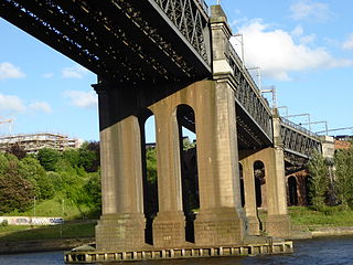
The King Edward VII Bridge is a railway bridge spanning the River Tyne between Newcastle upon Tyne and Gateshead, in North East England. It is a Grade II listed structure. The King Edward VII bridge has been described as “Britain’s last great railway bridge”.
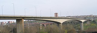
The Redheugh Bridge is a road bridge spanning the River Tyne west of Newcastle upon Tyne city centre on the north bank and Gateshead town centre on the south bank, in North East England. It currently carries the A189 road.
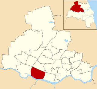
Benwell and Scotswood is an electoral ward of Newcastle upon Tyne in North East England. The ward encompasses the Benwell and Scotswood housing areas, as well as the Newcastle Business Park, which is located on the banks of the River Tyne and houses offices of companies such as British Airways and the Automobile Association. The population of the ward is 13,759, which is 5.3% of the total population of Newcastle upon Tyne. Car ownership in the area is 45.1%, lower than the city average of 54.7%. The 2011 Census gave a population of 12,694.

Cross Keys Bridge is a swing bridge that carries the busy single carriageway A17 road which runs from Newark in Nottinghamshire to King’s Lynn in Norfolk over the tidal River Nene in Sutton Bridge in the extreme south east of Lincolnshire close to the borders of both Norfolk and Cambridgeshire.

Wylam Railway Bridge is a footbridge and former railway bridge crossing the River Tyne at Hagg Bank, approximately 1⁄2 mile (0.8 km) west of Wylam in Northumberland, England.

Newcastle Civic Centre is a local government building located in the Haymarket area of Newcastle upon Tyne, England. It is the main administrative and ceremonial centre for Newcastle City Council. Designed by the city architect, George Kenyon, the building was completed in 1967 and was formally opened by King Olav V of Norway on 14 November 1968. The building enjoys Grade II* listed building status and is the joint-eighth tallest building in the city, standing at a total of 200 feet (61 m).

The Stella power stations were a pair of now-demolished coal-fired power stations in the North East of England that were a landmark in the Tyne valley for over 40 years. The stations stood on either side of a bend of the River Tyne: Stella South power station, the larger, near Blaydon in Gateshead, and Stella North power station near Lemington in Newcastle. Their name originated from the nearby Stella Hall, a manor house close to Stella South that by the time of their construction had been demolished and replaced by a housing estate. They operated from shortly after the nationalisation of the British electrical supply industry until two years after the Electricity Act of 1989, when the industry passed into the private sector.

The Tyne Valley Line is a 58-mile (93 km) route, linking Newcastle upon Tyne with Hexham and Carlisle, England. The line follows the course of the River Tyne through Tyne and Wear and Northumberland. Five stations and two viaducts on the route are listed structures.
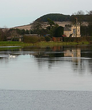
The Newcastle and Gateshead Water Company supplied drinking water to the towns of Newcastle upon Tyne and Gateshead, in the north east of England, from 1845 until 1974. It was initially called the Whittle Dean Water Company, but changed its name in 1863, and gradually increased the area which it supplied. It became part of the Northumbrian Water Authority in 1974 when the UK water companies were nationalized.


