
Belize City is the largest city in Belize and was once the capital of the former British Honduras. According to the 2010 census, Belize City has a population of 57,169 people in 16,162 households. It is at the mouth of the Haulover Creek, which is a distributary of the Belize River. The Belize River empties into the Caribbean Sea eight kilometres from Belize City on the Philip Goldson Highway on the coast of the Caribbean. The city is the country's principal port and its financial and industrial hub. Cruise ships drop anchor outside the port and are tendered by local citizens. The city was almost entirely destroyed in October 1961 when Hurricane Hattie swept ashore. It was the capital of British Honduras until the government was moved to the new capital of Belmopan in 1970.
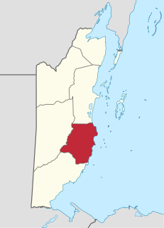
Stann Creek District is a district in the south east region of Belize. According to the 2010 census, the district had a population of 32,166 people. Its capital is the town of Dangriga, formerly known as "Stann Creek Town." Stann comes from "stanns," or safe havens used by colonialists coming from the "old world" to the "new world."

Hurricane Mitch is the second-deadliest Atlantic hurricane on record, causing over 11,000 fatalities in Central America in 1998, including approximately 7,000 in Honduras and 3,800 in Nicaragua due to cataclysmic flooding from the slow motion of the storm. It was the deadliest hurricane in Central American history, surpassing Hurricane Fifi–Orlene, which killed slightly fewer people there in 1974.

A swing bridge is a movable bridge that has as its primary structural support a vertical locating pin and support ring, usually at or near to its center of gravity, about which the turning span can then pivot horizontally as shown in the animated illustration to the right. Small swing bridges as found over canals may be pivoted only at one end, opening as would a gate, but require substantial underground structure to support the pivot.

Hurricane Keith was an Atlantic hurricane in October 2000 that caused extensive damage in Central America, especially in Mexico and Belize. It was the fifteenth tropical cyclone, eleventh named storm, and seventh hurricane of the 2000 Atlantic hurricane season. Keith developed as a tropical depression from a tropical wave in the western Caribbean Sea on September 28. The depression gradually strengthened, and became Tropical Storm Keith on the following day. As the storm tracked westward, it continued to intensify and was upgraded to a hurricane on September 30. Shortly thereafter, Keith began to rapidly deepen, and peaked as a Category 4 hurricane less than 24 hours later. Keith then began to meander erratically offshore of Belize, which significantly weakened the storm due to land interaction. By late on October 2, Keith made landfall in Ambergris Caye and Caye Caulker, Belize as a minimal hurricane. It quickly weakened to a tropical storm, before another landfall occurred near Belize City early on the following day. While moving inland over the Yucatán Peninsula, Keith weakened further, and was downgraded to a tropical depression before emerging into the Gulf of Mexico on October 4. Once in the Gulf of Mexico, Keith began to re-strengthen and was upgraded to a tropical storm later that day, and a hurricane on the following day. By late on October 5, Keith made its third and final landfall near Tampico, Tamaulipas, Mexico as a moderately strong Category 1 hurricane. The storm quickly weakened inland and dissipated as a tropical cyclone by 24 hours after landfall.

Hurricane Iris was a small, but powerful Category 4 hurricane that caused widespread destruction in Belize. Iris was the second-strongest storm of the 2001 Atlantic hurricane season, behind Hurricane Michelle. It was the ninth named storm, fifth hurricane, and third major hurricane of the year, forming from a tropical wave on October 4 just southeast of Barbados. It moved westward through the Caribbean, intensifying into a tropical storm on October 5 south of Puerto Rico, and into a hurricane on the following day. While passing south of the Dominican Republic, Iris dropped heavy rainfall that caused landslides, killing eight people. Later, the hurricane passed south of Jamaica, where it destroyed two houses. On reaching the western Caribbean Sea, Iris rapidly intensified into a Category 4 on the Saffir–Simpson scale. A small hurricane with an eye of only 7 mi (11 km) in diameter, Iris reached peak winds of 145 mph (230 km/h) before making landfall in southern Belize near Monkey River Town on October 9. The hurricane quickly dissipated over Central America, although its remnants contributed to the formation of Tropical Storm Manuel in the eastern Pacific Ocean. The hurricane caused severe damage—destroying homes, flooding streets, and leveling trees—in coastal towns south of Belize City.

Hurricane Hattie was one of the strongest and deadliest tropical cyclones of the 1961 Atlantic hurricane season, reaching a peak intensity as a Category 5 hurricane. The ninth tropical storm, seventh hurricane, fifth major hurricane, and second Category 5 of the season, Hattie originated from an area of low pressure that strengthened into a tropical storm over the southwestern Caribbean Sea on October 27. Moving generally northward, the storm quickly became a hurricane and later major hurricane the following day. Hattie then turned westward west of Jamaica and strengthened into a Category 5 hurricane, with maximum sustained winds of 165 mph (270 km/h). It weakened to Category 4 before making landfall south of Belize City on October 31. The storm turned southwestward and weakened rapidly over the mountainous terrain of Central America, dissipating on November 1.

Hurricane Francelia was the deadliest hurricane of the 1969 Atlantic hurricane season after causing significant flooding to Central America, especially Belize and Guatemala. The sixth named storm and fourth hurricane of the season, Francelia developed from a tropical wave in the southeastern Caribbean Sea on August 29. It moved west-northwestward and strengthened into a tropical storm on the following day. On September 1, Francelia reached hurricane status, shortly before re-curving west-southwest. While approaching Central America, the storm intensified and peaked as a 115 mph (185 km/h) Category 3 hurricane on September 2. Francelia weakened slightly before making landfall near Punta Gorda, Belize late on September 3. The storm quickly weakened inland and dissipated by the following day.

Caye Caulker is a small limestone coral island off the coast of Belize in the Caribbean Sea measuring about 5 miles (8.0 km) by less than 1 mile (1.6 km). The town on the island is known by the name Caye Caulker Village. The population of Caye Caulker is approximately 2,000 people today and still growing.

The Spuyten Duyvil Bridge is a railroad swing bridge that spans the Spuyten Duyvil Creek between Manhattan and the Bronx, in New York City. The bridge is located at the northern tip of Manhattan where the Spuyten Duyvil Creek meets the Hudson River, approximately 1,000 feet (300 m) to the west of the Henry Hudson Bridge.

Albert is an electoral constituency in the Belize District of Belize.
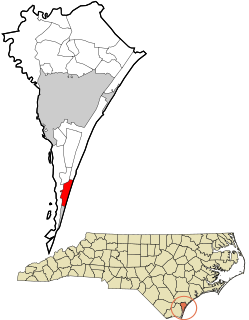
Pleasure Island is a coastal barrier island in Southeastern North Carolina, USA just south of the City of Wilmington. Pleasure Island is located within Federal Point Township, in New Hanover County. The coastal resort towns of Carolina Beach and Kure Beach, as well as the annexed communities of Wilmington Beach and Hanby Beach are located on the island. The southern end of Pleasure Island was separated from Bald Head Island by Corncake Inlet until the inlet was shoaled and closed in 1998 by Hurricane Bonnie; thus Pleasure Island and Bald Head Island are no longer separate islands.

The Matanzas Pass Bridge is a bridge located in Fort Myers Beach, Florida. It carries State Road 865 between the Florida mainland and Estero Island, which is a major tourist destination. The bridge is one of the island's two connections to the mainland. The other is the Bonita Beach Causeway on the south end of the island.
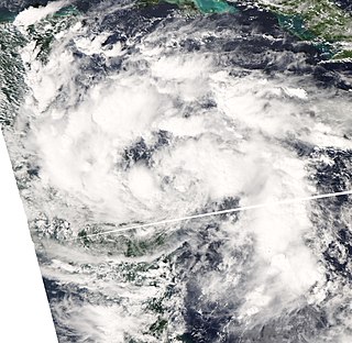
The October 2008 Central America floods were caused by a series of low-pressure areas including Tropical Depression Sixteen, a short-lived tropical cyclone in the 2008 Atlantic hurricane season that made landfall in Honduras. Heavy rainfall began in early October 2008 while a tropical wave passed through the region. On October 14, Tropical Depression Sixteen formed just off the northeast coast of Honduras, and at the same time a low-pressure system was on the Pacific coast. Both systems increased rainfall across the region, although the depression dropped heavy rainfall close to its center when it moved ashore on October 15. Although Tropical Depression Sixteen quickly dissipated over land, its remnants persisted for several days. Another low-pressure area interacted with a cold front on October 21, adding to the rainfall in the region.
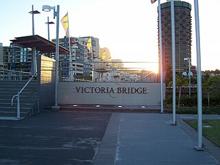
Victoria Bridge is a heritage-listed swing bridge over the Ross Creek at Stokes Street, Townsville CBD, City of Townsville, Queensland, Australia. The central-pivoting swing bridge was constructed by G. H. Royce & Co. in 1888 to 1889. It is one of only two of its type constructed in Australia.

Barton Road Swing Bridge is a swing bridge for road traffic in Greater Manchester that crosses the Manchester Ship Canal between Trafford Park in the Metropolitan Borough of Trafford to Barton-upon-Irwell in the City of Salford. The bridge is a Grade II listed building, and is part of a surrounding conservation area. It runs parallel to the Barton Swing Aqueduct which carries the Bridgewater Canal. The bridge opens regularly for traffic along the Manchester Ship Canal, which can cause delays for road traffic.

The Illinois Central Missouri River Bridge, also known as the IC Bridge or the East Omaha Bridge, is a rail through truss double swing bridge across the Missouri River connecting Council Bluffs, Iowa, with Omaha, Nebraska. It is owned by the Canadian National Railway and is closed to all traffic. At 521 feet long, the second version of the bridge was the longest swing bridge in the world from when it was completed in 1903 through 1915. In 1975 it was regarded as the third longest swing bridge.

The Chamberlain Bridge is a bridge in Bridgetown, the capital and largest city of the nation of Barbados. In 1872, it was a swing bridge across the marine inlet channel of the inner basin of the Careenage at Carlisle Bay. The outmoded steel structure was dismantled and rebuilt in 2005–2006 as a lifting bridge with the state-of the-art modern technology of an all-composite single-leaf bascule design. This design is a counterweighted bridge span that pivots upward, permitting pleasure craft to pass through an inlet channel. The bridge was built using fibre-reinforced plastic (FRP), which is lighter, long lasting and non-corrosive.
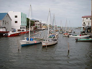
Haulover Creek is a coastal stream that runs through the center of Belize City and discharges into the Caribbean Sea. It is known for being the inlet of the Belize River, and separating the northern and southern areas of Belize City. There are multiple bridges built across it such as the Swing Bridge (Belize), which is the oldest of its kind in Central America, and the Belcan Bridge, which is used as the finishing line for the annual La Ruta Maya river challenge.

Belize, formerly known as British Honduras, is a Caribbean country located on the northeastern coast of Central America. Belize is bordered on the northwest by Mexico, on the east by the Caribbean Sea, and on the south and west by Guatemala. It has an area of 22,970 square kilometres (8,867 sq mi) and a population of 408,487 (2019). Its mainland is about 290 km (180 mi) long and 110 km (68 mi) wide. It has the lowest population and population density in Central America.

