Sykeston, North Dakota

Last updated

Sykeston, North Dakota
Kubis barbershop sykeston north dakota.jpg
Kubis Barbershop in Sykeston
ND Wells County Sykeston.svg
Location of Sykeston, North Dakota
Coordinates: 47°27′58″N99°23′58″W / 47.46611°N 99.39944°W / 47.46611; -99.39944
CountryUnited States
State North Dakota
County Wells
Founded1883
Area
[1]
  Total0.40 sq mi (1.02 km2)
  Land0.40 sq mi (1.02 km2)
  Water0.00 sq mi (0.00 km2)
Elevation
[2]
1,634 ft (498 m)
Population
 (2020)
  Total105
  Density265.82/sq mi (102.54/km2)
Time zone UTC-6 (CST)
  Summer (DST) UTC-5 (CDT)
ZIP code
58486
Area code 701
FIPS code 38-77660
GNIS feature ID1036291 [2]

Sykeston is a city in Wells County, North Dakota, United States. The population was 105 at the 2020 census. [3]

Contents

Sykeston was founded in 1883 by Richard Sykes, a prominent landowner and founder of several other cities in the state. [4] The city was the county seat of Wells County from 1884 to 1894, when Fessenden took over that role. [5]

As of 2010, the center of population of North Dakota was located approximately 9 miles (14 km) southeast of Sykeston. [6]

Geography

According to the United States Census Bureau, the city has a total area of 0.38 square miles (0.98 km2), all land. [7]

Demographics

Historical population
CensusPop.Note
1910 276
1920 36733.0%
1930 327−10.9%
1940 273−16.5%
1950 272−0.4%
1960 236−13.2%
1970 232−1.7%
1980 193−16.8%
1990 167−13.5%
2000 153−8.4%
2010 117−23.5%
2020 105−10.3%
2021 (est.)99 [8] −5.7%
U.S. Decennial Census [9]
2020 Census [3]

2010 census

As of the census of 2010, there were 117 people, 65 households, and 36 families residing in the city. The population density was 307.9 inhabitants per square mile (118.9/km2). There were 85 housing units at an average density of 223.7 per square mile (86.4/km2). The racial makeup of the city was 98.3% White, 0.9% Asian, and 0.9% from two or more races.

There were 65 households, of which 13.8% had children under the age of 18 living with them, 38.5% were married couples living together, 9.2% had a female householder with no husband present, 7.7% had a male householder with no wife present, and 44.6% were non-families. 36.9% of all households were made up of individuals, and 16.9% had someone living alone who was 65 years of age or older. The average household size was 1.80 and the average family size was 2.25.

The median age in the city was 53.9 years. 11.1% of residents were under the age of 18; 3.5% were between the ages of 18 and 24; 19.6% were from 25 to 44; 36.7% were from 45 to 64; and 29.1% were 65 years of age or older. The gender makeup of the city was 48.7% male and 51.3% female.

2000 census

As of the census of 2000, there were 153 people, 74 households, and 40 families residing in the city. The population density was 407.8 inhabitants per square mile (157.5/km2). There were 95 housing units at an average density of 253.2 per square mile (97.8/km2). The racial makeup of the city was 99.35% White, and 0.65% from two or more races.

There were 74 households, out of which 21.6% had children under the age of 18 living with them, 45.9% were married couples living together, 5.4% had a female householder with no husband present, and 45.9% were non-families. 43.2% of all households were made up of individuals, and 23.0% had someone living alone who was 65 years of age or older. The average household size was 2.07 and the average family size was 2.83.

In the city, the population was spread out, with 24.8% under the age of 18, 2.6% from 18 to 24, 22.2% from 25 to 44, 23.5% from 45 to 64, and 26.8% who were 65 years of age or older. The median age was 46 years. For every 100 females, there were 109.6 males. For every 100 females age 18 and over, there were 113.0 males.

The median income for a household in the city was $21,500, and the median income for a family was $28,750. Males had a median income of $21,000 versus $15,625 for females. The per capita income for the city was $11,342. About 10.5% of families and 14.3% of the population were below the poverty line, including 7.5% of those under the age of eighteen and 17.1% of those 65 or over.

Notable people

Climate

This climatic region is typified by large seasonal temperature differences, with warm to hot (and often humid) summers and cold (sometimes severely cold) winters. According to the Köppen Climate Classification system, Sykeston has a humid continental climate, abbreviated "Dfb" on climate maps. [10]

Related Research Articles

<span class="mw-page-title-main">Litchville, North Dakota</span> City in North Dakota, United States

Litchville is a city in Barnes County, North Dakota, United States, known for their canoeing and kayaking opportunities. The population was 169 at the 2020 census. Litchville was founded in 1900.

<span class="mw-page-title-main">Bowman, North Dakota</span> City in North Dakota, United States

Bowman is a city and county seat of Bowman County, North Dakota, United States. The population was 1,470 at the 2020 census.

<span class="mw-page-title-main">Arthur, North Dakota</span> City in North Dakota, United States

Arthur is a city in Cass County, North Dakota, United States. The population was 328 at the 2020 census.

<span class="mw-page-title-main">Munich, North Dakota</span> City in North Dakota, United States

Munich is a city in Cavalier County, North Dakota, United States. The population was 190 at the 2020 census. The city was named after Munich, Germany.

<span class="mw-page-title-main">Crosby, North Dakota</span> City in North Dakota

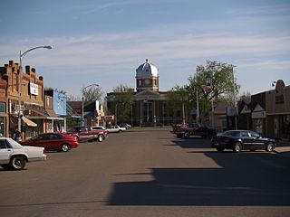
Crosby is a city and the county seat of Divide County, North Dakota, United States. The population was 1,065 at the 2020 census.

<span class="mw-page-title-main">Sentinel Butte, North Dakota</span> City in North Dakota, United States

Sentinel Butte is a city in Golden Valley County, North Dakota, United States. The population was 61 at the 2020 census.

<span class="mw-page-title-main">Emerado, North Dakota</span> City in North Dakota, United States

Emerado is a city in Grand Forks County, North Dakota, United States located near Grand Forks Air Force Base. It is part of the "Grand Forks, ND-MN Metropolitan Statistical Area" or "Greater Grand Forks". The population was 443 at the 2020 census. Grand Forks Air Force Base is located near Emerado.

<span class="mw-page-title-main">Pettibone, North Dakota</span> City in North Dakota, United States

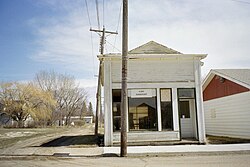
Pettibone is a small town in Kidder County, North Dakota, United States. The population was 60 at the 2020 census.

<span class="mw-page-title-main">Alexander, North Dakota</span> City in North Dakota, United States

Alexander is a city in McKenzie County, North Dakota, United States. The population was 319 at the 2020 census. Alexander was founded in 1905 and is named after early North Dakota politician Alexander McKenzie.

<span class="mw-page-title-main">Petersburg, North Dakota</span> City in North Dakota, United States

Petersburg is a city in Nelson County, North Dakota, United States. The population was 162 at the time of the 2020 census. Petersburg was founded in 1884.

<span class="mw-page-title-main">Hankinson, North Dakota</span> City in North Dakota, United States

Hankinson is a city in Richland County, North Dakota, United States. The population was 921 at the 2020 census. Hankinson was founded in 1886. It is part of the Wahpeton, ND–MN Micropolitan Statistical Area.

<span class="mw-page-title-main">Sharon, North Dakota</span> City in North Dakota, United States

Sharon is a city in Steele County, North Dakota, United States. The population was 86 at the 2020 census. Sharon was founded in 1896.

<span class="mw-page-title-main">Kensal, North Dakota</span> City in North Dakota, United States

Kensal is a city in Stutsman County, North Dakota, United States. The population was 146 at the 2020 census. Kensal was founded in 1892.

<span class="mw-page-title-main">Pingree, North Dakota</span> City in North Dakota, United States

Pingree is a city in Stutsman County, North Dakota, United States. The population was 41 at the 2020 census. Pingree was founded in 1882.

<span class="mw-page-title-main">Hoople, North Dakota</span> City in North Dakota, United States

Hoople is a city in Walsh County, North Dakota, United States. The population was 247 at the 2020 census. Hoople, named for early settler Alan Hoople, was founded in 1889. Hoople's nickname is "Tatertown."

<span class="mw-page-title-main">Fessenden, North Dakota</span> City in North Dakota, United States

Fessenden is a town in, and the county seat of, Wells County, North Dakota, United States. It was founded in 1893 and is home of the Wells County Fair. The population was 462 at the 2020 census.

<span class="mw-page-title-main">Harvey, North Dakota</span> City in North Dakota, United States

Harvey is a city in Wells County, North Dakota, United States. The population was 1,650 at the 2020 census. Harvey was founded in 1893 as a division point by the Soo Line Railway. Harvey is believed to have been named for a director of the Soo Line Railway, Col. Scott William Harvey of Minneapolis, Minnesota.

<span class="mw-page-title-main">Hurdsfield, North Dakota</span> City in North Dakota, United States

Hurdsfield is a city in Wells County, North Dakota, United States. The population was 64 at the 2020 census. Hurdsfield was founded in 1903.

<span class="mw-page-title-main">Parkston, South Dakota</span> City in South Dakota, United States

Parkston is a city in Hutchinson County, South Dakota, United States. The population was 1,567 at the 2020 census.

<span class="mw-page-title-main">Hartford, South Dakota</span> City in South Dakota, United States

Hartford is a suburban American city in Minnehaha County, South Dakota, a few miles northwest of Sioux Falls. Its population was 3,354 at the 2020 census.

References

  1. "ArcGIS REST Services Directory". United States Census Bureau. Retrieved September 20, 2022.
  2. 1 2 U.S. Geological Survey Geographic Names Information System: Sykeston, North Dakota
  3. 1 2 "Explore Census Data". United States Census Bureau . Retrieved January 28, 2022.
  4. Wick, Douglas A. "Sykeston (Wells County)". North Dakota Place Names. Retrieved May 5, 2011.
  5. "County History". Official Portal for North Dakota State Government. Retrieved May 4, 2011.
  6. "2010 Census Centers of Population by State". United States Census Bureau, Geography Division. Archived from the original on April 16, 2011. Retrieved May 5, 2011.
  7. "US Gazetteer files 2010". United States Census Bureau. Archived from the original on January 25, 2012. Retrieved June 14, 2012.
  8. "City and Town Population Totals: 2020-2021". United States Census Bureau. July 19, 2022. Retrieved July 19, 2022.
  9. United States Census Bureau. "Census of Population and Housing" . Retrieved October 30, 2013.
  10. Climate Summary for Sykeston, North Dakota