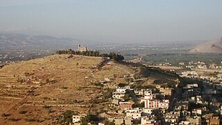
Majdal Anjar is a village of Beqaa Governorate, Lebanon. Majdal Anjar is an overwhelmingly Sunni Muslim town.

Kaukaba, Kaukabet El-Arab or Kaukaba Station is a village in the Hasbaya District in the Nabatiye Governorate in southern Lebanon.
Neba'a Faour, Tell Neba'a Faour, Mashna'et el Faour, Neba Faour or Nebaa Faour is a large, low-lying archaeological tell mound in the Bekaa Valley, Lebanon inhabited in the late 7th and early 6th millennium BC. It was initially discovered by Lorraine Copeland and Peter J. Wescombe in 1965 near the road from Beirut to Damascus, 5 miles from the border with Syria. The site was mainly composed of soil and pebbles on limestone bedrock, the site showed heavy erosion since it was abandoned and recent damage from modern construction in the area. It has been suggested as an example of an aceramic stage following the Pre-Pottery Neolithic B (PPNB) that is called the Pre-Pottery Neolithic C (PPNC); sites of comparable culture are Tell Ramad, Labwe and others in the Byblos region. It is generally dated between the second half of the 7th millennium and the beginning of the 6th millennium BC.
Hashbai or Tell Hashbai is an archaeological site on the west of the Beqaa Valley in Lebanon.
Ard Tlaili or Tell Ard Tlaili is a small tell mound archaeological site in a plain at the foot of the Lebanon Mountains 11 km (7 mi) northwest of Baalbeck, in the Beqaa Valley in Lebanon.
Ras Baalbek I is a rock shelter 500 m (1,600 ft) east of Ras Baalbek in the northern Beqaa Valley in Lebanon. It sits north of the Wadi Teniyet er-Râs valley at a height of 1,000 m (3,300 ft). It was first discovered by Lorraine Copeland and Peter Wescombe in 1965-1966. It was later excavated by Jacques Besançon in 1970. Retouched blades along with a pressure-flaked arrowhead and a burin were found dated to the Neolithic period.
Tell Neba'a Litani or Neba'a Litani is a medium size tell 9 kilometres (5.6 mi) west of Baalbek in the northern Beqaa Valley of Lebanon. I It is located near the spring which is the main source of the Litani River at a height of 1,002 metres (3,287 ft). It was first studied by Lorraine Copeland and Peter Wescombe in 1965-1966 and is accessible via a road which turns from Hoch Barada to the left. Materials recovered included flint tools such as scrapers and the blade from a segmented sickle. Pottery included burnished, painted and red washed shards, some with incised decoration or lattice patterns. The material resembled finds from Byblos and Ard Tlaili leading Copeland and Wescombe to suggest a late Neolithic occupation for the tell that extended into the Bronze Age.
Tell Ain Nfaikh or Ain Nfaikh is an archaeological site in an area c. 100 square metres (1,100 sq ft) of a ploughed field 300 metres (980 ft) east of the Litani, north of Rayak on the west of the Beqaa Valley in Lebanon.
Aamiq or Aammiq II is an archaeological site southwest of Zahle in the Aammiq Wetland, Beqaa Valley, Lebanon.

Qaraoun is a Lebanese Town, 85 km from Beirut, known for its Lake Qaraoun in the Beqaa Valley formed by the El Wauroun Dam built in 1959. It is an ecologically fragile zone in the Western Beqaa District. The village lies about 800 m above sea level. The dam is located nearby on the Litani River.
Tell Deir is an archaeological site approximately halfway between Joub Jannine and Chtaura in Lebanon.
Tell Nahariyah is an archaeological site in the Beqaa Mohafazat (Governorate) in Lebanon. It is located c. 2.7 miles (4.3 km) south of Rayak situated on the left bank of the Litani river. It was discovered in 1963 by Diana Kirkbride who examined recovered material with Maurice Dunand. Neolithic, Chalcolithic and Bronze Age materials were found and discussed by James Mellaart and Lorraine Copeland. The area is now under cultivation.
Tell Delhamieh is an archaeological site 3 km south southwest of Rayak in the Beqaa Mohafazat (Governorate). It dates at least to the Neolithic.
Tell Karmita is an archaeological site 4 km north of Bar Elias, on the Zahle road in the Beqaa Mohafazat (Governorate), Lebanon. It dates at least to the Neolithic with early Iron Age materials also found.
Tell Qasr Labwe is an archaeological site 1 km west of Labweh in the Beqaa Mohafazat (Governorate). It dates at least to the Neolithic and there is a Roman temple on the site.
Tell Saatiya is an archaeological site 4.4 km south southwest of Majdal Anjar on the road to Rachaya in the Beqaa Mohafazat (Governorate) in Lebanon. It dates at least to the Neolithic with large quantities of Early Bronze Age materials.
Tell Saoudhi is an archaeological site 1 km north of Tell Delhamiyeh near Rayak in the Beqaa Mohafazat (Governorate). It dates at least to the Neolithic.
Tell Serhan is an archaeological site 9 km southeast of Rayak Air Base, 4 km northeast of Bar Elias in the Beqaa Mohafazat (Governorate) in Lebanon. It dates at least to the Neolithic with middle and late Bronze Age materials plentiful.
Tell Shaikh Hassan al Rai is an archaeological site 2 km south of el Marj, 2 km north of Hoch Harime in the Beqaa Mohafazat (Governorate) in Lebanon. It dates at least to the Neolithic with Medieval material also attested.
Tell Taalabaya is an archaeological site 2.5 km southwest of the bridge at Maalaka in the Beqaa Mohafazat (Governorate) in Lebanon. It dates at least to the Neolithic.