
Santa Maria di Leuca lighthouse is an active light located at the extremity of Santa Maria di Leuca nearby the same name Sanctuary.

Punta Torre Canne Lighthouse is an active lighthouse in the homonymous village in the municipality of Fasano. The place takes the name from an ancient coastal tower built in the 16th century to protect the coast from the Turks, and from the presence of giant cane.
Meloria south end Lighthouse is an active lighthouse located in the Ligurian Sea, 3 nautical miles west of the south entrance of the Port of Livorno, in the southern part of the Meloria shoal.
Torre San Giovanni di Ugento Lighthouse is an active lighthouse located in Torre San Giovanni, in front of the Marina, on the south-western coast of the Salento Peninsula, on the Ionian Sea.
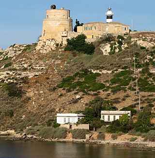
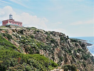
Capo Ferro Lighthouse is an active lighthouse located on the same name promontory which marks the southern entrance to the Strait of Bonifacio and to the Maddalena archipelago, in the municipality of Arzachena, in the north east of Sardinia, Italy, on the Tyrrhenian Sea.
Capo Sant'Elia Lighthouse is an active lighthouse located on Capo Sant'Elia promontory, adjacent to Calamosca Bay which separates the Golfo degli Angeli from that of Quartu Sant'Elena. The structure is situated in the municipality of Quartu Sant'Elena, in the southern Sardinia on the Tyrrhenian Sea.
Capo Spartivento Lighthouse is an active lighthouse located on Cape Spartivento promontory which is the southernmost point of Sardinia and represents the eastern boundary of the Gulf of Teulada and the western limit of the Gulf of Cagliari on the Tyrrhenian Sea. The structure is situated in the municipality of Domus de Maria.

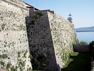
Isola della Bocca Lighthouse is an active lighthouse located on a small islet, at the southern entrance of the outer Port of Olbia, 250 metres (820 ft) from the mainland, in the municipality of Olbia on the Tyrrhenian Sea.

Isola dei Cavoli Lighthouse is an active lighthouse located on a small islet, 690 metres (2,260 ft) from Cape Carbonara, the southernmost tip of western Sardinia in the municipality of Villasimius on the Tyrrhenian Sea.

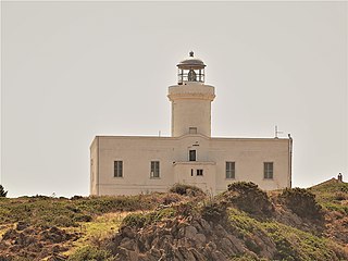
Porto Conte Lighthouse is an active lighthouse located on a promontory, halfway on the east side of the bay of Porto Conte, opposite to Capo Caccia Lighthouse and west of Alghero on the Sea of Sardinia.
Capo Cefalù Lighthouse is an active lighthouse located on the promontory of Capo Cefalù under the steep limestone ridge, 280 metres (920 ft) high, named Rocca east of Cefalù, Sicily on the Tyrrhenian Sea.

Capo Gallo Lighthouse is an active lighthouse located on the northern tip of the promontory of Monte Pellegrino marks the western entrance to the Gulf of Palermo, Sicily on the Tyrrhenian Sea.
Capo Zafferano Lighthouse is an active lighthouse located at the extreme tip of the homonymy promontory, under a steep ridge, that marks the eastern entrance to the port of Palermo. The lighthouse is in the municipality of Santa Flavia on the Tyrrhenian Sea.

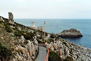
Scoglio Palumbo Lighthouse is an active lighthouse located on an islet 102 metres (335 ft) long and 67 metres (220 ft) wide just 0.6 nautical miles west of the entrance to the port of Trapani on the Sicily Channel.
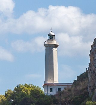
Forte La Rocca Lighthouse is an active lighthouse located next to the tip of the promontory of the Argentario on the Tyrrhenian Sea.
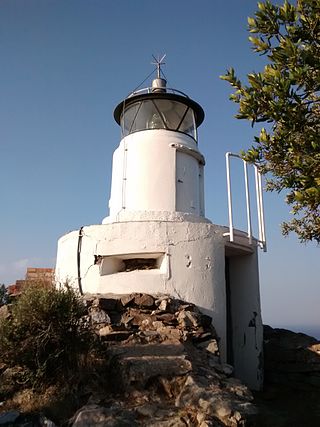
Monte Poro Lighthouse is an active lighthouse located on the summit of Monte Poro, in the south western part of Elba on the Tyrrhenian Sea, a region covered by Macchia Mediterranea. The place was of some strategic interest during World War II because close to the lighthouse are the ruins of a German position.

Punta Ferraione Lighthouse is an active lighthouse located on the eastern tip of a small bay which delimits the harbour of the island of Capraia in the Tuscan Archipelago on the Tyrrhenian Sea.

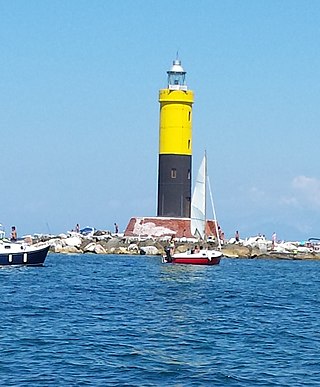
Vada Shoal Lighthouse is an active lighthouse, located circa 4 nautical miles offshore Vada on the Ligurian Sea, in order to signalling the presence of the shoals.

Viareggio Diga Foranea Lighthouse is an active lighthouse, located at halfway the breakwater of the dock of Viareggio on the Ligurian Sea.

Murano Lighthouse is an active lighthouse located in the south east part of the island of Murano in the Venetian Lagoon on the Adriatic Sea.

