Montana is a state in the Mountain West division of the Western United States. It is bordered by Idaho to the west, North Dakota and South Dakota to the east, Wyoming to the south, and the Canadian provinces of Alberta, British Columbia, and Saskatchewan to the north. It is the fourth-largest state by area, the eighth-least populous state, and the third-least densely populated state. Its state capital is Helena, while the largest city is Billings. The western half of Montana contains numerous mountain ranges, while the eastern half is characterized by western prairie terrain and badlands, with smaller mountain ranges found throughout the state.

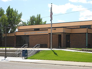
Valley County is a county in the U.S. state of Montana. Valley County was created in 1893 with area partitioned from Dawson County. As of the 2020 census, the population was 7,578. Its county seat is Glasgow. It is located on the Canada–United States border with Saskatchewan.

Tampico is a village located in Tampico Township, Whiteside County, Illinois, United States next to Rock Falls and Sterling, Illinois. As of the 2010 census the village had a total population of 790, up from 772 at the 2000 census. It is known as the birthplace of Ronald Reagan, the 40th President of the United States.

Tamaulipas, officially the Free and Sovereign State of Tamaulipas, is a state in Mexico; one of the 31 states which, along with Mexico City, comprise the 32 Federal Entities of Mexico. It is divided into 43 municipalities.

Tampico is a city and port in the southeastern part of the Mexican state of Tamaulipas. It is located on the north bank of the Pánuco River, about 10 kilometers (6 mi) inland from the Gulf of Mexico, and directly north of the state of Veracruz. Tampico is the fifth-largest city in Tamaulipas, with a population of 314,418 in the city proper and 929,174 in the metropolitan area.

General Francisco Javier Mina International Airport, also known as Tampico International Airport formerly Campo de Aviación George Lawrence Rihl , is an international airport located at Tampico, Tamaulipas, Mexico. It is named after General Francisco Javier Mina, a leader in Mexico's War of Independence. It handles national and international air traffic of the metropolitan area of Tampico, Ciudad Madero and Altamira.
Center is an unincorporated community in Taylor Township, Howard County, Indiana, United States. Center is a suburb of Kokomo and is a part of the Kokomo, Indiana Metropolitan Statistical Area.

Club Deportivo y Social Tampico Madero is a Mexican professional football club based in Tampico and Ciudad Madero, Tamaulipas that plays in the Liga Premier de México.

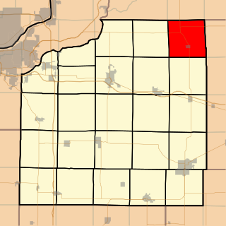
Yorktown Township is one of twenty-four townships in Henry County, Illinois, USA. As of the 2010 census, its population was 431 and it contained 190 housing units.

The Birthplace of Ronald Reagan, also known as the Graham Building, is located in an apartment on the second floor of a late 19th-century commercial building in Tampico, Illinois, United States. The building was built in 1896, and housed a tavern from that time until 1915. On February 6, 1911, the future 40th President of the United States, Ronald Reagan, was born in the apartment there. The Reagan family subsequently moved into a house in Tampico a few months later.

Tampico is an unincorporated community in Grassy Fork Township, Jackson County, Indiana.
The following radio stations broadcast on FM frequency 100.1 MHz:

Tampico Alto is a municipality of the Mexican state of Veracruz. It is located in the state's Huasteca Alta region, at the northern end of Tamiahua Lagoon. The municipal seat is also called Tampico Alto.
Statistics of the Primera División de México for the 1979–80 season.
The Gravelbourg Formation is a stratigraphical unit of Bajocian age in the Western Canadian Sedimentary Basin.
Prophetstown High School, or PHS, is a public four-year high school located at 310 West Riverside Drive in Prophetstown, Illinois, a small city of Whiteside County, Illinois, in the Midwestern United States. PHS is part of Prophetstown-Lyndon-Tampico Community Unit School District 3, which serves the communities of Prophetstown, Lyndon, Tampico, Deer Grove, and Yorktown, and includes PLT Middle School, Prophetstown Elementary School, and Tampico Elementary School. The campus is 15 miles southwest of Sterling, Illinois. The school serves a mixed small city, village, and rural residential community. The school lies within the Sterling micropolitan statistical area.
Tampico is a census-designated place and unincorporated community in Yakima County, Washington, United States, located approximately eighteen miles west of Yakima on Ahtanum Creek. The population was 312 at the 2010 United States Census.

Hinsdale is an unincorporated community and census-designated place in Valley County, Montana, United States. The town's population was 217 and the community's population as a whole was 583 as of the 2010 census. The community is located on the Milk River and U.S. Route 2, with Montana Highway 537 headed north out of town and South Bench Road crossing the railroad tracks and running south of town. Hinsdale has a post office with ZIP code 59241.
The following television stations operate on virtual channel 12 in the United States:
Tampico is an unincorporated community in Darke County, in the U.S. state of Ohio.


