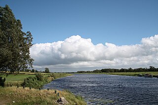
Tandragee is a town in County Armagh, Northern Ireland. It is built on a hillside overlooking the Cusher River, in the civil parish of Ballymore and the historic barony of Orior Lower.

Drumsurn is a small village and townland in County Londonderry, Northern Ireland. It is 8 kilometres (5.0 mi) southeast of Limavady and 10 kilometres (6.2 mi) northeast of Dungiven. It lies in the Roe Valley, at the foot of Donald's Hill and at the edge of the Sperrins. Drumsurn had a population of 357 people in the 2001 Census. It is situated within Causeway Coast and Glens district.

Gilford is a village in County Down, Northern Ireland. The village sits on the River Bann between the towns of Banbridge, Tandragee and Portadown. It covers the townlands of Loughans, Ballymacanallen and Drumaran. It had a population of 1,933 people in the 2011 Census. Gilford is within the Armagh, Banbridge and Craigavon district.

Ballymagorry or Ballymagory is a small village and townland in County Tyrone, Northern Ireland. It is west of Artigarvan and 5 kilometres (3.1 mi) north of Strabane. In the 2001 Census it had a population of 565. It lies within the Strabane District Council area and lies on the River Glenmornan.
Kells is a village near Ballymena in County Antrim, Northern Ireland, that also encompasses the neighbouring village of Connor. As such it is also known as Kells and Connor in which they share a primary school, library, development association etc. It is in Mid and East Antrim District Council. Kells and Connor had a population of 2,053 people in the 2011 Census.
Madden is a small village and townland in County Armagh, Northern Ireland. It is within the Armagh City, Banbridge and Craigavon Borough Council area. It has a population of around 200 people.
Ballydugan or Ballydougan is a townland in County Armagh, Northern Ireland. It lies on the County Armagh–County Down border, between Lurgan and Gilford. Ballydougan is within the Armagh City, Banbridge and Craigavon Borough Council area.

The A26 is a road in Northern Ireland. It travels in a north–south direction from Coleraine, County Londonderry to Banbridge, County Down.

The Clogher Valley Railway was a 37-mile-long (60 km), 3 ft narrow gauge railway in County Tyrone and County Fermanagh, Northern Ireland. It opened in May 1887 and closed on 1 January 1942.
Thomas Sinton, JP was an Irish industrialist and magistrate. Sinton made a significant impact upon the Irish linen trade; not least establishing the village of Laurelvale, County Armagh.

Tandragee Castle, Tandragee, County Armagh, Northern Ireland, was built in 1837 by The 6th Duke of Manchester as the family's Irish home. The Duke of Manchester acquired the estate through his marriage to Millicent Sparrow (1798–1848).

Bannfoot is a small village in the townland of Derryinver, County Armagh, Northern Ireland. It sits where the Upper Bann flows into Lough Neagh.
The Oriel was a restaurant in Gilford, County Down, Northern Ireland. It was a fine dining restaurant that was awarded one Michelin star in both 2004 and 2005.


