Argyll and Bute is one of 32 unitary council areas in Scotland and a lieutenancy area. The current lord-lieutenant for Argyll and Bute is Jane Margaret MacLeod. The administrative centre for the council area is in Lochgilphead at Kilmory Castle, a 19th-century Gothic Revival building and estate. The current council leader is Robin Currie, a councillor for Kintyre and the Islands.
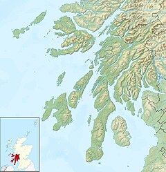
Lochgoilhead is a village on the Cowal peninsula, in Argyll and Bute, Scottish Highlands. It is located within the Loch Lomond and The Trossachs National Park and is widely considered to be one of the most beautiful areas in Argyll and in Scotland as a whole.

Cowal is a rugged peninsula in Argyll and Bute, on the west coast of Scotland. It is bounded on the west by Loch Fyne and on the east by Loch Long and the Firth of Clyde. The Kyles of Bute separate it from Bute to the south.

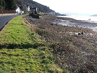
Loch Long is a body of water in the council area of Argyll and Bute, Scotland. The Sea Loch extends from the Firth of Clyde at its southwestern end. It measures approximately 20 miles in length, with a width of between one and two miles. The loch also has an arm, Loch Goil, on its western side.

Loch Lomond and The Trossachs National Park is a national park in Scotland centred on Loch Lomond and the hills and glens of the Trossachs, along with several other ranges of hills. It was the first of the two national parks established by the Scottish Parliament in 2002, the second being the Cairngorms National Park. The park extends to cover much of the western part of the southern highlands, lying to the north of the Glasgow conurbation, and contains many mountains and lochs. It is the fourth-largest national park in the British Isles, with a total area of 1,865 km2 (720 sq mi) and a boundary of some 350 km (220 mi) in length. It features 21 Munros and 20 Corbetts.

Arrochar is a village located near the head of Loch Long, on the Cowal peninsula in Argyll and Bute, Scottish Highlands. The village is within the Loch Lomond and The Trossachs National Park.

The Arrochar Alps are a group of mountains located around the head of Loch Long, Loch Fyne, and Loch Goil, near the villages of Arrochar and Lochgoilhead, on the Cowal Peninsula in Argyll and Bute, Scotland. The mountains are especially popular with hillwalkers, due to their proximity and accessibility from Glasgow. They are largely within the Loch Lomond and The Trossachs National Park and in part also extend into the Argyll Forest Park. Glens which go into the heart of the range include: Glen Croe, Hell's Glen and Glen Kinglass.

Ardlui is a hamlet in Argyll and Bute, Scottish Highlands. It is located at the head of Loch Lomond. It is on the A82 road between Crianlarich and Glasgow and Ardlui railway station is on the West Highland Line between Glasgow Queen Street and Oban or Fort William.
Tarbert is a place name in Scotland and Ireland. Places named Tarbert are characterised by a narrow strip of land, or isthmus. This can be where two lochs nearly meet, or a causeway out to an island.
Tarbet may refer the following places in Scotland:
Kilmun is a linear settlement on the north shore of the Holy Loch, on the Cowal peninsula in Argyll and Bute, Scottish Highlands.It takes its name from the 7th century monastic community founded by an Irish monk, St Munn. The ruin of a 12th-century church still stands beside the Kilmun Parish Church and Argyll Mausoleum.

Loch Goil; is a small sea loch forming part of the coast of the Cowal peninsula in Argyll and Bute, Scotland. The sea loch is entirely within the Loch Lomond and The Trossachs National Park.

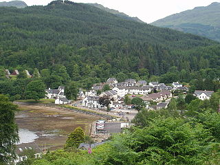
Strone is a village on the Cowal peninsula in Argyll and Bute in the Scottish Highlands at the point where the north shore of the Holy Loch becomes the west shore of the Firth of Clyde. The village lies within the Loch Lomond and The Trossachs National Park.

Glen Croe is a glen in the heart of the Arrochar Alps on the Cowal Peninsula, in Argyll and Bute, Scotland. The glen is surrounded by large and rugged mountains characterised by huge boulders. The glen is within the Loch Lomond and The Trossachs National Park.

Portavadie is a village on the shores of Loch Fyne in Argyll and Bute, Scotland.

Succoth; is a village on the Cowal peninsula in Argyll and Bute, Scotland.
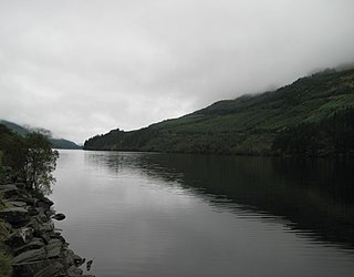
Loch Eck is a freshwater loch located on the Cowal peninsula, north of Dunoon, Argyll and Bute, Scotland. It is seven miles long. It is oriented in a north-south direction. Its main inflow, at the northern end, is the River Cur, and its main outflow, at the southern end, is the River Eachaig, which meanders somewhat within the confines of the broad strath before flowing into the head of Holy Loch, about 5 km further south.
Blairmore is a village located on the Cowal peninsula in Argyll and Bute, Scotland. Blairmore lies within the Loch Lomond and The Trossachs National Park. It is situated on the western shore of Loch Long and around 1 mile (1.6 km) north of Strone. The village was largely built during the Victorian era and has a small wooden pier which dates to 1855.
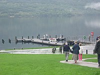 Tarbet Pier - geograph.org.uk - 252215
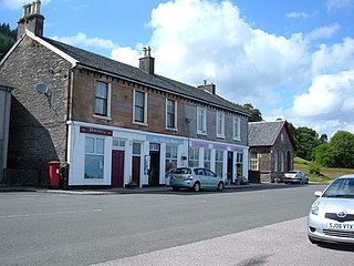
 Tarbet Hotel Tarbet - geograph.org.uk - 1091022