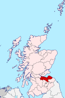
Lothian is a region of the Scottish Lowlands, lying between the southern shore of the Firth of Forth and the Lammermuir Hills and the Moorfoot Hills. The principal settlement is the Scottish capital, Edinburgh, while other significant towns include Livingston, Linlithgow, Bathgate, Queensferry, Dalkeith, Bonnyrigg, Penicuik, Musselburgh, Prestonpans, North Berwick, Dunbar, and Haddington.

Avon Water, also known locally as the River Avon, is a 24-mile-long (39 km) river in Scotland, and a tributary of the River Clyde.

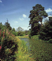
The River Tweed, or Tweed Water, is a river 97 miles (156 km) long that flows east across the Border region in Scotland and northern England. Tweed cloth derives its name from its association with the River Tweed. The Tweed is one of the great salmon rivers of Britain and the only river in England where an Environment Agency rod licence is not required for angling. The river generates a large income for the local borders region, attracting anglers from all around the world.

The River Dee, in south-west Scotland, flows from its source in Loch Dee amongst the Galloway Hills, firstly to Clatteringshaws Loch, then into Loch Ken, where it joins the Water of Ken. From there, the Dee flows 15 miles (24 km) southwards to Kirkcudbright, and into Kirkcudbright Bay to reach the Solway Firth. The distance is just over 38 miles (61 km) in total. Together with its tributaries, the Dee's total catchment area is over 400 square miles (1,000 km2).

The River Irthing is a river in Cumbria, England and a major tributary of the River Eden. The name is recorded as Ard or Arden in early references. For the first 15 miles of its course it defines the border between Northumberland and Cumbria.
The River Wyre is a river in Lancashire, England, United Kingdom, which flows into the Irish Sea at Fleetwood. It is approximately 28 miles (45 km) in length. The river is a County Biological Heritage Site and has a sheltered estuary which, from its northwest corner, penetrates deep into the almost square peninsula of the Fylde.

The River Ayr is a river in Ayrshire, Scotland. At 65 km (40 mi) it is the longest river in the county.
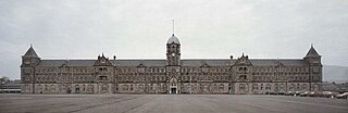
Redford Cavalry and Infantry Barracks is located on Colinton Road, near the Edinburgh City Bypass, east of the suburb of Colinton in Edinburgh, Scotland.
The Gala Water is a river in the Scottish Borders area of Scotland and a tributary of the River Tweed. It is sometimes known as the "Gala", which nickname is also shared with Galashiels, which it flows through. The "Braw Lads O Gala Watter" is a song about people from Galashiels.
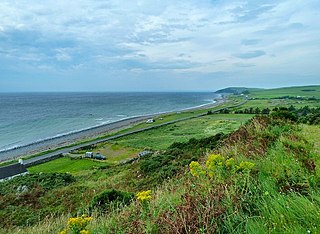
The Machars is a peninsula in the historical county of Wigtownshire in Galloway in the south-west of Scotland. Its name is derived from the Gaelic word Machair meaning low-lying or level land, known as "links" on the east coast of Scotland. Although there are no high peaks in The Machars, it is not flat and would best be described as undulating or rolling. The North Atlantic Drift or Gulf Stream creates a mild climate, and dolphins and basking sharks are frequently seen in the seas.
Cammo is a northwestern suburb of Edinburgh, the capital of Scotland. It is south of A90, at the edge of the city, approximately 6 miles from the city centre.
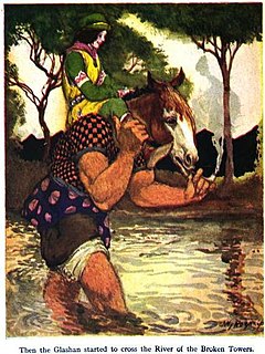
Glashtyn is a legendary creature from Manx folklore.

The Jed Water is a river and a tributary of the River Teviot in the Borders region of Scotland.
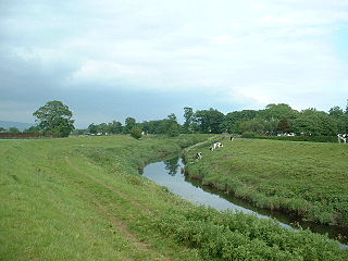
The Lyne Water is a tributary of the River Tweed which rises in the Pentland Hills of southern Scotland at Baddinsgill Reservoir. It runs through West Linton and Romannobridge, passes Flemington and Lyne Station and enters the Tweed west of Peebles. It floods regularly in winter and occasionally in summer. There is free fishing above Flemington Bridge, and below Flemington fishing in the river is administered by the Peebles fishing authority.

Loch Ness is a large freshwater loch in the Scottish Highlands extending for approximately 37 kilometres southwest of Inverness. It takes its name from the River Ness, which flows from the northern end. Loch Ness is best known for alleged sightings of the cryptozoological Loch Ness Monster, also known affectionately as "Nessie". It is one of a series of interconnected, murky bodies of water in Scotland; its water visibility is exceptionally low due to a high peat content in the surrounding soil. The southern end connects to Loch Oich by the River Oich and a section of the Caledonian Canal. The northern end connects to Loch Dochfour via the River Ness, which then ultimately leads to the North Sea via the Moray Firth.
The Quair Water is a tributary of the River Tweed in the Scottish Borders area of Scotland. Its name is related to Traquair.

Bonjedward is a hamlet in the Scottish Borders area of Scotland, two miles north of Jedburgh where the Jed Water joins the River Teviot.

The River Garry is a major tributary of the River Tummel, itself a tributary of the River Tay, in the traditional county of Perthshire in the Scottish Highlands. It emerges from the northeastern end of Loch Garry (56.8193°N 4.2311°W), just to the southeast of the Pass of Drumochter, and flows southeastwards and eastwards down Glen Garry to the narrow Pass of Killiecrankie beyond which it joins the Tummel (56.7182°N 3.7790°W).
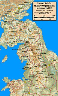
Blatobulgium was a Roman fort, located at the modern-day site known as Birrens, in Dumfriesshire, Scotland.

Daer Water is one of the streams located in the watershed region which surrounds the River Clyde in Scotland. It begins in the Lowther Hills about 600 metres (2,000 ft) above sea level and joins with Potrail Water near the Lanarkshire town of Elvanfoot at which point they become the River Clyde. The Daer Water flows through the Daer Reservoir which supplies water to the nearby towns of Lanarkshire.
