Taylorsville, Mississippi

Last updated

Taylorsville, Mississippi
Tville arial.jpg
Taylorsville Town Hall
Motto: 
"Grow With Us..." [1]
Smith County Mississippi Incorporated and Unincorporated areas Taylorsville Highlighted.svg
Location of Taylorsville, Mississippi
Usa edcp location map.svg
Red pog.svg
Taylorsville, Mississippi
Location in the United States
Coordinates: 31°49′48″N89°25′49″W / 31.83000°N 89.43028°W / 31.83000; -89.43028
Country United States
State Mississippi
County Smith
Area
[2]
  Total3.86 sq mi (9.99 km2)
  Land3.86 sq mi (9.99 km2)
  Water0.00 sq mi (0.00 km2)
Elevation
276 ft (84 m)
Population
 (2020)
  Total1,148
  Density297.64/sq mi (114.92/km2)
Time zone UTC-6 (Central (CST))
  Summer (DST) UTC-5 (CDT)
ZIP code
39168
Area code 601
FIPS code 28-72400
GNIS feature ID0678604
Website https://www.visittvillems.org/

Taylorsville is a town located in southeastern Smith County, Mississippi, United States. With a population of 1,148 in the 2020 census, the town is the most populous city in Smith County.

Contents

History

Taylorsville was established on the Gulf and Ship Island Railroad in 1900. The site was selected by an employee of the railroad, and soon after a post office was built. The post office was originally located about five miles away in Old Taylorsville (now a community located off of Mississippi Highway 531), but was later moved to New Taylorsville. It was the moving of the post office to New Taylorsville that established the present location of the town.

Soon after, the Old Stringer Hotel was built. Many years later, in 1946, it was burned down in an arson fire. The town of Taylorsville was founded as a result of the extensive pine forests that grow in Smith County and the surrounding areas. The vast majority of the area was cut by Eastman-Gardiner. As lumber was a very plentiful resource, new businesses and homes both were rapidly built.

There are a variety of industries present in Taylorsville, including lumber, manufacturing, signage, agriculture, and finance. Taylorsville is the headquarters of Southern Pine Electric, an electric co-op chartered in March 1938 to serve 481 homes and farms. Today, Southern Pine Electric is one of the largest electric cooperatives in the United States with nearly 10,000 miles of energized line serving more than 65,000 meters. The 11-county service area encompasses 14.3% of the total land mass of Mississippi. [3]

Geography

According to the United States Census Bureau, the city has a total area of 3.7 square miles (9.6 km2), all land. The city is located just west of the Leaf River, which passes under Mississippi Highway 28 about 1 mile outside of the Taylorsville city limits. [4] The Leaf River is a main tributary of the Pascagoula River, which flows to the Gulf of Mexico.

Demographics

Historical population
CensusPop.Note
1910 623
1920 601−3.5%
1930 80533.9%
1940 95518.6%
1950 1,11616.9%
1960 1,1321.4%
1970 1,29914.8%
1980 1,3876.8%
1990 1,4121.8%
2000 1,341−5.0%
2010 1,3530.9%
2020 1,148−15.2%
U.S. Decennial Census [5]
Downtown Taylorsville 20161031 220650782 iOS.jpg
Downtown Taylorsville

2020 census

Taylorsville racial composition [6]
RaceNum.Perc.
White (non-Hispanic)75165.42%
Black or African American (non-Hispanic)33729.36%
Native American 10.09%
Asian 20.17%
Other/Mixed 232.0%
Hispanic or Latino 342.96%

As of the 2020 United States census, there were 1,148 people, 654 households, and 460 families residing in the town.

2010 census

As of the census of 2010, there were 1,353 people, 534 households, and 375 families residing in the town. The population density was 364.3 inhabitants per square mile (140.7/km2). There were 598 housing units at an average density of 162.4 per square mile (62.7/km2). The racial makeup of the town was 81.58% White, 17.75% African American, 0.37% from other races, and 0.30% from two or more races. Hispanic or Latino people of any race were 0.37% of the population. [7]

There were 534 households, out of which 35.0% had children under the age of 18 living with them, 53.2% were married couples living together, 14.0% had a female householder with no husband present, and 29.6% were non-families. 28.5% of all households were made up of individuals, and 16.5% had someone living alone who was 65 years of age or older. The average household size was 2.48 and the average family size was 3.05.

In the town, the population was spread out, with 26.2% under the age of 18, 8.9% from 18 to 24, 26.3% from 25 to 44, 22.5% from 45 to 64, and 16.0% who were 65 years of age or older. The median age was 38 years. For every 100 females, there were 88.1 males. For every 100 females age 18 and over, there were 82.0 males.

The median income for a household in the town was $28,563, and the median income for a family was $38,958. Males had a median income of $30,776 versus $20,096 for females. The per capita income for the town was $15,202. About 12.5% of families and 16.1% of the population were below the poverty line, including 24.1% of those under age 18 and 10.2% of those age 65 or over.

Arts and culture

BBQ festival

The Grillin' N Chillin' Barbecue Festival is a two-day event that is held each year in Taylorsville on the first weekend in November. The festival starts on Friday night with the barbecue teams firing up the grills to compete for various prizes.

On Saturday morning, the town closes a one-mile stretch of Mississippi Highway 28 for the car and bike show, which features prizes and a burnout competition. The festival has been a great success for the town, bringing in much-needed tourism dollars and attracting barbecue cooks from all over Mississippi and the southeastern United States. [8]

Education

Taylorsville Attendance Center is a public school governed by the Smith County School District. [9] Taylorsville also has The First Baptist Church of Taylorsville Christian School, a K4–6th grade private school operated by the church.

Media

Taylorsville is served by two newspapers: The Smith County Reformer and The Post. Both provide news on a local level, while television and high-speed internet provides wider-scale news. Radio station WBBN-FM 95.9 (B95), is licensed to Taylorsville with its studios in Laurel.

Infrastructure

Transportation

The city has no public transit system other than the bus routes to Taylorsville High School, but is served by several Mississippi state highways and one county highway. [10]

State highways

Taylorsville is located approximately 10 miles from U.S. Highway 84. The town is connected to a railroad system which connects to the West Taylorsville Industrial Park and runs west to Magee.

Notable people

Related Research Articles

<span class="mw-page-title-main">Leake County, Mississippi</span> County in Mississippi, United States

Leake County is a county in the center of the U.S. state of Mississippi. As of the 2020 census, the population was 21,275. Its county seat is Carthage. The county is named for Walter Leake, the Governor of Mississippi from 1822 to 1825.

<span class="mw-page-title-main">Taylorsville, Georgia</span> Town in Georgia, United States

Taylorsville is a town in Bartow and Polk counties in the U.S. state of Georgia. The population was 252 at the 2020 census, up 20.0% from 210 at the 2010 census.

<span class="mw-page-title-main">Bruce, Mississippi</span> Town in Mississippi, United States

Bruce is a town situated along the Skuna River in Calhoun County, Mississippi, United States. As of the 2020 census, it had a population of 1,707.

<span class="mw-page-title-main">Calhoun City, Mississippi</span> Town in Mississippi, United States

Calhoun City is a town in Calhoun County, Mississippi, United States. The population was 1,774 at the 2010 census.

<span class="mw-page-title-main">Vardaman, Mississippi</span> Town in Mississippi, United States

Vardaman is a town in Calhoun County, Mississippi. The town's population was 1,316 at the time of the 2010 United States Census.

<span class="mw-page-title-main">Carrollton, Mississippi</span> Town in Mississippi, United States

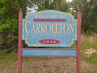
Carrollton is a town in and the second county seat of Carroll County, Mississippi, United States, which is within the Mississippi Delta. The population was 190 at the 2010 census, down from 408 in 2000. Centrally located in the county, the town is part of the Greenwood, Mississippi micropolitan area. The first county seat, Vaiden, was founded in the eastern part of the county during its early settlement.

<span class="mw-page-title-main">Ackerman, Mississippi</span> Town in Mississippi, United States

Ackerman is a town in Choctaw County, Mississippi, United States. The population was 1,594 according to 2020 census, which shows an increase from 1,510 reported in the 2010 census It is the county seat of Choctaw County.

<span class="mw-page-title-main">Leakesville, Mississippi</span> Town in Mississippi, United States

Leakesville is a town in and the county seat of Greene County, Mississippi, United States. It is located along the Chickasawhay River in Greene County, Mississippi, United States. It is served by the junction of Mississippi routes 57 and 63. As of the 2010 census, the rural town population was 898, down from 1,026 at the 2000 census.

<span class="mw-page-title-main">McLain, Mississippi</span> Town in Mississippi, United States

McLain is a town in Greene County, Mississippi, United States. The population was 441 at the 2010 census, down from 603 at the 2000 census.

<span class="mw-page-title-main">Pickens, Mississippi</span> Town in Mississippi, United States

Pickens is a town in Holmes County, Mississippi, United States. Per the 2020 census, the population was 920.

<span class="mw-page-title-main">Louin, Mississippi</span> Town in Mississippi, United States

Louin is a town in Jasper County, Mississippi, United States, located along Mississippi Highway 15. The population was 277 at the 2010 census, down from 339 at the 2000 census. On June 18, 2023, the town was hit by a destructive EF3 tornado causing 1 death.

<span class="mw-page-title-main">Bassfield, Mississippi</span> Town in Mississippi, United States

Bassfield is a town in Jefferson Davis County, Mississippi, United States. The population was 192 at the 2020 census, down from 254 at the 2010 census.

<span class="mw-page-title-main">Soso, Mississippi</span> Town in Mississippi, United States

Soso is a town in Jones County, Mississippi, United States. The population was 418 at the 2020 census.

<span class="mw-page-title-main">Standing Pine, Mississippi</span> Census-designated place in Mississippi, United States

Standing Pine is a census-designated place (CDP) in Leake County, Mississippi, United States. It is one of the eight communities of the Mississippi Band of Choctaw Indians Reservation, and the population is 94% Choctaw. The total population of the CDP was 517 at the 2020 census.

<span class="mw-page-title-main">Amory, Mississippi</span> City in Mississippi, United States

Amory is a city in Monroe County, Mississippi, United States. The population was 6,666 at the 2020 census, down from 7,316 in 2010. Located in the northeastern part of the state near the Alabama border, it was founded in 1887 as a railroad town by the Kansas City, Memphis and Birmingham Railroad. As a result, Cotton Gin Port, along the Tombigbee River to the east, was abandoned as businesses and people moved for railroad access.

<span class="mw-page-title-main">Rolling Fork, Mississippi</span> City and county seat in Mississippi, United States

Rolling Fork is a city and county seat of Sharkey County, Mississippi, United States. As of the 2020 census, the population of the town was 1,883.

<span class="mw-page-title-main">Belmont, Mississippi</span> Town in Mississippi, United States

Belmont is a town in Tishomingo County, Mississippi, United States. The population was 2,021 at the 2010 census.

<span class="mw-page-title-main">Taylorsville, North Carolina</span> Town in North Carolina, United States

Taylorsville is a town in Alexander County, North Carolina, United States. The population was 2,098 at the 2010 census. It is the county seat of Alexander County.

<span class="mw-page-title-main">Ridgeland, South Carolina</span> Town in South Carolina, United States

Ridgeland is a town in Jasper and Beaufort counties, South Carolina, United States. The population was 3,749 at the 2020 census, a 7.1% decrease from 2010. It has been the county seat of Jasper County since the county's formation in 1912. As defined by the U.S. Census Bureau, Ridgeland is included within the Hilton Head Island–Bluffton metropolitan area.

<span class="mw-page-title-main">Stuart, Virginia</span> Town in Virginia, United States

Stuart is a town in Patrick County, Virginia, United States, where it is the county seat. The population was 1,408 at the 2010 census. The town of Stuart was named after Confederate Gen. J.E.B. Stuart, of nearby Ararat, Virginia.

References

  1. "Town of Taylorsville Mississippi". Town of Taylorsville Mississippi. Archived from the original on February 3, 2013. Retrieved October 10, 2012.
  2. "2020 U.S. Gazetteer Files". United States Census Bureau. Retrieved July 24, 2022.
  3. "Business Directory | Taylorsville, MS". www.townoftaylorsville.com. Retrieved October 31, 2016.
  4. "Recreation | Taylorsville, MS". www.townoftaylorsville.com. Retrieved October 31, 2016.
  5. "Census of Population and Housing". Census.gov. Retrieved June 4, 2015.
  6. "Explore Census Data". data.census.gov. Retrieved December 17, 2021.
  7. Bureau, U.S. Census. "U.S. Census website". United States Census Bureau . Retrieved October 31, 2016.
  8. "Festival 2016 | Taylorsville Chamber of Commerce". taylorsvillechamber.com. Retrieved October 31, 2016.
  9. "Taylorsville High School". sites.google.com. Retrieved October 31, 2016.
  10. "Smith County Highway Map" (PDF). Archived (PDF) from the original on August 6, 2014.