
A ghost town, deserted city, extinct town, or abandoned city is an abandoned settlement, usually one that contains substantial visible remaining buildings and infrastructure such as roads. A town often becomes a ghost town because the economic activity that supported it has failed or ended for any reason. The town may have also declined because of natural or human-caused disasters such as floods, prolonged droughts, extreme heat or extreme cold, government actions, uncontrolled lawlessness, war, pollution, or nuclear and radiation-related accidents and incidents. The term can sometimes refer to cities, towns, and neighborhoods that, though still populated, are significantly less so than in past years; for example, those affected by high levels of unemployment and dereliction.

Mount Assiniboine, also known as Assiniboine Mountain, is a pyramidal peak mountain on the Great Divide, on the British Columbia/Alberta border in Canada.
Goshen was a pioneer town in western Whatcom County.
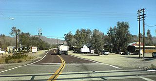
Nipton is an unincorporated community in the Ivanpah Valley in San Bernardino County, California. With a population of about 15 – 20, it is located on the northeastern border of Mojave National Preserve, approximately 12 miles (19 km) southeast of Primm, Nevada and the Ivanpah Solar Power Facility. It is accessible via Nevada State Route 164.

Clinton Creek is a ghost town in Yukon. It was a small company-owned asbestos mining town in western Yukon near the confluence of the Yukon and Fortymile rivers. It operated by the Cassiar Asbestos Corporation, which also operated the asbestos mine in Cassiar, British Columbia, from 1967 to 1978, when it was closed and all the buildings were auctioned off.
Butedale is a ghost town on Princess Royal Island, in British Columbia, Canada. It was founded in 1911 as a fishing, mining and logging camp. Initially the salmon cannery was established by Western Packers which was purchased and operated by the Canadian Fishing Company until it ceased operating in the 1970s. At its peak, Butedale's summertime population was over 400.
Emory Creek Provincial Park is a provincial park in British Columbia, Canada, located on the west side of the Fraser River just south of the town of Yale. It commemorates the location of a large boomtown, variously known as Emory, Emory Bar or Emory City, that first rose during the Fraser Canyon Gold Rush but became a major construction town during the building of the Canadian Pacific Railway in the 1880s.
Emory Creek in 1858 was a tent and shack camp, established by miners in search of gold. When it became evident that the gold was not available in the amounts estimated, the miners started moving north on the Fraser River. A few Chinese remained in the area. The area came into the hands of a man named Walker, who felt Emory Creek would become the head of riverboat navigation on the Fraser. Eventually, he sold the land to the Oppenheimer Brothers in early 1879. In the fall of 1879, Emory was chosen by the C.P.R. as the western terminus. In a short time it became Emory Creek. The town consisted of thirteen streets with its own newspaper, various shops, a brewery, nine saloons and a sawmill. When Yale was made the terminus, Emory was all but abandoned by 1885, with the completion of the railway. Today, it is an easily accessible treed campground with paved roads and flush outhouses.

A wood waste burner, known as a teepee burner or wigwam burner in the United States and a beehive burner in Canada, is a free-standing conical steel structure usually ranging from 30 to 60 feet in height. They are named for their resemblance to beehives, teepees or wigwams. A sawdust burner is cylindrical. They have an opening at the top that is covered with a steel grill or mesh to keep sparks and glowing embers from escaping. Sawdust and wood scraps are delivered to an opening near the top of the cone by means of a conveyor belt or Archimedes' screw, where they fall onto the fire near the center of the structure.

School District 28 Quesnel is a school district in central British Columbia. Most schools are located in Quesnel with one outlying school in Wells, a small community near the historic gold mining town of Barkerville and another school in the community of Nazko which is 100 km west of Quesnel.

Del Bonita is a hamlet in southern Alberta, Canada within Cardston County. It is located approximately 49 km (30 mi) south of Magrath at the junction of Highway 62 and Highway 501. Due to its location near the Canada–United States border, it serves as a port of entry into the U.S. state of Montana at the nearby Del Bonita Border Crossing which is located 3 km (1.9 mi) to the south. Del Bonita is a name derived from Spanish meaning "of the pretty".
Barkley Valley is a former gold-mining community and now ghost town located on the easternmost fork of Haylmore Creek in the Cayoosh Range of the Lillooet Country of the Southern Interior of British Columbia, Canada.
The Lower Kootenay First Nation is a First Nation based in the East Kootenay region of British Columbia. In the British Columbia Treaty Process They are part of the Ktunaxa Kinbasket Tribal Council.

Beaver was a sternwheel steamboat built in 1873 for the Willamette Transportation Company.

Fairview is a ghost town in British Columbia on the west side of the Okanagan River between Cawston and Oliver. It is the original townsite for what is now the town of Oliver, famous for the Fairview Hotel that burned down in 1902.
Locust Grove is an unincorporated community and ghost town in Sherman County, Oregon, United States. It is located on Oregon Route 206, six miles west of Wasco.
Richfield is a ghost town located in the Cariboo region of British Columbia, Canada. The town is situated beside Williams Creek.
Kerr Creek is a ghost town located in the Similkameen Division Yale Land region of British Columbia. The town is situated near northeast of Midway, west of Grand Forks. It was founded in 1893 by Robert D. Kerr.
Fisherman is a ghost town located in the Boundary Country region of British Columbia. The town is situated On C.P.R., North of Grand Forks, British Columbia. Fisherman was a named railway point.
Champion Creek is a ghost town located in the West Kootenay region of British Columbia. It is a former Doukhobor settlement. The town is near Champion Creek on the east side of Columbia River, between Trail and Castlegar.
