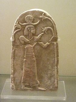
Tell Beit Mirsim

Last updated
A stela from Tell Beit Mirsim Astela from Tel Beit Mirsim.jpg
A stela from Tell Beit Mirsim
Position of Tell Beit Mirsim among other Bronze and Early Iron Age tells in the area Gerar.jpg
Position of Tell Beit Mirsim among other Bronze and Early Iron Age tells in the area

Tell Beit Mirsim is an archaeological site in Israel, on the border between the Shfela and Mount Hebron.

Contents

It was excavated for four seasons (1926, 1928, 1930 and 1932) by William F. Albright. [1] The site has "a town plan characteristic of the Kingdom of Judah that is also known from other sites" including, Beit Shemesh, Tell en-Nasbeh, Khirbet Qeiyafa and Beersheba. "A casemate wall was built at all of these sites and the city’s houses next to it incorporated the casemates as one of the dwelling’s rooms. This model is not known from any Canaanite, Philistine or Kingdom of Israel site." [2]

Albright identified the ruin with the biblical city Dvir (Debir), or Kiryat Sefer by another name. [3] He hoped to find an ancient archive there. This identification is not currently accepted by the archaeological community. Khirbet Rabud is seen as the more likely location. [4]

Related Research Articles

<span class="mw-page-title-main">Nahf</span> Local council

Nahf is an Arab town in the Northern District of Israel. It is located in between the lower and upper Galilee, about 23 kilometres (14 mi) east of Acre. In 2019 it had a population of 13,113. Archaeologists believe that the area was an important center for viticulture in the Hellenistic period and possibly the Early Bronze Age IB period.

<span class="mw-page-title-main">Kiryat Ata</span> City in Haifa, Israel

Kiryat Ata is a city in the Haifa District of Israel. In 2019 it had a population of 59,030, 92% of whom were Jewish citizens.

<span class="mw-page-title-main">Khirbet Beit Lei</span> An archaeological site in Israel with remains of Byzantine church

Khirbet Beit Lei or Beth Loya is an archaeological tell in the Judean lowlands of Israel. It is located about 5.5 km southeast of Tel Lachish and ten miles west-northwest of Hebron, on a hill 400 m above sea level.

'Ara is a village in the Haifa District in northern Israel, located in the Wadi Ara valley. Since 1985, 'Ara has been part of the Ar'ara local council. It is located north of highway 65, between Ar'ara and Kfar Qara. Its population of 4,600 is almost entirely Muslim.

<span class="mw-page-title-main">Barqa, Gaza</span> Place in Gaza, Mandatory Palestine

Barqa was a Palestinian Arab village located 37 km north of Gaza near the modern-day Israeli city of Ashdod. It was referred to as Barka by the Greeks and Bareca by the Romans during their rule over the ancient Philistine city. In 1945, the village had a population of 890 and total land area of 5,206 dunums.

<span class="mw-page-title-main">Nein</span> Place in Northern, Israel

Nein — also Nain or Naim in English — is an Arab village in northern Israel. Located in the Lower Galilee, 14 kilometers (8.7 mi) south of Nazareth, Nein covers a land area of approximately 1,000 dunams and falls under the jurisdiction of Bustan al-Marj Regional Council, whose headquarters it hosts. Its total land area consisted of 3,737 dunums prior to 1962. According to the Israeli Central Bureau of Statistics, in 2019 it had a population of 1,876.

<span class="mw-page-title-main">Tur'an</span> Local council

Tur'an is a local council in the Northern District of Israel. It is located at the foot of Mount Tur'an and the Tur'an Valley, near the main road from Haifa to Tiberias, and about 7 kilometres (4.3 mi) north of Nazareth. In 2019 it had a population of 14,240, most of whom are Israeli Arabs.

<span class="mw-page-title-main">Mashhad, Israel</span> Local council in Israel

Mashhad is an Arab town located 5 kilometers (3.1 mi) northeast of Nazareth in Israel's Northern District. In 2019 it had a population of 8,373, most of whom were Muslims.

<span class="mw-page-title-main">Farwana</span> Place in Baysan, Mandatory Palestine

Farwana, was a Palestinian village, located 4.5 kilometers (2.8 mi) south of Bisan, depopulated in 1948.

<span class="mw-page-title-main">Na'ura</span> Place in Northern, Israel

Na'ura is an Arab village located in northern Israel. Located to the east of Afula, it falls under the jurisdiction of the Gilboa Regional Council. In 2019 it had a population of 2,324.

<span class="mw-page-title-main">Ramat Yishai</span> Town in Northern District, Israel

Ramat Yishai is a town in the Northern District of Israel, located on the side of the Haifa–Nazareth road about 4 kilometres (2.5 mi) eastern to Kiryat Tivon. It was previously called Jaida and was inhabited by Arabs. It achieved local council status in 1958. In 2019 it had a population of 7,785; the vast majority of residents are Jewish.

<span class="mw-page-title-main">Uzeir</span> Place in Northern, Israel

Uzeir is an Arab village in northern Israel. Located near Nazareth Illit in the Lower Galilee, it falls under the jurisdiction of al-Batuf Regional Council. In 2019 it had a population of 3,276.

<span class="mw-page-title-main">Kafr Misr</span> Place in Israel

Kafr Misr is an Arab village in northeastern Israel. Located near Afula to the south of the Sea of Galilee, it falls under the jurisdiction of Bustan al-Marj Regional Council. In 2019 it had a population of 2,750.

<span class="mw-page-title-main">Sulam</span> Place in Northern, Israel

Sulam is an Arab village in north-eastern Israel. Known in ancient times as Shunama and Shunem, it is first mentioned in the Amarna Letters in the 14th century BCE. Archaeological excavations in the village attest to habitation extending from the Bronze Age through to modern times. Located near Afula, it falls under the jurisdiction of Bustan al-Marj Regional Council. In 2019 it had a population of 2,609.

<span class="mw-page-title-main">Zemer</span> Local council in Central, Israel

Zemer is an Arab local council in the Central District of Israel. It is located in the Arab Triangle area, between Baqa al-Gharbiyye and Bat Hefer on Road 574. Zemer is the result of a merger of four villages – Bir al-Sika, Ibtan, Marja and Yama - in 1988.

<span class="mw-page-title-main">Tamra, Jezreel Valley</span> Place in Northern, Israel

Tamra is an Arab village in north-eastern Israel. Located in the Jezreel Valley, it falls under the jurisdiction of Gilboa Regional Council. In 2019 it had a population of 1,601.

<span class="mw-page-title-main">Ein Hemed</span>

Ein Hemed is a national park and nature reserve in the hills seven kilometres west of modern Jerusalem and some 12 kilometres west of the Old City. It is also known by the Latin name it received from the Crusaders, Aqua Bella, and as Khirbat Iqbalā in Arabic. The park is located on the path of an old Roman road, also used in later periods. The road connected the coastal plain with Jerusalem, passing through Bab al-Wad. A fortified Hospitaller building from the Crusader period, relatively well preserved, is arguably the main attraction beside the streams and lush vegetation.

<span class="mw-page-title-main">Khirbat Umm Burj</span> Place in Hebron, Mandatory Palestine

Khirbat Umm Burj was a Palestinian Arab village in the Hebron Subdistrict, sometimes designated in modern maps as Burgin. Its ruins are today located within the borders of Israel. It occupied an extensive site, stretching about 30 dunams on the crest of a hill, rising some 430 metres (1,410 ft) above sea level, and commanding a good prospect of the surrounding region. It was depopulated during the 1948 Arab–Israeli War on October 28, 1948, during the third stage of Operation Yo'av under the command of Yigal Allon. The site is located 17 km northwest of Hebron.

<span class="mw-page-title-main">Al-Tira, Ramle</span> Place in Ramle, Mandatory Palestine

Al-Tira was a Palestinian village in the Ramle Subdistrict. It was depopulated during the 1948 Arab–Israeli War on July 10, 1948, by the Alexandroni and Armored (Eighth) brigades under Operation Dani. It was located 12 km northeast of Ramla. al-Tira was mostly destroyed with the exception of a few houses survived destruction.

<span class="mw-page-title-main">Jatt, Israel</span> Local council in Israel

Jatt is an Arab local council in the Triangle area of Haifa District in Israel. In 2019 it had a population of 12,100.

References

  1. W. F. Albright, The Fourth Joint Campaign of Excavation at Tell Beit Mirsim, Bulletin of the American Schools of Oriental Research, No. 47 (Oct., 1932), pp. 3-17.]
  2. "Israel Antiquities Authority". Archived from the original on 2012-06-23. Retrieved 2014-12-20.
  3. Joshua, 15:15
  4. Trevor Bryce (2009). The Routledge Handbook of the Peoples and Places of Ancient Western Asia: From the Early Bronze Age to the Fall of the Persian Empire. Taylor & Francis. p. 588. ISBN   978-0-415-39485-7.

Bibliography

Coordinates: 31°27′21″N34°54′35″E / 31.455775°N 34.909846°E / 31.455775; 34.909846