Related Research Articles
Campbell County is a county in the U.S. state of South Dakota. As of the 2020 census, the population was 1,377, making it the fourth-least populous county in South Dakota. Its county seat is Mound City. The county was created in 1873 and organized in 1884. It was named for Norman B. Campbell, a Dakota Territory legislator in 1873 and son of General Charles T. Campbell.
Emmons County is a county in the U.S. state of North Dakota. As of the 2020 census, the population was 3,301. Its county seat has been Linton since 1899.
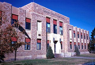
Linton is a city in and the county seat of Emmons County, North Dakota, United States. The population was 1,071 at the 2020 census. When compared with the other 356 cities in North Dakota, Linton ranks in the top twelve percent based on the number of its residents. The city serves as a governmental, commercial and business hub for Emmons County.
Ada is a township in Dickey County, North Dakota, United States. Its population during the 2000 Census was 60, and was estimated at 52 in 2009. Its population in 1900 was 232.

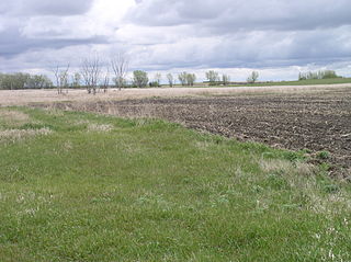
Temvik is a ghost town in Emmons County, North Dakota, United States. It is situated between Linton and Hazelton. The town had a school and several grain elevators early in the twentieth century; all that remains today is a farm.

Raleigh is a census-designated place (CDP) in Grant County, North Dakota, United States. An unincorporated community, it was designated as part of the U.S. Census Bureau's Participant Statistical Areas Program on March 31, 2010. It was not counted separately during the 2000 Census, but was included in the 2010 Census, where a population of 12 was reported.
Buchanan Valley Township is a former township in Emmons County, North Dakota. Its population as of the 2000 Census was 40. The township was dissolved on March 23, 2009, and added to the census-designated North Emmons Unorganized Territory.
Campbell Township is the only township in Emmons County, North Dakota, United States. Its population as of the 2000 Census was 66. It lies in the northeastern corner of the county and borders the following other former townships within Emmons County:
Hazelton Township is a former township of Emmons County, North Dakota, United States. The township disbanded on January 1, 2001, and is now part of the unorganized territory of North Emmons. The township recorded a population of 70 during the 2000 Census.
Lincoln Township is a former township of Emmons County, North Dakota, United States. The township recorded a population of 28 during the 2000 Census.
Edna Township is a civil township in Barnes County in the U.S. state of North Dakota. As of the 2000 Census, its population was 74. It is the 20th largest township in the county in terms of both total population and population density.
McCulley Township is a former township of Emmons County, North Dakota, United States that was located in public land survey Township 134N, Range 76W. The township disbanded on March 1, 1998, and is now part of the unorganized territories of Northeast Emmons and West Emmons. Its last recorded population before dissolving was 79 during the 1990 Census.

Amity Township is a civil township in Bottineau County in the U.S. state of North Dakota. As of the 2000 census, its population was 35.
Roth is an unincorporated community in Bottineau County in the U.S. state of North Dakota. It is located roughly 6 miles (9.7 km) to the west of Souris. Roth does not have a post office, but it shares the zip code of 58783 with Souris.

Pickering Township is a civil township in Bottineau County in the U.S. state of North Dakota. Its population was 193 as of the 2010 census, down from 213 at the 2000 census.

Cecil Township is a civil township in Bottineau County in the U.S. state of North Dakota. As of the 2000 census, its population was 28.

Haram Township is a civil township in Bottineau County in the U.S. state of North Dakota. As of the 2000 census, its population was 85.
Schrunk Township is a civil township in Burleigh County in the U.S. state of North Dakota. As of the 2000 census, its population was 26, but had increased to an estimated 71 by 2009.

Blaine Township is a township in Bottineau County in the U.S. state of North Dakota. Its population during the 2000 Census was 30, and an estimated 27 people as of 2009.
References
- ↑ U.S. Census Bureau. Census 2000. "Census Demographic Profiles, Tell Township" (PDF). CenStats Databases. Retrieved 2009-01-31.[ dead link ]
- ↑ "Geographic Change Notes for North Dakota". United States Census Bureau. Archived from the original on 2012-10-10. Retrieved 2010-06-17.