Tempo, Ontario

Last updated
Tempo
Canada Ontario location map 2.svg
Red pog.svg
Tempo
Location of Tempo in Ontario
Coordinates: 42°51′24″N81°16′40″W / 42.85667°N 81.27778°W / 42.85667; -81.27778 Coordinates: 42°51′24″N81°16′40″W / 42.85667°N 81.27778°W / 42.85667; -81.27778
CountryCanada
ProvinceOntario
RegionSouthwestern Ontario
Municipality London
Elevation
257 m (843 ft)
Time zone UTC-5 (Eastern Time Zone)
  Summer (DST) UTC-4 (Eastern Time Zone)
Area code(s) 519, 226

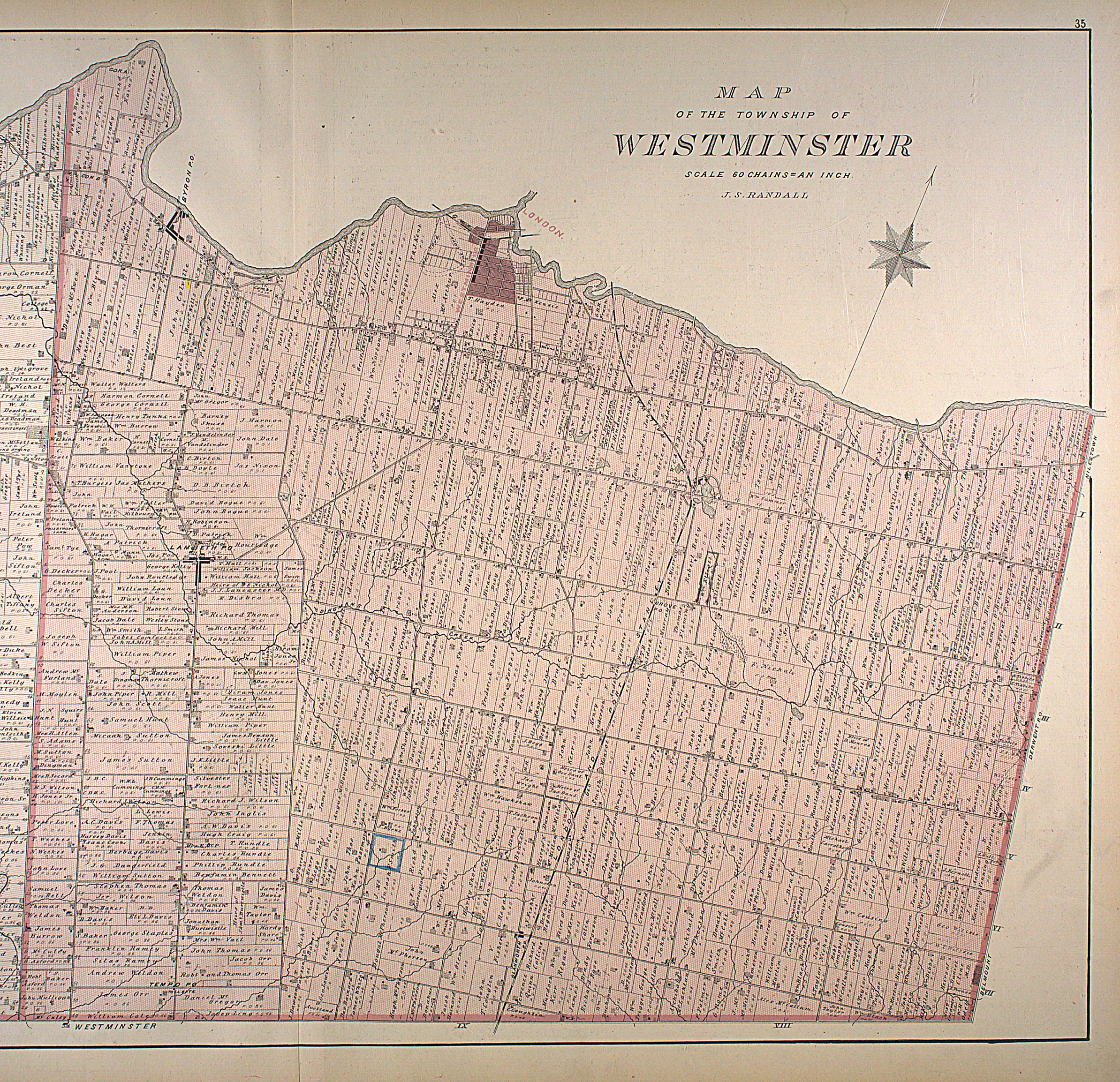
Tempo is an unincorporated place in the city of London in Southwestern Ontario, Canada. [1] It is located just south of the community of Lambeth at interchange 177 of Ontario Highway 401 with the former Ontario Highway 4.

Contents

History

Tempo originally was a village in Westminster Township, Middlesex County. [2] It had a post office until it closed in 1913. [3] Most of the village was demolished in the 1950s during the construction of Highway 401. There was one church, called Tempo Presbyterian Church, [3] which opened in the mid-19th century and closed down in the first decade of the 21st century. The building still stands, as the Rose Chapel, a wedding venue.

Education

Children who live in Tempo attend primary school in Lambeth.

Economy

Farms in the area are mostly cash crop, and a few cash crop/livestock mixed farms. The livestock raised are cattle and sheep, and the main grown crop are corn and beans. There are two farmer's markets in Tempo, Farmer Jack's and Thomas Brothers Market, both of which sell locally grown fruits and vegetables, along with local meats.

There also is a Best Western Plus hotel south of Highway 401 interchange.

Related Research Articles

Ontario Highway 401 Highway in Ontario

King's Highway 401, commonly referred to as Highway 401 and also known by its official name as the Macdonald–Cartier Freeway or colloquially referred to as the four-oh-one, is a controlled-access 400-series highway in the Canadian province of Ontario. It stretches 828 kilometres (514 mi) from Windsor in the west to the Ontario–Quebec border in the east. The part of Highway 401 that passes through Toronto is North America's busiest highway, and one of the widest. Together with Quebec Autoroute 20, it forms the road transportation backbone of the Quebec City–Windsor Corridor, along which over half of Canada's population resides. It is also a Core Route in the National Highway System of Canada. The route is maintained by the Ministry of Transportation of Ontario (MTO) and patrolled by the Ontario Provincial Police. The speed limit is 100 km/h (62 mph) throughout its length, with the only exceptions the posted 80 km/h (50 mph) limit westbound in Windsor and in most construction zones.

Mount Forest, Ontario Unincorporated community in Ontario, Canada

Mount Forest is an unincorporated community located at the junction of Highway 6 and Highway 89 in the township of Wellington North, Ontario, Canada. The town's motto was previously "High, Healthy, Happy", which used to be seen on the water tower and welcome sign when approaching the town from the south. In September, 2020 they adopted the motto "Simply Explore". As of the 2011 Canadian census the population of Mount Forest was 4,757.

Stouffville, Ontario Town in Ontario, Canada

Stouffville is the primary urban area within the town of Whitchurch-Stouffville in the York Region of Ontario, Canada. It is situated within the Greater Toronto Area and the inner ring of the Golden Horseshoe. The urban area is centred at the intersection of Main Street, Mill Street, and Market Street. Between 2006 and 2011, the population of the Community of Stouffville grew 100.5% from 12,411 to 24,886, or from 51% to 66% of the total population of the larger town of Whitchurch-Stouffville.

Oxford County, Ontario Regional municipality in Ontario, Canada

Oxford County is a regional municipality in the Canadian province of Ontario. Highway 401 runs east–west through the centre of the county, creating an urban industrial corridor with more than half the county's population, spanning 25 km between the Toyota auto assembly plant in Woodstock and the CAMI General Motors auto assembly plant in Ingersoll. The local economy is otherwise dominated by agriculture, especially the dairy industry.

Lakeshore, Ontario Town in Ontario, Canada

Lakeshore is a town on Lake St. Clair, in Essex County, Ontario, Canada. The town was incorporated in 1999 by amalgamating the Town of Belle River with the townships of Maidstone, Rochester, Tilbury North, and Tilbury West. It is part of the Windsor census metropolitan area.

Ontario Highway 402 Highway in Ontario

King's Highway 402, commonly referred to as Highway 402 and historically as the Blue Water Bridge Approach, is a freeway in the Canadian province of Ontario that connects the Blue Water Bridge international crossing near Sarnia to Highway 401 in London. It is one of multiple trade links between Ontario and the Midwestern United States. Its 400-series number denotes a King's Highway with controlled access. It is four lanes for much of its length, though the approach to the Blue Water Bridge is six lanes.

Westminster, Middlesex County, Ontario Neighbourhood in London, Ontario, Canada

Westminster refers to both a neighbourhood in the City of London, Ontario, Canada, and a much larger area within which the neighbourhood lands have been situated.

Holland Marsh Wetland and agricultural area in Ontario, Canada

The Holland Marsh is a wetland and agricultural area in Ontario, Canada, about 50 kilometres (31 mi) north of Toronto. It lies entirely within the valley of the Holland River, stretching from the northern edge of the Oak Ridges Moraine near Schomberg to the river mouth at Cook's Bay, Lake Simcoe. In its entirety it comprises about 21,000 acres, with two distinct divisions. Historically it has simply been referred to as "the marsh".

Lambeth, London, Ontario Neighbourhood in London, Ontario, Canada

Lambeth is a neighbourhood in the City of London, Ontario, Canada. It is immediately north of Highway 402, and east of Colonel Talbot Road. Almost all of its residents live in low-density, single detached dwellings. As of 2011, the area is home to 4,410 residents. The neighbourhood is considered a middle to upper-income area, with an average family income of $129,685 an average dwelling value of $340,707 and a home ownership rate of 93%.

The Ontario tobacco belt is the tobacco-growing region located in Norfolk County and eastern Elgin County in Southwestern Ontario, Canada. The region is close to the north shore of Lake Erie, with a moderate climate and sandy, silt-loam soils that are well-suited to a wide variety of crops.

Norwich, Ontario Township in Ontario, Canada

The Township of Norwich is a municipality located in Oxford County in Southwestern Ontario, Canada. The preferred pronunciation of the town name is NOR-witch, which differs from the pronunciation NORR-ij used for the city of Norwich, England. The origin of Norwich, Ontario, is more likely Norwich in upper New York State, the area from which the pioneering families emigrated in the early 19th century, where the community was known as Norwichville.

Canada is one of the largest agricultural producers and exporters in the world. As with other developed nations, the proportion of the population and GDP devoted to agriculture fell dramatically over the 20th century but it remains an important element of the Canadian economy. A wide range of agriculture is practised in Canada, from sprawling wheat fields of the prairies to summer produce of the Okanagan valley. In the federal government, overview of Canadian agriculture is the responsibility of the Department of Agriculture and Agri-Food.

King's Highway 135, commonly referred to as Highway 135, was a provincially maintained highway in the Canadian province of Ontario on the southern edge of London, following Exeter Road, which it is better known as. The road's main purpose was to link Highway 401 in London with Highway 2 in Lambeth, at a time when the London-area section of Highway 401 was only completed to the interchange with Highway 4.

The economy of Saskatchewan has been associated with agriculture resulting in the moniker "Bread Basket of Canada" and Bread Basket of the World. According to the Government of Saskatchewan, approximately 95% of all items produced in Saskatchewan, depend on the basic resources available within the province. Various grains, livestock, oil and gas, potash, uranium, wood and their spin off industries fuel the economy.

King's Highway 73, commonly referred to as Highway 73, was a provincially maintained highway in the Canadian province of Ontario. The route began in Port Bruce and progressed north through Aylmer, encountering Highway 401 immediately before terminating east of Dorchester. The route was established in mid-1937, remaining unchanged for nearly six decades before being transferred to Elgin County and Middlesex County in 1997 and 1998. Today the route is known as Elgin County Road 73 and Middlesex County Road 73.

King's Highway 74, commonly referred to as Highway 74, was a provincially maintained highway in the Canadian province of Ontario that travelled north from Highway 3 at New Sarum to Middlesex County Road 29 on the outskirts of London. The 22.4-kilometre-long (13.9 mi) was assumed by the province in September 1937. Aside from paving and the construction of an interchange with Highway 401, it remained generally unchanged for the next six decades until it was decommissioned in 1997 and transferred to Elgin County and Middlesex County. The road has since been redesignated as Elgin County Road 74 and Middlsex County Road 74.

The Drumbo Fall Fair is a three-day annual agricultural event which takes place in the village of Drumbo, Blandford-Blenheim township, Oxford County, Ontario, Canada. The fairgrounds are at 42 Center Street, a few minutes from the 401 highway. The fair is held annually on the third weekend after Labour Day.

King's Highway 76, commonly referred to as Highway 76, was a provincially maintained highway in the Canadian province of Ontario. The route began at Highway 3 in Eagle and progressed north through the community of West Lorne, encountering Highway 401 immediately before terminating southwest of Glencoe at Longwoods Road. Today the route it followed is known as Elgin County Road 76 and Middlesex County Road 76.

Subzi Mandi Cash & Carry

Subzi Mandi Cash & Carry is an Indian-American/Canadian supermarket chain with 10 locations in the US states of New Jersey, New York, and Texas, and 4 locations in the Canadian province of Ontario. The supermarket is owned and operated by Nanak Subzi Mandi Inc., which is based in Trenton, New Jersey with Canadian operations based in Brampton, Ontario.

References

  1. "Tempo". Geographical Names Data Base. Natural Resources Canada . Retrieved 2012-06-10.
  2. "Map of The Township of Westminster, Middlesex County" (JPG). 1880 Map of Ontario Counties - The Canadian County Atlas Digital Project. McGill University . Retrieved 2012-06-10.
  3. 1 2 Grainger, Jennifer (2002). Vanished villages of Middlesex. Natural Heritage Books. pp. 234–238. ISBN   9781896219516. OCLC   746470066 . Retrieved 2012-06-10.