Related Research Articles

In archaeology, excavation is the exposure, processing and recording of archaeological remains. An excavation site or "dig" is the area being studied. These locations range from one to several areas at a time during a project and can be conducted over a few weeks to several years.
Oshara Tradition, the northern tradition of the Picosa culture, was a Southwestern Archaic tradition centered in the area now called New Mexico and Colorado. Cynthia Irwin-Williams developed the sequence of Archaic culture for Oshara during her work in the Arroyo Cuervo area of northwestern New Mexico. Irwin contends that the Ancestral Puebloans developed, at least in part, from the Oshara.
The Big Eddy Site (23CE426) is an archaeological site located in Cedar County, Missouri, which was first excavated in 1997 and is now threatened due to erosion by the Sac River.
The Mooney site is a precontact Native American archaeological site on the Red River Levee in Norman County, Minnesota. It is a multicomponent site consisting of remains from both the Archaic and Woodland traditions. No diagnostic Archaic artifacts were found. However, animal remains and lithic materials recovered from one meter below the Woodland artifacts returned a carbon 14 date that provided the basis for the Archaic classification. The Woodland tradition is defined by a vertical scatter of materials, dated to about 1000 using thermoluminescence methods. Many animal bones were found at the site, reflecting a great emphasis on a wide range of hunting activity that focused on bison. Artifacts such as local and exotic lithic materials were found, as well as a wide variety of pottery and other ceramic remains. Much of the pottery followed the Sandy Lake model; however, some artifacts were placed in a new class of artisanship known as Red River Ware.
Baker Cave is a prehistoric archaeological site located on a small canyon near Devils River in Southwest Texas. Dating from circa 7,000–7,800 BCE, Baker Cave is a part of a system of rock shelters in the Lower Pecos Canyons region and was 120 feet long by 56 feet deep. The ceiling varied from 18 feet (5.5 m) at the mouth to just a few inches in the back.

Franktown Cave is located 25 miles (40 km) south of Denver, Colorado on the north edge of the Palmer Divide. It is the largest rock shelter documented on the Palmer Divide, which contains artifacts from many prehistoric cultures. Prehistoric hunter-gatherers occupied Franktown Cave intermittently for 8,000 years beginning about 6400 BC The site held remarkable lithic and ceramic artifacts, but it is better known for its perishable artifacts, including animal hides, wood, fiber and corn. Material goods were produced for their comfort, task-simplification and religious celebration. There is evidence of the site being a campsite or dwelling as recently as AD 1725.

The Magic Mountain site is an Archaic and Woodland village site in Jefferson County, Colorado dating from 4999 BC to 1000 AD. The site was added to the National Register of Historic Places in 1980.

The Archaic–Early Basketmaker Era was an Archaic cultural period of ancestors to the Ancient Pueblo People. They were distinguished from other Archaic people of the Southwest by their basketry which was used to gather and store food. They became reliant on wild seeds, grasses, nuts, and fruit for food and changed their movement patterns and lifestyle by maximizing the edible wild food and small game within a geographical region. Manos and metates began to be used to process seeds and nuts. With the extinction of megafauna, hunters adapted their tools, using spears with smaller projectile points and then atlatl and darts. Simple dwellings made of wood, brush and earth provided shelter.

The following outline is provided as an overview of and topical guide to the prehistoric people of Colorado, which covers the period of when Native Americans lived in Colorado prior to contact with the Domínguez–Escalante expedition in 1776. People's lifestyles included nomadic hunter-gathering, semi-permanent village dwelling, and residing in pueblos.
The Mill Branch archaeological site is located in Warren County, Georgia west of Augusta and south of Thomson. It is located in the Brier Creek watershed. A reservoir was deemed necessary to assist in kaolin processing during times of drought. For this project to commence, a permit was needed from the Corps of Engineers, which required a cultural resource impact study to first be done. J.M. Huber Corporation contracted Southeastern Archaeological Services to do an initial survey of the area in 1988 with additional data recovery in 1990. J.M Huber Corporation determined that two sites surveyed by Southeastern Archaeological Services, specifically 9WR4 and 9WR11, could not be avoided or preserved. Huber no longer owns this property. These two sites were excavated between April 23 and May 31, 1990. The field report, Archaeological Investigations at Mill Branch Sites 9WR4 and 9WR11 Warren County, Georgia, was published in 1995 and compiled by R. Jerald Ledbetter.
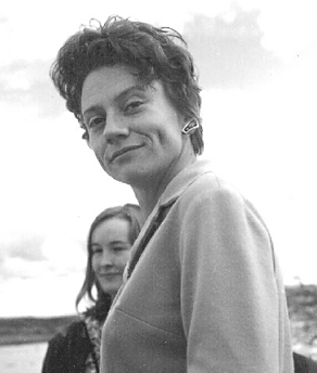
Cynthia Irwin-Williams was an archaeologist of the prehistoric American Southwest. She received a B.A. in Anthropology from Radcliffe College in 1957; the next year she received a M.A. in the same field. In 1963 she completed her educational career in Anthropology with a PhD. from Harvard University. Beginning her career in the 1950s, Irwin-Williams was considered a groundbreaker for women in archaeology, like her friend and supporter Hannah Marie Wormington.
Sisyphus Shelter is an archaeological site that was uncovered in Colorado when the Colorado Department of Highways was working on I-70. The excavation of this site became a joint project between the Colorado Department of Highways and the Bureau of Land Management. Fieldwork on the site was completed in 1980. Archaeologists John Gooding and Wm. Lane Shields as well as many others completed the excavation and prepared a comprehensive site report. Over the course of the fieldwork on Sisyphus Shelter, twenty-six features of human origin were discovered as well as numerous stone artifacts and two perishable items. The artifacts appeared to be all Late Archaic in origin. Dating indicated a range of occupations from modern times to 4400 B.P. being the oldest sample. Gooding and Shields (1985) suggest that the occupations of the shelter were not consistent and affected by seasonal changes.
The Cherry Creek Rockshelter is an archaeological site in central Colorado, located within modern-day Castlewood Canyon State Park near Franktown, Colorado. Current research indicates that it was used by Native American inhabitants beginning in the Archaic period. The site is situated on the Palmer Divide, which allowed for a unique prehistoric environment that contributed to an abundance of food and water sources, as well as lithic materials for tool-making. These factors, combined with the structure and situation of the shelter itself, made the site a particularly attractive environment for prehistoric peoples to settle in. Archaeological study of the site began in 1955, with the most current original research concluding in 2002.

The Ellerbusch site (12-W-56) is a small but significant archaeological site in the southwestern part of the U.S. state of Indiana. Unlike many sites created by people of the same culture, it occupies an upland site near a major river floodplain. Its existence appears to have been the result of the coincidence of periods of peace and growth in the related Angel site, which led some townspeople to leave their homes for new villages that were more convenient for resource gathering. Researched partly because of its small size, Ellerbusch has produced information that greatly increases present awareness of other small sites and of its culture's overall patterns of settlement in the region. Because of its archaeological value, the site was declared a historic site in the late twentieth century.
The Carlston Annis Shell Mound is a prominent archaeological site in the western part of the U.S. state of Kentucky. Located along the Green River in Butler County, this shell midden has been declared a historic site because of its archaeological value.
This page is a glossary of archaeology, the study of the human past from material remains.
Aigyr-Zhal 2 is a historical site in Naryn city on the territory of University of Central Asia (UCA), Kyrgyzstan. It is a part of a bigger and more complex site Aigyr-Zhal. It is dated between Mesolithic time and Middle Ages. Aigyr-Zhal is the only site in the Tian-Shan that has evidence of human occupation from Mesolithic time till the Turkic period . It was first was discovered in 1953 by Akhmat Kibirov. However, during the Soviet time the site was partially destroyed, therefore it was impossible to research the site for a long time. Only in 2012 it was first researched by Kubat Tabaldiev's archaeological team. The length of Aigyr-Zhal 2 is 300 metres, while the width is 100 metres, and the heigh of the site is 2026 metres above the sea level. Since 2002 the whole Aigyr-Zhal complex is in the list of National importance of Kyrgyzstan.
The Palos site (Ck-26) is located on the Cal-Sag Canal in Cook County, Illinois, United States, near the city of Chicago. It is classified as a Protohistoric to early Historic site with Upper Mississippian affiliation.
The Booker Site is an archeological site in Sny Bottom of the Mississippi Valley. The investigations for this site began during August and September 1990 by the Contract Archaeology Program of the Center for American Archaeology. Excavations for this site began in 1993 in Pike County, Illinois.
The Two Dogs Site is a lithic quarry site located in Person County, North Carolina. This prehistoric archaeological site dates to the Middle Archaic and Woodland Periods, and it is classified as a lithic quarry site due to the presence of thousands of lithic artifacts found there. Located in the Carolina Slate Belt, the stone materials present at Two Dogs provided prehistoric peoples with openly accessible lithic resources, predominantly for tool-making, as they passed through the site between other, more residential areas. Two Dogs was excavated from 2004-2005 following shovel testing at the beginning of the decade. The lithic materials found at the Two Dogs Site were subjected to petrographic analysis, and isotopes were geochemically tested to confirm the origins of the stone artifacts. The Two Dogs site has been determined to be neither residential or agricultural; rather, this site was exclusively an area where people from nearby sedentary civilizations could access their necessary lithic resources.
References
- Stiger, M. (2001). Hunter-Gatherer Archaeology of the Colorado High Country. Boulder, Colorado: University Press of Colorado. ISBN 0-87081-612-8.
- Commerce, G. C. (2013). Museums and Observatory In Gunnison, Colorado. Retrieved April 28, 2013, from Chamber of Commerce Gunnison, Colorado: https://web.archive.org/web/20130321060257/http://www.gunnison-co.com/index.php?pid=museum